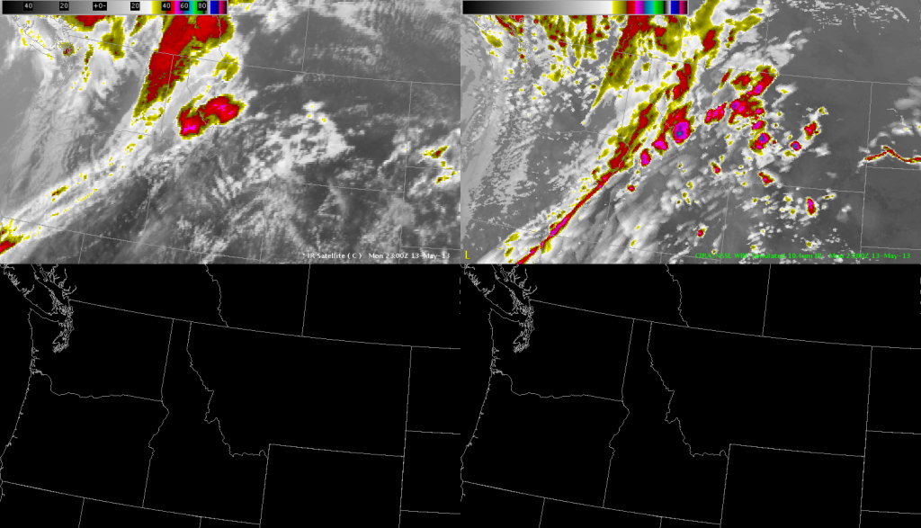
 Comparing the simulated satellite from NSSL-WRF/GOESR/CIRA on the right to the actual IR on the left at 23 UTC on May 12 depicts general good agreement. The simulated satellite imagery overdeveloped isolated convection over southern Idaho, Montana, and Wyoming, and was a bit to quick/far to the east with the cooler/deeper moisture plume from far northern California to Alberta. The simulated IR verified very well with post-frontal cold air cumulus depiction over western Washington and northwest Oregon. Michael Scotten
