
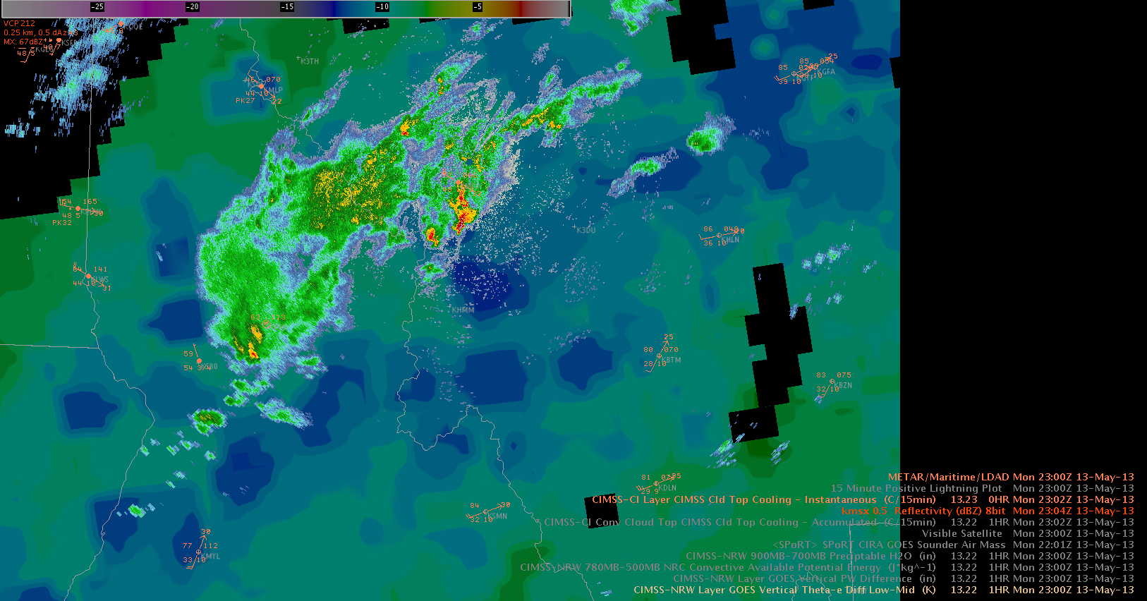
Despite moving atop an increasingly dry boundary layer (ref. to dewpoint readings in the mid to upper thirties), the strong to severe thunderstorms keep their strength. The GOES vertical theta-e difference (low-mid) product highlights the moist and unstable air mass nicely with 500-1000 J/kg (another product) present. In fact the thunderstorms really increased in strength when approaching and eventually crossing that plume of unstable air. For this event, the product by CIMMS helped a lot to get a feeling about how supportive the air mass stratification would be ahead of the thunderstorm despite decreasing boundary layer moisture. In the near future we should see a potential increase of a downburst risk with inverted-V profiles to the E/SE of the storm. A marginal hail risk continues with that storm. Helge