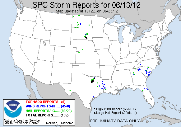
Today, we started operations in the Albuquerque (NM) and Midland (TX) county warning areas. Another early-morning mesoscale convective system left an outflow boundary over west Texas. While the atmosphere recovered in its wake during the afternoon, storms developed in the less-capped/higher-terrain to the north. Forecasters Tim Tinsley and Jeff Garmon monitored the experimental products in Midland, while Mike Dutter, Randy Skov, Steve Nelson, and Ty Judd split duties in the Albuquerque (ABQ) CWA. The forecasters evaluated the CI, cloud-top-cooling, OUN WRF, and 3DVAR products.
This time, however, storms in the ABQ CWA struggled to maintain strength as they moved off the mountains. This prompted a domain switch of the southern ABQ forecasters (Dutter and Skov) to the Sioux Falls (FSD), South Dakota CWA and the northern ABQ forecasters (Nelson and Judd) to the Fort Worth, Texas CWA (storms were ongoing in both CWAs).
Upon arrival, the FSD crew immediately issued severe warnings. These warnings verified well, as hail up to the size of golfballs and a funnel cloud were observed in the CWA. The FWD crew also began issuing warnings as soon as they arrived in their CWA. By that time, two supercell thunderstorms were ongoing in the Dallas-Fort Worth Metro Area, producing hail up to the size of baseballs and one report of a funnel cloud. Substantial hail damage occurred over the densely populated suburbs of Irving and Grand Prairie. The 3DVAR products — as well as the OUN WRF in FWD — were interrogated during the event.
The Midland crew issued several warnings, using the OUN WRF, CI, and 3DVAR products. No reports were received, owing the sparse population of west Texas. The MESH in one storm, however, was up to 2.5 inches in diameter.
-G. Garfield, Week 5 Coordinator

