EWP2012 PROJECT OVERVIEW:
The National Oceanic and Atmospheric Administration (NOAA) Hazardous Weather Testbed (HWT) in Norman, Oklahoma, is a joint project of the National Weather Service (NWS) and the National Severe Storms Laboratory (NSSL). The HWT provides a conceptual framework and a physical space to foster collaboration between research and operations to test and evaluate emerging technologies and science for NWS operations. The Experimental Warning Program (EWP) at the HWT is hosting the 2012 Spring Program (EWP2012). This is the fifth year for EWP activities in the testbed. EWP2012 takes place across five weeks (Monday – Friday), from 7 May through 15 June. There are no operations during Memorial Day week (28 May – 1 June).
EWP2012 is designed to test and evaluate new applications, techniques, and products to support Weather Forecast Office (WFO) severe convective weather warning operations. There will be three primary projects geared toward WFO applications this spring, 1) evaluation of 3DVAR multi-radar real-time data assimilation fields being developed for the Warn-On-Forecast initiative, 2) evaluation of multiple CONUS GOES-R convective applications, including pseudo-geostationary lightning mapper products when operations are expected within the Lightning Mapping Array domains (OK/west-TX, AL, DC, FL), and 3) evaluation of model performance and forecast utility of the OUN WRF when operations are expected in the Southern Plains.
WEEK 4 SUMMARY:
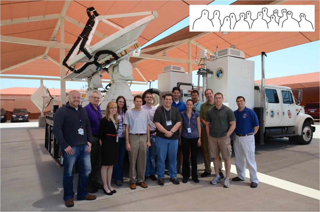
Week #4 travel support for visiting forecasters was provided by NSSL, the GOES-R program office, and the NWS Pilot Program. We had six visiting NWS forecasters this week: Marc Austin (WFO, Norman, OK), Rich Grumm (WFO, State College, PA), Chris Leonardi (WFO, Charleston, WV), Jennifer Palucki (WFO, Albuquerque, NM), Kristen Schuler (CWSU, Kansas City, MO), and Gary Skwira (WFO, Lubbock, TX). Other visiting participants this week included Kathrin Wapler (Deutscher Wetterdienst, Germany), and Chris Karstens (Iowa State University). The weather this week was once again characterized by severe weather events that were regionally-diverse. However, there were no notably-exceptional severe weather events.
Photo: 1) Chris Siewert (CIMMS/SPC/GOES-R), 2) Rich Grumm (WFO, State College, PA), 3) Kristen Schuler (CWSU, Kansas City, MO), 4) Jennifer Palucki (WFO, Albuquerque, NM), 5) Gary Skwira (WFO, Lubbock, TX), 6) Marc Austin (WFO, Norman, OK), 7) Chris Leonardi (WFO, Charleston, WV), 8) Gabe Garfield (CIMMS/WFO Norman, OK), 9) Kathrin Wapler (Deutscher Wetterdienst, Germany), 10) Travis Smith (CIMMS/NSSL), 11) Greg Stumpf (CIMMS/NWS-MDL), 12) Chris Karstens (Iowa State University), and 13) Steve Martanaitis (NWS/WDTB). Photograph by Jim LaDue (NWS/WDTB).
REAL-TIME EVENT OVERVIEW:
4 June: Lubbock (LBB), Little Rock (LZK), Amarillo (AMA)
5 June: Norman (OUN), Jacksonville (JAX), Melbourne (MLB), Tallahassee (TAE), Great Falls (TFX)
6 June: Cheyenne (CYS), Boulder (BOU), Fort Worth (FWD)
7 June: Sterling (LWX), Boulder (BOU), Rapid City (UNR), Cheyenne (CYS)
FEEDBACK ON EXPERIMENTAL PRODUCTS:
3DVAR:
- would like to see downdrafts depicted – for wet/dry microbursts
- aviation uses: downdrafts, turbulence (not necessarily related to convective weather)
- does a pretty good job, with updraft strength. Tornadoes also good. But outflow winds are very radar dependent, range depend. Assimilation methods may help with some of this.
- would like to see TDWR data included.
- would like to have a map depicting radar coverage (this is on the web site, but not in AWIPS2)
OUN-WRF:
This was the first week where the EWP has at least some forecasters working somewhere in the OUN WRF all four days.
- it seems to be most useful for estimating storm mode and initiation time (though initiation sometimes has an early bias).
- too many cold pool – interactions mess things up once convection is ongoing
- used mostly pre-convection – then transitioned to radar-based products once convection was ongoing
- was very useful to distinguish between supercells at day, and squall line at night on April 14
- every run is so sensitive to the initial conditions. But still does well on change of mode. HRRR generated convection too far south on Thursday. But OUN WRF was a little too far north
- suggested improvement: add surface, dewpoint, wind flags, etc. To the special products. To get an idea or sanity check to verify against sfc obs. QPF would also be useful.
GOES-R Satellite products:
- Simulated satellite was really useful. Thought the NSSL WRF was spot-on
- Nearcast products has agreement with OUN WRF
- CI: “confetti” in UH product was interesting. Lots of colors. Liked the “Ultimate CI” AWIPS2 procedure
- Returning forecaster really liked the probabilistic data field compared to the yes/no deterministic one shown last year
GOES-R PGLM:
- was actually used this week – convection in the LMAs helps!
- need 5- and 15-min products. Also, color curves, hard to see grey
- one “lightning jump” observed
- forecasters would really like to see the 3D LMA data in FSI
- to be deployed in 2016 (west) and 2017 (east)
- useful for fire weather – source charges in dust storms creating CG lightning
There are more GOES-R feedback details on the GOES-R HWT Blog Weekly Summary.
OVERALL COMMENTS:
- training before arriving is better than training all day Monday
- would like to have more PI interaction to show them where to find the products on day #1, though
- AWIPS2: better than expected. Needs 64-bit version to fix multiple memory issues.
- Liked discussion with developers. Would like to see uncertainly in the products (when they work best / when they don’t) quantified in some way
CONTRIBUTORS:
Travis Smith, EWP2012 Week #4 Weekly Coordinator

