EPZ Meso Update 2050Z

CI products were able to correctly depict a small hail producing t-storm about 1.5 hours ahead of time.

In the first image below, the UAH CI showed a 53 index (upper left) indicating significant cloud growth at 1732Z.

The next image below shows CIMSS CI of -7 to -8 K/15 min at 1745Z (lower left) which is typical of weak storms based on recent studies.

The next image below at 1901Z depicts the same storm, 1.5 hrs later when it first reaches 60 dbz in KEPZ comp reflectivity (upper right) and 77-80 DVIL (lower right).  At this point the storm is likely producing small hail.

Another point to take away from this case is that for this environment, it takes about an index of 50 to 60 UAH CI to produce strong storms.

AMS

Tags: None

BRO: The Mexican storm

Here are a couple of FSI images of the storm that is still in Mexico.  Definitely a supercell, worthy of a SVR for large hail.  TOR?  Perhaps.  But alas, it is not in the U.S.

Greg Stumpf, EWP2012 Week #1 Coordinator

Tags: None

BRO Starr county update @ 1930z.

Severe storm over northern Starr county increasing in intensity.  This can be seen in the maximum updraft product.  In addition…Max surface vorticity and Updraft Helicity associated with this storm have been increasing with time.  Vorticity (up to 3 km & 3-7 km)(not shown) are also increasing.  SRM still not showing any rotation…but will continue to monitor storm.  Barnes/Hovis

Tags: None

8 May 2012: Outlook

Looks like we are operating in S and SW Texas again.  The upper level flow and shear remains best under the sub-tropical jet, and ample moisture remains in place.  Unfortunately, there is no cap in the south Texas area, and convection is already ongoing, with some embedded severe, in that area.  Shear is adequate for severe, and a small chance of tornadoes.  But there is a lot of current convection owing to the weak cap.  And there is a chance for storms to move out of Old Mexico across the Rio Grande.  Nevertheless, we are going to have one team operate as Brownsville (BRO) and the MRMS and 3DVAR domains will be available to them over that area.  We have a contingency to also add Corpus Christie (CRP) as well if needed.

A second area of convection, with CI just beginning, is over far west Texas and southern New Mexico, as well as adjacent Old Mexico.  Moisture is mre lacking in that area, so the main threat will be microbursts.  We will have our second team operating as the El Paso, TX (EPZ) office and look primarily at the nowcast and CI products only, since this is too far west to include in the MRMS domain.

Here is the SPC DAY1 outlook for comparison:

Greg Stumpf, EWP2012 Week#1 Coordinator


Tags: None

Daily Summary – 7 May 2012

Our first day for EWP2012 so our teams operating an MCS with embedded severe cells in the San Angelo, TX, (SJT) and Austin/San Antonio, TX (KEWX) WFOs.  The storms were moderately severe with low coverage. Mostly 1-1.75″ hail, a few wind damage reports, and one tornado report near Llano, TX.  Our teams issued a few SVR warnings, as they were adapting to the new experimental products.

Greg Stumpf, EWP2012 Week #1 Coordinator


Tags: None

EWP STATUS FOR 8 MAY 2012: 1-9pm SHIFT

EWP STATUS FOR 8 MAY 2012:  1-9pm SHIFT

We will be conducting a 1-9pm shift for Tue 8 May 2012.  We will be operating in much the same areas as Monday, as the strong sub-tropical jet and high shear persists.  Hoping that the convection isn’t too confined to Old Mexico or in the radar void areas of SW TX.  Expect operations as MAF, SJT, and EWX again.

Second area of concern is the DC area, although it appears that the convection might affect only the western part of the CWA and late.  Because this is a less certain area for severe, we will stick with the SW TX target for determining our Tues flex shift time, which will be the “default” of 1-9pm.

Greg Stumpf, EWP2012 Week #1 Coordinator


Tags: None

EWX Meso Update 2320Z UTC

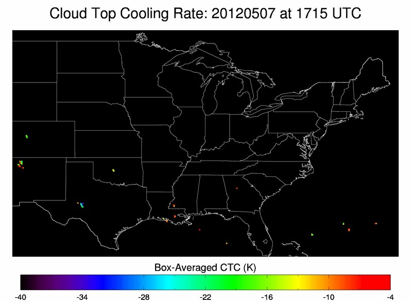
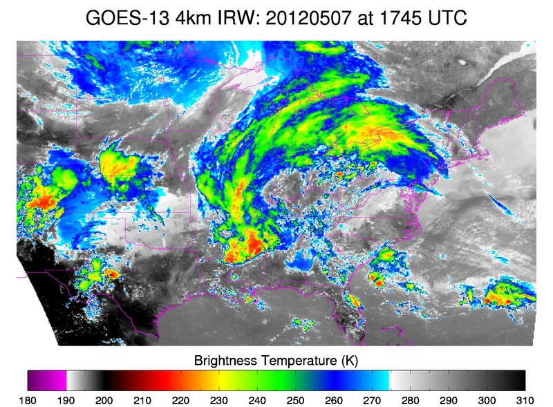
The first image below shows cloud top cooling rates at 1715Z.  Note the values of almost -35 K in the light blue over west central TX.    The second image below of IR satellite imagery at 1745Z, depicts the beginning phases of strong convection in the same region as the cloud top cooling noted 30 min before strong convection initiated.  The CIMSS cloud top cooling product correctly predicted the formation of a  complex of strong storms that later became severe during the late afternoon/early evening hours.

Cloud Top Cooling

IR Sat

RB/AMS

Tags: None