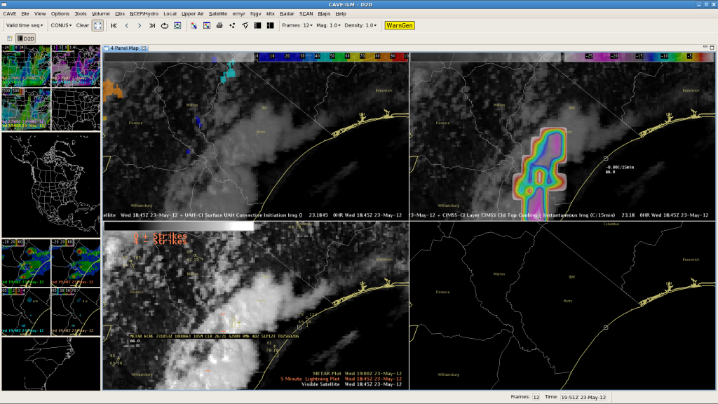
Here in WFO ILM, we have had some great success with the CIMMS Cloud Top Cooling (CTC) product this afternoon (see our previous post). Here is another success story from Horry County, SC. First we will look at the Cloud Top Cooling product at 1845Z (Top Right panel):

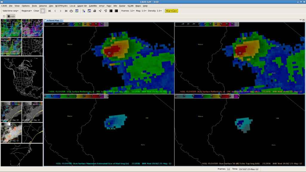
There are two “bull’s eye’s” over SC. Our storm is the northern “bull’s eye”. The CTC showed cooling rates of -21C/15minutes AT 1845Z, which typically correlates to strong convection with significant lead times averaging 45 minutes before Maximum Expected Size of Hail (MESH) exceeds 1″. Now let’s look at some verification. First is the MESH image from 1936Z (lower left panel). This is the first time the MESH exceeded 1″ for a LEAD TIME OF 51 minutes!

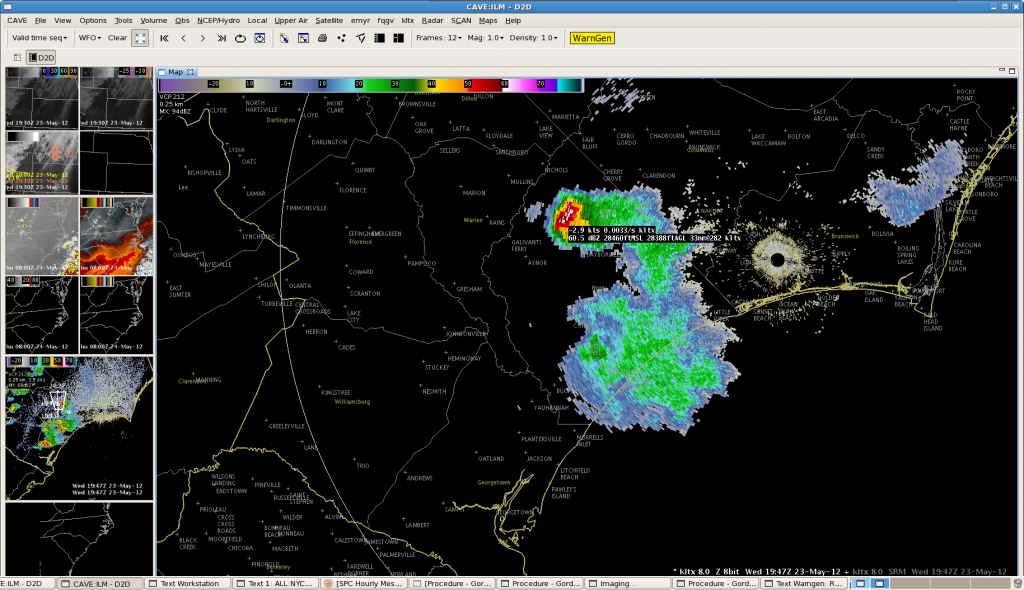
And now for a conventional radar image from 1947Z from the KLTX Radar:

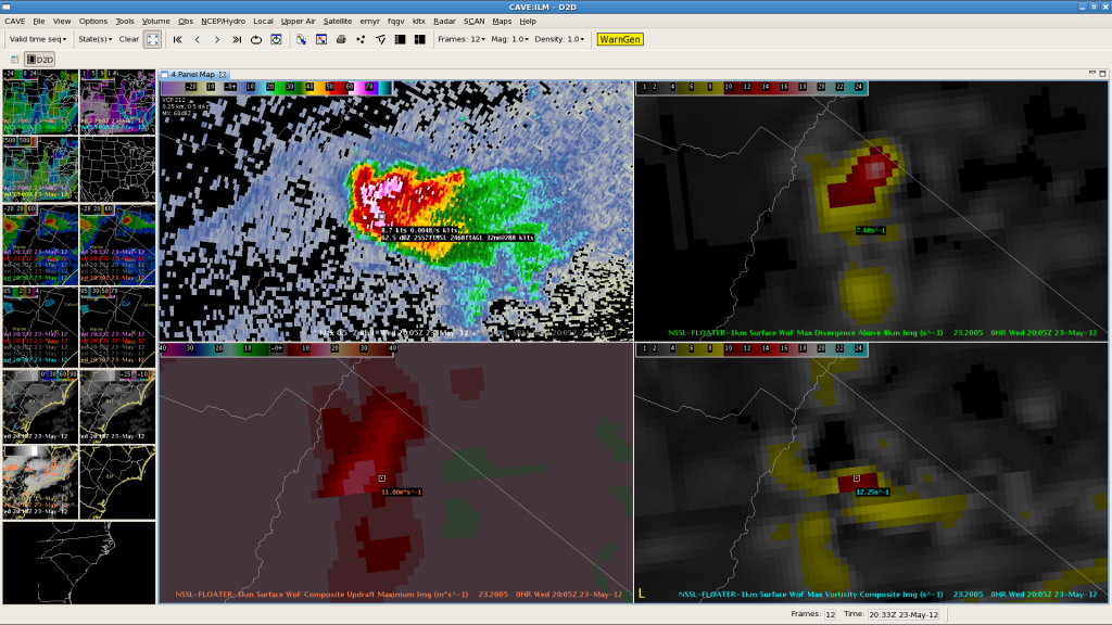
The cursor readout shows this storm has 60dbz echos up over 28,000ft…which is above even the -30C level from the 12Z CHS sounding (~25,000ft). We finally got verification of quarter size hail in NW Horry County by around 20Z, though the reports seem to have not come from directly beneath the core of the storm so some larger hail was possibly produced. Now let’s examine some NSSL 3DVAR Imagery:

You can easily identify this storm based on the Max Divergence above 8km, Updraft Composite, and Max Vorticity Images as all show local, significant maxima. Today, the CTC product has shown significant value in lead time for severe hail beneath the Southeastern CONUS upper low.–Gordon Strassberg for WFO ILM.
