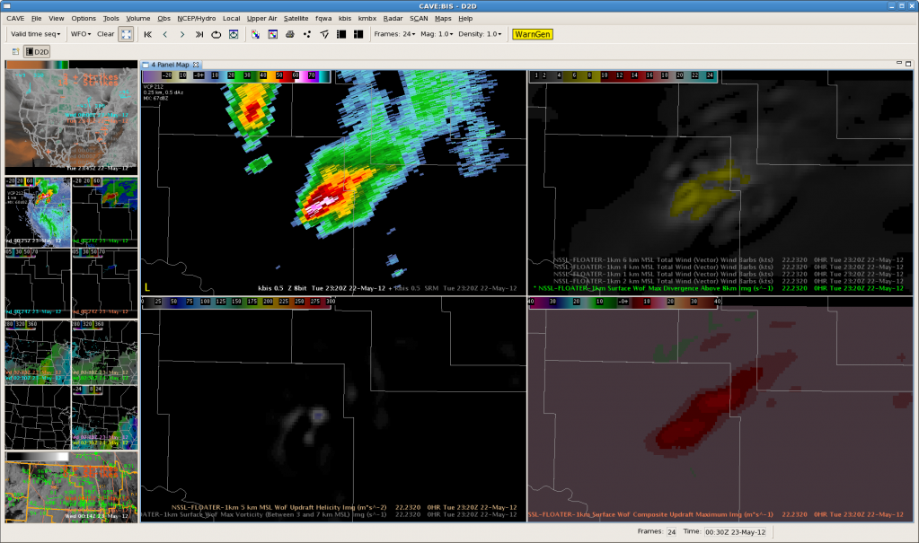
As would be expected, 3D-VAR struggles at greater distances from the radar. A fairly large supercell thunderstorm that had a history of producing brief tornadoes was at 12-15kft AGL on BIS 88-D’s lowest slice. It could be implied from base radar products that this storm had a powerful updraft, modest to strong mid-level rotation and strong storm-top divergence. However, since the storm was too far from the radar, 3D-VAR products such as max updraft composite, updraft helicity, updraft vorticity and max convergence above 8km appeared much weaker than what was likely reality.


