Today’s scenario developed roughly as expected with storms in both the Jacksonville and Melbourne CWAs. However the Melbourne CWA experienced enough of an inactive period that Todd and Stephen decided to go to a canned case. As they did two storms with quasi-supercell characteristics developed west of Daytona Beach and drifted southeast. Brian and Julia were both in the Jacksonville CWA, but with only the remnants of the outflow-driven multicell moving south through Jacksonville, I suggested that Julia could monitor Melbourne’s CWA. She began to do so but quickly ran into an overload situation as she attempted to monitor the new products, issue severe thunderstorm warnings for the entire CWA, and special marine warnings, all while CAVE periodically crashed. I should’ve had her just issue warnings for the two storms approaching Cape Kennedy so that she could have more time using the new products.
Product evaluation:
Todd and Stephen appreciated the GOES sounder nearcasting CAPE on the same 4 panel as the simulated satellite imagery, real-time IR and VIS, and lightning data. They noticed the storms struggling the most where CAPE was least across the central peninsula. There was also a well defined theta-E gradient with maximum values across Jacksonville’s CWA, dropping toward the south.
With the early storm north of Jacksonville, Todd and Stephen noticed the midlevel vorticity picking up on the storm along with midlevel updraft strength worked well in depicting the intensifying storm.
The UAH CI product at flagged a severe storm warned at 2145 UTC as early as 1945 UTC with the UW CTC picking up on it at 2045 UTC.
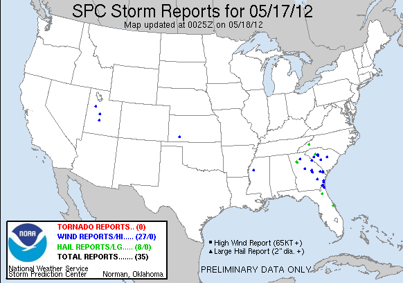
It’s useful to note that SPC’s slight risk area in SE CO and SW KS had only one report as of 0000 UTC. SC, GA and northeast FL was the most active part of the country.
Jim LaDue: EWP Week 2 coordinator

