Update: 2011-06-09 0120 UTC

We are done warning for the night and beginning discussion and surveys.  First discussion is on the storms NW of DVN.  The gust front moved out ahead of the refl cores, and this is visible on the 3DVAR wind vectors as well.

Greg Stumpf, EWP2011 Week4 Coordinator

Tags: None

Update: 2011-06-09 0040 UTC

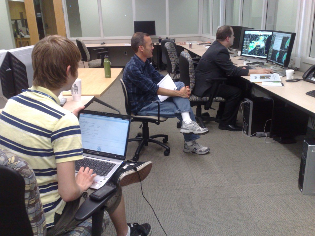
Our participants hard at work issuing warnings, using 3DVAR and MRMS experimental data:

Fig 1.  Chris B. issuing warnings as MKE (Milwaukee) while 3DVAR scientist David Dowell, and student intern Alex, observe.

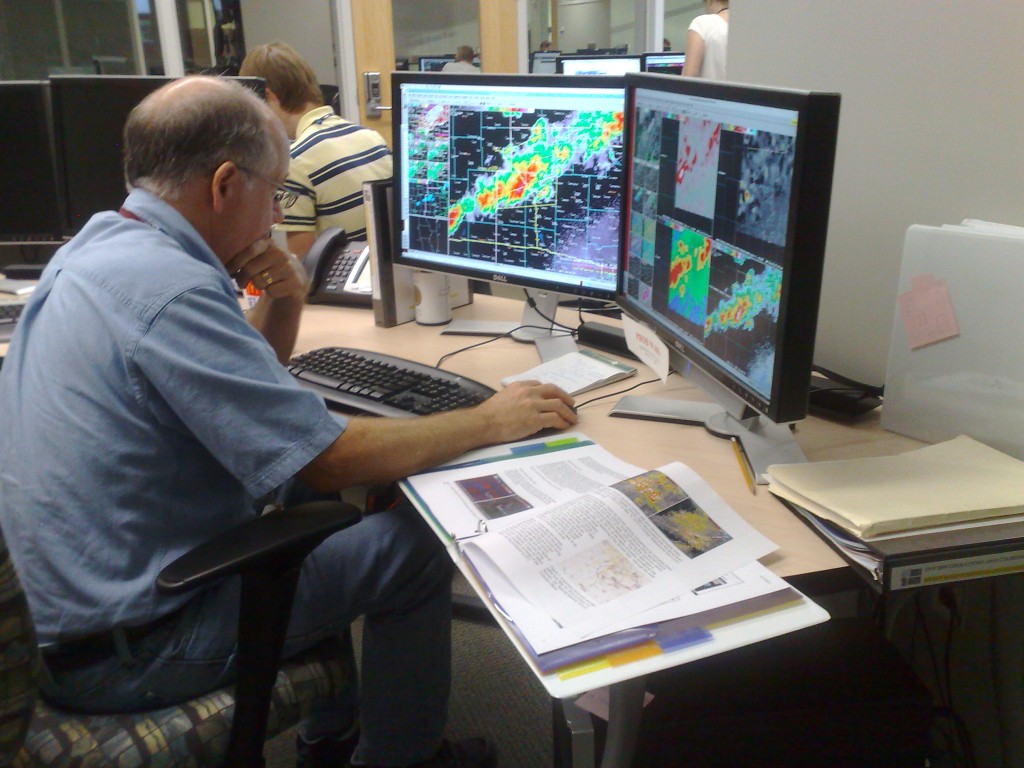
Fig. 2.  Chris S. issuing warnings as DVN (Davenport IA).

Greg Stumpf, EWP2011 Week4 Coordinator

Tags: None

Update: 2011-06-09 0005 UTC

Weak rotational couplets are now being observed on the storms in MKE’s area in SW Wisconsin.  Interstngly, they are better observed from KDVN radar, but in a typical WFO setup, Milwaukee couldn’t look at KDVN level II data, unless they used an alternate source (like GR2AE).  But in the HWT, our MKE forecaster can just walk over to the DVN forecaster and look at their level II data.  Here is the storm relative velocity data in question:

Fig 1.  KDVN Velocity data.

Fig 2.  KMKX velocity data.

Greg Stumpf, EWP2011 Week4 Coordinator


Tags: None

Update: 2011-06-08 2255 UTC

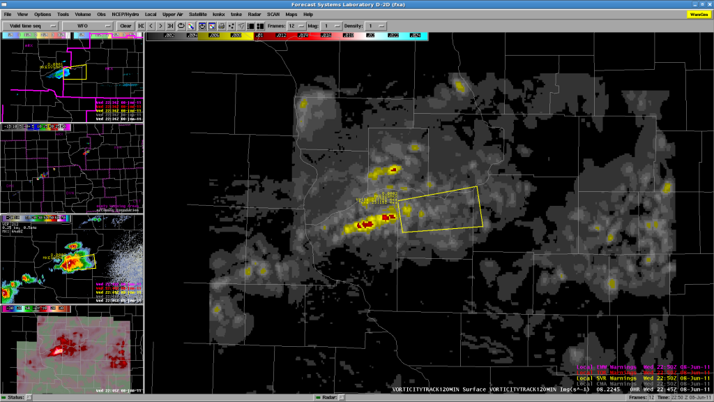
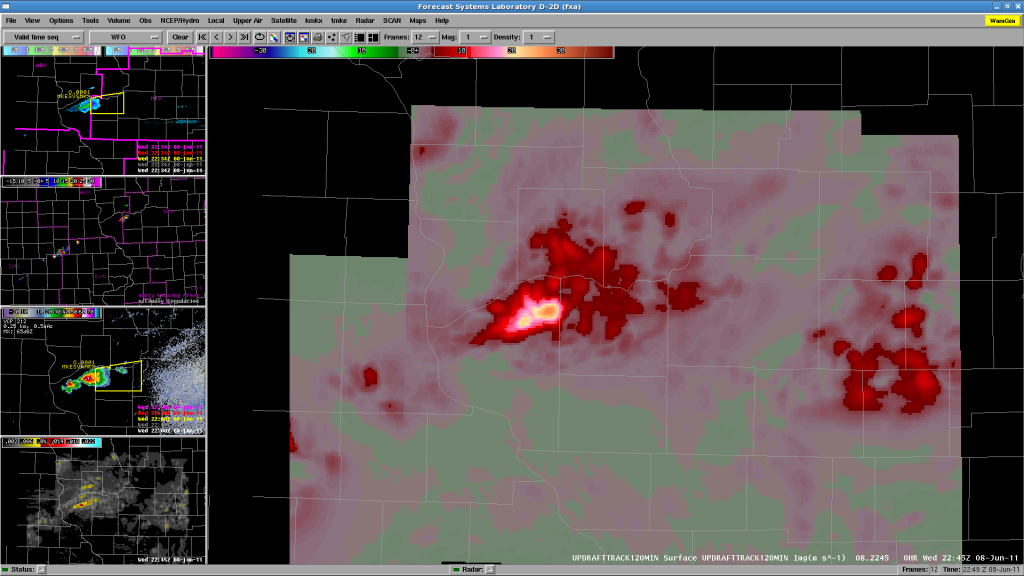
Bill and Justin are finishing up their shifts and filling out the surveys.  Meanwhile, We have Chris B working MKX and Chris S working DVN, both have now started issuing SVR warnings.  The 3DVAR domain is currently over the storms in SW Wisconsin.  A few images:

Fig 1.  120-minute vorticity track from 3DVAR.

Fig 2.  120-minute updraft strength track from 3DVAR.

Operations continue as the storms develop along the WSW-ENE oriented cold front.

Greg Stumpf, EWP2011 Week4 Coordinator

Tags: None

Update: 2011-06-08 2211 UTC

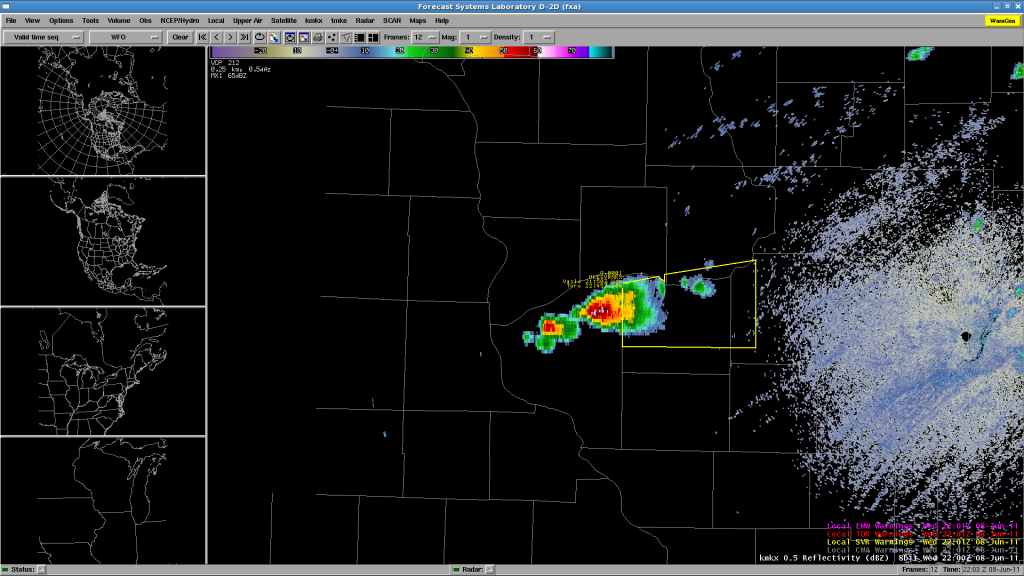
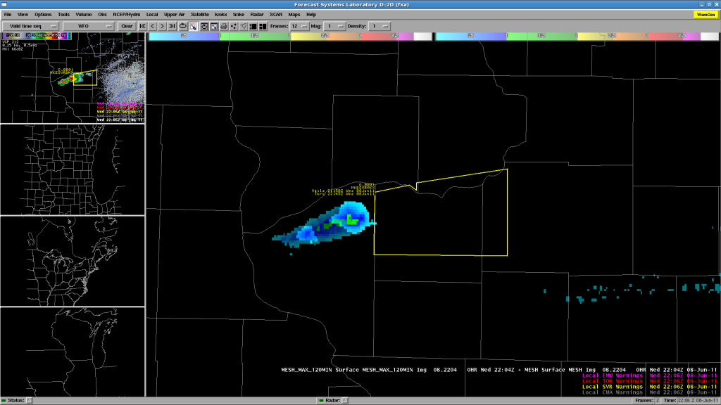
We have two CWAs operating now:  MKX (Milwaukee/Sullivan WI) and DVN (Davenport/Quad Cities IA/IL).  After a few hours of monitoring CI, we finally have our first severe storm in SE Wisconsin, getting ready to move into MKX CWA, so they issued a SVR warning on that cell.

Fig 1.  KMKX reflectivity and SVR warning.

Fig 2.  MESH, 2-hour MESH Swath, and SVR warning.

We were also monitoring the TX-OK-KS area for CI in the conditional risk area, but since storms are now firing in our current CWAs, we have abandoned that idea.  OUN WRF evaluation may have to wait until Thursday.  Note too that the OK-LMA is down (owing to the 24 May tornadoes), and thus we cannot evaluated PGLM data for Oklahoma.

Greg Stumpf, EWP2011 Week4 Coordinator

Tags: None

2011-06-08: Area Forecast Discussion Update

NW OK/SW KS

SOUTHERLY FLOW WILL CONTINUE TO ALLOW FOR MODEST IMPROVEMENT IN BL MOISTURE ACROSS THE SOUTHERN HIGH PLAINS THIS AFTERNOON…WITH SURFACE DEWPOINTS LIKELY REACHING THE LOWER 50S ACROSS THE REGION BY LATE IN THE DAY. THIS WILL COMBINE WITH VERY HOT TEMPERATURES…AROUND 100…TO RESULT IN MODERATE INSTABILITY. DESPITE VERY WARM H7 TEMPS…AROUND 15 C…FORECAST SOUNDINGS ARE LARGELY UNCAPPED AND FEATURE A CLASSIC INVERTED-V STRUCTURE. BL CONVERGENCE…ESPECIALLY IN THE VICINITY OF THE DRYLINE/SYNOPTIC FRONT INTERSECTION SHOULD BE SUFFICIENT TO ALLOW FOR ISOLATED/WIDELY SCT CONVECTION BY LATE AFTERNOON. VERTICAL SHEAR SHOULD REMAIN QUITE WEAK…GENERALLY PRECLUDING ORGANIZED STORM STRUCTURES. HOWEVER…IN LIGHT OF THE THERMODYNAMIC STRUCTURE…THERE SHOULD BE AN ENHANCED RISK OF HIGH-BASED CONVECTION PRODUCING OCCASIONAL HYBRID WET/DRY MICROBURSTS ACROSS THE REGION BY THE END OF THE DAY.

Tags: None

2011-06-08: Area Forecast Discussion

SYNOPSIS

THE LARGE SCALE PATTERN OVER THE CONUS CONTINUES TO BE CHARACTERIZED BY AN EASTERN RIDGE/WESTERN TROUGH…WITH A SURFACE QUASI-STATIONARY FRONT EXTENDING FROM THE NORTHERN GREAT LAKES INTO THE CENTRAL PLAINS. AS OF WEDNESDAY MORNING…A SW TROUGH WAS RAPIDLY SHEARING OUT OVER ONTARIO…AS IT ENCOUNTERED THE STRONGLY CONFLUENT FLOW OVER EASTERN NORTH AMERICA.

GREAT LAKES/UPPER MISS VALLEY

THE AFTERNOON CONVECTIVE FORECAST IS SOMEWHAT COMPLICATED BY THE PRESENCE OF ONGOING WARM SECTOR CONVECTION FROM EXTREME EASTERN IA INTO EASTERN WI AND MI. OVERALL…THIS ACTIVITY HAS BEEN GRADUALLY TRENDING DOWNWARD IN TERMS OF COVERAGE/INTENSITY DURING THE PAST TWO HOURS. MEANWHILE…THERE IS A NARROW CORRIDOR BETWEEN THE FRONT AND THE BACK EDGE OF THIS CONVECTION THAT IS DESTABILIZING QUITE NICELY FROM SOUTH CENTRAL IA INTO NORTHERN WI (MLCAPE VALUES WERE ALREADY IN THE 2500-3000 J/KG RANGE IN THIS AREA AS OF 1600 UTC). lOW LEVEL SOUTHWEST FLOW IN THIS REGION SHOULD MAINTAIN SURFACE DEWPOINTS IN THE MID/UPPER 60S…WHILE AFTERNOON TEMPS SHOULD SOAR WELL INTO THE 90S. A CONSENSUS OF MODEL GUIDANCE SUGGESTS MLCAPE SHOULD EASILY EXCEED 3500 J/KG JUST AHEAD OF THE FRONT BY LATE AFTERNOON. THIS REGION IS ALONG THE SOUTHERN EDGE OF THE WESTERLIES…SO SHEAR PARAMETERS RANGE FROM FAIRLY STRONG ACROSS NORTHERN WI…TO RELATIVELY WEAK ACROSS SOUTHERN IA. THIS IS UNLIKELY TO CHANGE SIGNIFICANTLY THROUGHOUT THE DAY.

AS THE FRONT SLOWLY SAGS SOUTHEAST ACROSS THE REGION… SCATTERED THUNDERSTORMS ARE EXPECTED TO DEVELOP THIS AFTERNOON. LACK OF SIGNIFICANT LARGE-SCALE FORCING SHOULD LIMIT THE OVERALL COVERAGE. HOWEVER…CLUSTERING OF CONVECTION ALONG COLD POOLS COULD OCCUR…PARTICULARLY IN THE MORE WEAKLY SHEARED AIRMASS ACROSS EASTERN IA. ACROSS WI…STORMS MAY TEND TO BE MORE DISCRETE/SUPERCELLULAR IN NATURE. HOWEVER…WITH THE VEERED LOW-LEVEL FLOW…THE THREAT OF TORNADOES SEEMS TO BE LOW…UNLESS WINDS BACK LOCALLY IN THE VCNY OF LINGERING OUTFLOW/DIFF HEATING BOUNDARIES. OTHERWISE…THE MAIN THREATS WILL BE IN THE FORM OF LARGE HAIL…SOME OF WHICH COLD BE VERY LARGE…AND DAMAGING DOWNBURSTS IN ASSOCIATION WITH THE MORE ACTIVE MULTICELLULAR COLD POOLS.

NORTHEAST/NRN NEW ENGLAND

ALTHOUGH THE AIRMASS OVER THE NORTHEAST WILL BECOME QUITE UNSTABLE THIS AFTERNOON…THE PRESENCE OF THE UPPER RIDGE OVER THE EASTERN CONUS SUGGESTS THE LARGE SCALE PATTERN IS GENERALLY UNFAVORABLE FOR SIGNIFICANT CONVECTIVE DEVELOPMENT. THE SURFACE FRONT WILL ALSO REMAIN TOO FAR TO THE WEST OF THE REGION TO PROVIDE A FOCUS FOR CONVECTION THIS AFTERNOON. ALTHOUGH DIFF HEATING SHOULD RESULT IN INITIATION ACROSS THE HIGHER TERRAIN OF NORTHERN NY/NORTHERN NE THIS AFTERNOON…IT APPEARS COVERAGE IS LIKELY TO BE TOO ISOLATED TO WARRANT EWP OPERATIONS IN THIS REGION. (A HIGHER THREAT MAY EXIST IN THIS AREA AFTER 00Z…ESPECIALLY IF CONVECTION ORGANIZES ALONG THE FRONT ACROSS SOUTHEAST ONTARIO/SRN QUEBEC THIS AFTERNOON).

CENTRAL HIGH PLAINS

VERTICAL WIND SHEAR WILL LIKELY BE SUPPORTIVE OF A ROTATING STORM OR TWO BY EARLY EVENING…IF SUFFICIENT DESTABILATION CAN OCCUR IN THE WAKE OF DEPARTING SURFACE RIDGE OVER CENTRAL AND NORTHERN PLAINS.  AT THIS TIME…RETURN FLOW OF INCREASINGLY MOIST UPSLOPE FLOW SUGGESTS ONLY MODEST DESTABILIZATION TODAY AND EXPECT VERY ISOLATED STORM COVERAGE THROUGH 03Z. THUS…BELIEVE EWP OPERATIONS SHOULD BE FOCUSED FARTHER EAST OVER GREAT LAKES/UPPER MISSISSIPPI VALLEY REGION.

Tags: None

Update – 2011-06-08 0105 UTC

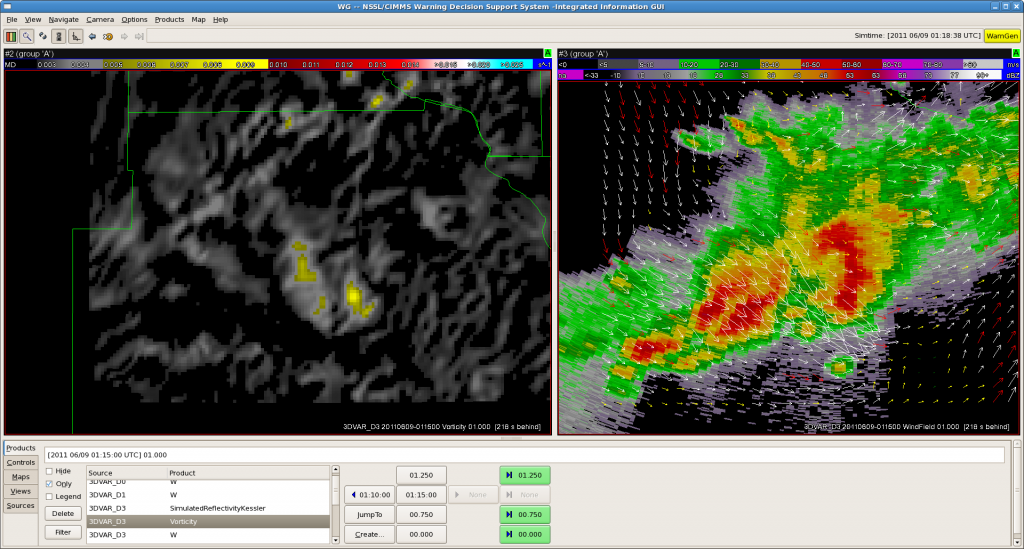
Bill and Justin worked three isolated storms in the BIS area, issuing a SVR warning on one of them.  The basis for the SVR ground relative velocities, mainly a wind threat, perhaps 60-65 mph and 1″ hail.  The actual WFO issued a Tornado Warning on the storm, but the EWP team felt that the circulation was too shallow to warrant a TOR.  Our 3DVAR data feed was out until about 0040 UTC, and wasn’t used much for the warning.  By then, the storms were below severe limits.  While watching the 3DVAR on Jidong’s website prior to restoring the AWIPS feed, there was decent vorticity at 3km, perhaps at the time of the official NWS TOR warning.  Here are some images:
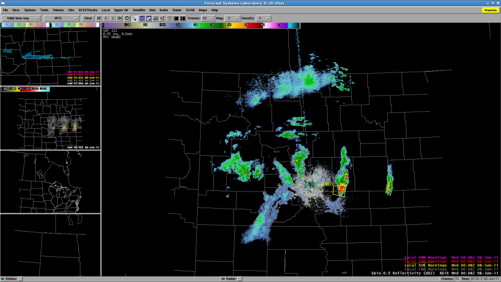
Fig. 1.  KBIS reflectivity and EWP SVR warning.
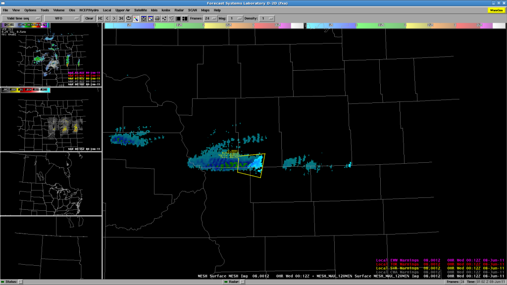
Fig 2.  MESH and 120-min MESH Swath, and EWP SVR warning.
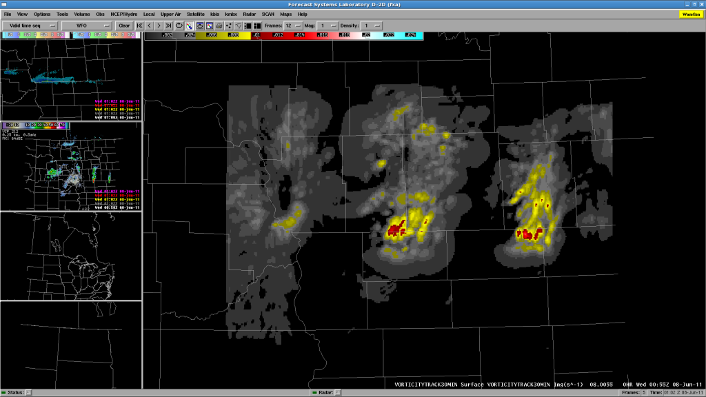
Fig 3.  30-min 3DVAR Vorticity Track.

Here’s an image at 0004 UTC at the time of the NWS TOR issuance.  I’ve placed a marker where the supposed strong rotation couplet is observed.  Note on the reflectivity image that this position is well out ahead of the “hook” in the clear air ahead of the storm core.  Looks like side lobe contamination rather than a vortex couplet.  There is no continuity upstairs either.
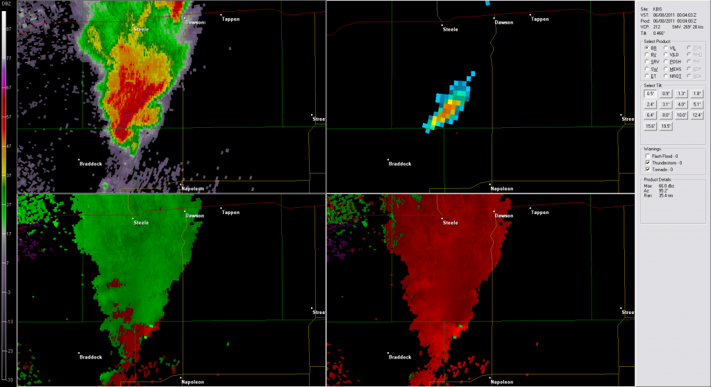
Fig 4.  KBIS images from 0004 UTC 8 June 2011 from GR2AE.

We’ve wrapped up fpr the night, and the forecasters are filling out their surveys.

Greg Stumpf, EWP2011 Week4 Coordinator
Tags: None

Update – 2011-06-07 2305 UTC

Enough waiting!  We’ve decided to slide the MRMS and 3DVAR domains to the west to pick up the ongoing convection in BIS CWA.  Re-locaizing the machines now.  Will add BIS localization and either split Bill and Justin to BIS and FGF or put them both on BIS for now.  They are taking a dinner break while AWIPS does its thing.

Tags: None

Update – 2011-06-07 2215 UTC

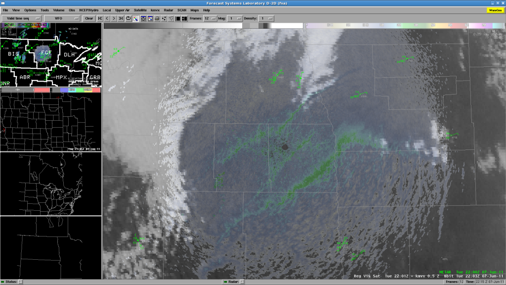
Well, we’ve been waiting, and there has been no CI in either DLH or FGF CWAs.  There has been a hint of some towers on the bulging dryline near FGF, just east of the Red River in Minnesota:

but so far, most of the thunderstorms are remaining west in BIS’s CWA.  Chris and Chris are ending their real-time shift and beginning their surveys.  Meanwhile, Justin is being moved from the DLH WFO to join Bill on the FGF CWA, hoping for CI there, or even the storms in BIS area to move into the west edge of the CWA.

Greg Stumpf, EWP2011 Week 4 Coordinator

Tags: None