The EWP2010 Thank You Post

This is this year’s EWP Thank You post, expressing our gratitude to the many participants of the Experimental Warning Program’s 2010 spring experiment. This year’s experiment was just as successful as the previous experiments, and it could not have been carried out without the hard work and long hours of our team of participants.  EWP2010 ended on a real high note this year, with experimental warning operations for the 17 June 2010 Minnesota and North Dakota outbreak.  All told, we issued 230 warnings and follow up statements on that one day alone, a record for EWP real-time operations.  And the software worked better than ever – of course with most bugs finally being fixed by the end of the experiment.  It seems like a century ago that we began operations on 12 April with the PARISE and CASA experiments.  All told, we have nine weeks of operations, 3 more weeks than any previous years.

The biggest expression of thanks goes to our two AWIPS/WES gurus “on loan” from the NWS Warning Decision Training Branch, Ben Baranowski and Darrel Kingfield.   Their tireless efforts helped keep the ship running through thick and thin.  Without their expertise to set up our simulated real-time NWS forecast office warning environment, localizable to any WFO in the country, as well as our WES archive cases, we simply wouldn’t have had an EWP2010.  Major kudos!

These scientists brought their expertise to the experiment to help guide live operations and playback of archive cases for each of the experiments:

For the Phased-Array Radar Innovative Sensing Experiment (PARISE), we’d like to thank the the principle scientists, Pamela Heinselman (NSSL) and Daphne LaDue (CIMMS), as well as their support team of Ric Adams, Rick Hluchan, Heather Lazrus, Heather Moser, Jennifer Newman, Dave Preignitz, and Adam Smith (all OU, CIMMS, and/or NSSL).

For the Collaborative Adaptive Sensing of the Atmosphere (CASA) experiment was again led by Brenda Phillips (U. Mass.), Jerry Brotzge (OU), and Ellen Bass (U. VA). In addition, we had help from Don Rude (U. VA), David Westbrook (U. Mass.), Cedar League (Univ. Colorado – Colorado Springs), Rachel Butterworth (OU), Brendan Hogan (U. VA), and Kevin Kloesel (OU).

For the Multi-Radar/Multi-Sensor (MRMS) application experiment, they included principle investigators Greg Stumpf (CIMMS/NWS/MDL) and Travis Smith (CIMMS/NSSL), with additional help from CIMMS/NSSL folks Kevin Manross, Kristin Kuhlman, Sarah Stough, and Steve Irwin.

For the GOES-R Proving Ground experimental warning activities, including the Pseudo- Geostationary Lightning Mapping (pglm) array experiment, our thanks go to principle scientists Chris Siewert (CIMMS/SPC) and Kristin Kuhlman (CIMMS/NSSL), along with Geoffrey Stano (NASA-Huntsville), Eric Bruning (Univ. Maryland/NESDIS), Wayne Feltz (UWM), Justin Sieglaff (UWM), Kris Bedka (UWM), Jason Brunner (UWM), Lee Cronce (UWM), Sarah Monette (UWM), Jordan Gerth (UWM), and Lindsay Richardson (CIMMS/NSSL).

Next, we’d like to thank the Weekly Coordinators for keeping operations on track during the experiment’s second phase (MRMS, GOES-R): Travis Smith, Kristin Kuhlman, Kevin Manross, and Greg Stumpf.

We had much IT help from Kevin Manross, Jeff Brogden, Charles Kerr, Villiappa Lakshmanan, Vicki Farmer, Karen Cooper, Paul Griffin,Brad Sagowitz, and Greg Stumpf.

The EWP leadership team of Travis Smith and David Andra, along with the other HWT management committee members (Steve Weiss, Jack Kain, Mike Foster, Russ Schneider, and Jeff Kimpel), and Stephan Smith, chief of the MDL Decision Assistance Branch, were instrumental in providing the necessary resources to make the EWP spring experiment happen.

Finally, we express a multitude of thanks to our National Weather Service and international operational meteorologists who traveled to Norman to participate as evaluators in this experiment (and we also thank their local and regional management for providing the personnel). They are:

Mark Bacon (WFO Wilmington, NC)

Jim Caruso (WFO Wichita, KS)

Jeff Cupo (FAA Training Center, Oklahoma City, OK)

Mike Scotten (WFO Memphis, TN)

Doug Cain (WFO Midland/Odessa, TX)

John Cockrell (WFO Amarillo, TX)

Andrea Lammers (WFO Louisville, KY)

Brian Montgomery (WFO Albany, NY)

Ernie Ostuno (WFO Grand Rapids, MI)

Jennifer Palucki (WFO Albuquerque, NM)

Ryan Sharp (WFO Louisville, KY)

Kathy Torgerson (WFO Pueblo, CO)

Les Lemon (WDTB, Norman, OK)

Steve Hodanish (WFO Pueblo, CO)

Ron Przybylinski (WFO St. Louis, MO)

Bill Martin (WFO Glasgow, MT)

Steve Nelson (WFO Peachtree City/Atlanta, GA)

David Blanchard (WFO Flagstaff, AZ)

Matthew Kramar (WFO Sterling, VA)

Ken Pomeroy (NWS Western Region HQ, Salt Lake City, UT)

Darren Van Cleave (WFO Rapid City, SD)

Rod Donavon (WFO Des Moines, IA)

John Murray (WFO New York, NY)

James Sieveking (WFO St. Louis, MO)

David Zaff (WFO, Buffalo, NY)

Frank Alsheimer (WFO Charleston, SC)

Dan Darbe (WFO Peachtree City/Atlanta, GA)

Daniel Nietfeld (WFO Omaha, NE)

Pat Spoden (WFO Paducah, KY)

Andy Taylor (WFO Norman, OK)

Angela Lese (WFO Lousiville, KY)

Melissa Kreller (NWS Southern Region HQ, Fort Worth, TX)

Marcus Austin (WFO Tallahassee, FL)

David Sharp (WFO Melbourne, FL)

Many thanks to everyone, including those we may have inadvertently left off this list. Please let us know if we missed anyone. We can certainly edit this post and include their names later.

Greg Stumpf (EWP2010 Operations Coordinator)

Tags: None

Forecaster Thoughts – Marcus Austin (2010 Week 9 – MRMS/GOES-R)

The last week of the EWP2010 was a successful one with ample opportunities to test and evaluate the latest technologies soon to become available to operational meteorologists. As a SCEP at the NWS Tallahassee, FL, I had little previous warning experience. Initially, the program was a bit overwhelming, with so many new products to evaluate and only one short week to do so, however, by the later part of the week, certain products became favored over others and the process of developing situational awareness became more natural and comfortable. Our week was the last of the program and was geared toward the GOES-R and MRMS products. My comments on each of these can be found below.  We had a very busy couple of days on June 16th and 17th with a long lived tornadic supercell over South Dakota and a widespread tornado outbreak on the 17th. These two days were challenging and the products in development at the HWT were very useful in the warning decision process. I’d like to thank all who were involved in putting the program together as well as those who stayed around for support. It was a lot of fun and I hope I can make it out again soon.

MRMS Products

The Multi-Radar Multi-Sensor algorithms were an excellent tool during the warning process. In particular, those which emphasized reflectivity at the 0°C, -10°C, and -20°C isotherms were instrumental in assessing hail potential. These combined with products such as the 50 dBZ echo top height above -20°C and layer average reflectivity at the various isotherms highlighted major storms versus those that posed a lesser severe threat. In terms of MESH versus MESHb, storm reports showed that MESH outperformed MESHb when considering more classic supercellular/tornadic storms while MESHb worked well in multicell/linear MCS type events where updraft strength was not as robust. These tools were also useful in terms of delimiting severe warned areas. Looking at reflectivity well above the freezing level allowed forecasters to notice non-descended cores that may produce severe weather downstream. This improved overall polygon size and orientation considering future threats.

In terms of analyzing tornado potential, rotation tracks and the low and mid level shear products were good to reference when orienting polygons. With these tools, storm rotation trends could be derived and tornado warnings could more accurately reflect the individual threat from the tornado. These products complimented base reflectivity and velocity data well and provided extra guidance on the location and motion of potential tornadic circulations.

Overall, the MRMS products were most useful during the warning phase of the experiment. They provided a good quick look when analyzing traditional radar data and a confidence booster when issuing warnings for severe hail and tornadoes. Products geared toward reflectivity thresholds provided an overview of which cells tended to be more severe and how they were growing/decaying over time. This prevented possible oversight of minor severe storms while focusing on those that were producing the most severe weather at the time. I hope to see these products move into the operational realm so more forecasters have an opportunity to test them in real severe weather scenarios.

GOES-R Products

The GOES-R tools were mainly geared toward convective activity. A convective initiation algorithm was developed to discern areas of likely impending thunderstorm development. This product would be very useful, especially for aviation interests when making short-term changes to TAFs to reflect thunderstorm threats. It would also be a good reference for putting out watches/mesoscale discussions when forecasting short-term probability of severe weather given a volatile thunderstorm environment. Unfortunately, we were unable to effectively evaluate this product as the shifts took place in the afternoon after most convection had already initiated. Verification was carried out the day after to see how severe reports lined up with the CI detections. Overall, I feel that visible satellite would likely clue me in on convective initiation, but the tool performed well in retrospect.

In addition to these, overshooting top (OT)/cloud top cooling and enhanced-v signature products were developed to indicate the likelihood of severe weather for particular storm cells. OT detections were widespread with very few enhanced-v signatures detected. Enhanced-v detections were always associated with severe weather, mainly in supercell thunderstorms. Some overshooting tops on visible satellite were missed, but overall it performed fairly well. The real question is how useful would such a product be in a warning situation. I would not feel comfortable warning solely on an OT or enhanced-v detection without some base radar data or perhaps MRMS imagery to back it up. These products would have been better before the event began and in a regional sense to get a feel for where the strongest convection was occurring, or where the greatest potential for severe weather would begin. One glaring limitation of the GOES-R products is that they only work under clear skies with no cirrus present. Overall, I found these products to be more interesting than useful in terms of issuing warnings; however I was not able to evaluate them thoroughly due to time limitations.

Marcus Austin (Student Career Employment Program, NWS Tallahassee FL – 2010 Week 9 Evaluator)

Tags: None

Week 9 EWP Summary: 14-18 June 2010

SUMMARY:

Week #9 of EWP2010 concluded the 2010 spring experiment, and wrapped up with continued MRMS and GOES-R experimentation.  The 2010 experiment ended with probably our most prolific severe weather outbreak in our four-year history with the MN-ND record tornado outbreak.  During this week, NSSL and the GOES-R program hosted the following National Weather Service participants:  Angela Lese (WFO Louisville, KY), Melissa Kreller (Southern Region HQ, Fort Worth, TX), Marcus Austin (WFO Tallahassee, FL), and Dave Sharp (Melbourne, FL).

REAL-TIME EVENT OVERVIEW:

14 June: “Practice” IOP for some severe storms over Oklahoma and Texas.

15 June: All-day IOP focusing on an Ohio Valley MCS wind event, with some isolated non-tornadic supercells ahead of the MCS.  Many experimental warnings were issued.

16 June: Early afternoon IOP over the DC domain netted only marginally severe storms.  Evening IOP focused on western SD, including a prolific nearly stationary multiple-tornado supercell near Dupree.

17 June: Record tornado outbreak for Minnesota and North Dakota.  We issued 230 experimental severe weather warnings and statements through a 6 hour IOP, a daily record for the EWP.

MRMS:

As was the case from the previous 3 weeks of EWP2010, the forecasters became increasingly more comfortable with the MRMS products as the week moved along.  As if carefully choreographed, the weather events for each successive day became increasingly more severe and widespread, to prepare our forecasters the the following day’s activities!  In general, the forecasters used the MRMS products to their extent by the final day of activities, finding them to be very useful.  However, we did find one forecaster who gravitated back to a comfort level of using more traditional techniques nearing the final few hours of the 17 June outbreak, when a cluster of tornadic supercells was affecting southern MN.

In addition, as seems to be the case each spring, the experimental infrastructure seems to finally come to a nearly bug-free condition in the final few days of the experiment.  The HWT AWIPS system had very few issues on the last few days of the week, although some of the experimental MRMS grids still took a little long to load up for the first time.  If we plan to use AWIPS1 for one more year, this is a top priority to find a solution – speed up the loading of these products.  One of the developer/researchers did happen to note that he was amazed at the complexity of the procedures that were used by some of the forecasters, with multiple 4-panel panes with image combinations, etc., and at how our visiting forecasters could keep up with that.

Some of the comments received during the end-of-week debriefing were echoed from previous week’s forecasters.  For example, it was again noted that the tracks products (hail and rotation) were very helpful in double-checking the orientation of the storm-based polygons, and also helped to fine tune the width of the polygons to cover narrower severe weather threats.  However, it was noted that in the final few hours of the MN-SD outbreak, because there was so much severe weather, some the polygons started getting “wide” again since there was not enough time to keep up with the widespread coverage of the severe storms.  Knowing this, we could consider this event a good archive practice case, one which could be performed by the forecasters at the end of the week once familiarity of the MRMS products is at its peak.

It was again noted that some of the MRMS products, such as the Height of the 50 dBZ over the -20 degree C altitude were very useful to provide a simple quick-look heads up as to which storms were worthy of closer inspection or warning.  These products are somewhat sparse grids, and only show the most severe storms (so not many at once).  Since they are from the MRMS grid, there is no need to explore each storm from each radar using all-tilts or 4-panels with height sampling, or have to choose the appropriate radar – the “answer” is right there on one simple rapidly-refreshing grid.

And again, comments were made regarding developing MRMS products to help with wind-based warnings, such as those which could exploit the LLSD Radial Shear computations for a Mid-Altitude Radial Convergence (MARC) signature detection.

Other comments included:  The “thickness” products, such as H50_Above_H253 should include negative values so that we can know when storms are approaching severe limits. since the grids are so sparse they are sometimes hard to see; MESH appears to do better than MESHb at low elevations, and the reverse at high elevations (NOTE:  The gridded-MESH does not do an elevation correction like the cell-based ORPG version – this needs to be fixed); 30-min tracks worked better for training storms.

GOES-R:

As with other weeks, the GOES-R products were not used nearly as much as the MRMS products, but then again that is somewhat by design.  A convective initiation product is more useful at the onset of storms, and many of our shifts had begun after CI.  The forecasters did not that although the Overshooting Tops and Thermal Couplet products were sparse, they usually happened on storms that were already obviously severe from the radar data.  They did give a little more confidence however, but they had a tendency to stop looking at the products during the heat of the warning events.

Other useful comments included:  The products are on very sparse grids, so larger icons and alerts would be useful; they wouldn’t mind that the CI product was more liberal in its detection with higher FAR, but adding probabilistic info might help parse the more important signatures; would like a good Western U.S. example where there is a lack of multi-radar coverage (but unfortunately, also a lack of severe storms); have earlier starting shifts to concentrate on the CI products.

The PGLM data exposure was mainly through the 24 May 2008 Oklahoma archive case.  A couple of forecasters noted that they would have to acquire more understanding of what the relative values mean to severe weather before becoming more comfortable with it.  They also hoped that in future EWPs, there could be more emphasis placed on events outside traditional Oklahoma tornadic storms.  Unfortunately, time did not permit us to make additional archive events, and there were only and handful of real-time events that coincided with our domains (and the networks being active).  In fact, we didn’t have a single Central Florida severe event to test.

There are more details on the GOES-R HWT Blog Weekly Summary.

OVERALL COMMENTS:

Several commented that a simple 20-min Articulate primer on each of the experiments would have been very useful to have prior to arriving in Norman.  In addition, a 20-min Articulate on existing ways to get the MRMS data (Google Earth KML, and On-Demand) should be developed as soon as possible, to continue to expand the word out on these very useful applications.  Also suggested that regional teleconference meetings and workshops would be a good way to get the spread the word.

The forecasters prefer that we “hand-hold” on the first day a little better.  Perhaps an archive case on the first day and then throw them into warnings.  Also, default procedures need to be developed to avoid having to set them up the first day, which takes a long time [NOTE:  This was also suggested last year, but as I’ve learned, forecasters are very unique on their procedures, combining the experimental data with their own, that I felt it was better served to allow the forecasters to build their own.  I will have to re-visit this decision for next year.]

There were comments about the fact that the products still took some time to initially load, and that there was a lot of maintenance required of the AWIPS system.  [NOTE:  A full-time HWT IT person could really help here!]

A LOOK AHEAD:

We are finished for the spring.  The next operation could occur as early as this fall.  Details will be announced as they arrive.

Greg Stumpf, EWP2010 Operations Coordinator

Week 9 EWP Summary: 14-18 June 2010

SUMMARY:

Week #9 of EWP2010 concluded the 2010 spring epxeriment, and wrapped up with continued MRMS and GOES-R

experimentation.  The 2010 experiment ended with probably our most prolific severe weather outbreak in our

four-year history with the MN-ND record tornado outbreak.  During this week, NSSL and the GOES-R program

hosted the following National Weather Service participants:  Angela Lese (WFO Louisville, KY), Melissa Kreller

(Southern Region HQ, Fort Worth, TX), Marcus Austin (WFO Tallahassee, FL), and Dave Sharp (Melbourne, FL).

REAL-TIME EVENTS:

14 June:  “Practice” IOP for some severe storms over Oklahoma and Texas.

15 June:  All-day IOP focusing on an Ohio Valley MCS wind event, with some isolated non-tornadic supercells

ahead of the MCS.  Many experimental warnings were issued.

16 June:  Early afternoon IOP over the DC domain netted only marginally severe storms.  Evening IOP focused on

western SD, including a prolific nearly stationary multiple-tornado supercell near Dupree.

17 June:  Record tornado outbreak for Minnesota and North Dakota.  We issued 230 experimental severe weather

warnings and statements through a 6 hour IOP, a daily record for the EWP.

A summary of each experiment follows:

MRMS:

As was the case from the previous 3 weeks of EWP2010, the forecasters became increasingly more comfortable

with the MRMS products as the week moved along.  As if carefully choreographed, the weather events for each

successive day became increasingly more severe and widespread, to prepare our forecasters the the following

day’s activities!  Actually, on the final day, we did find one forecaster who gravitated back to a comfort

level of using more traditional techniques nearing the final few hours of the event, when the a cluster of

tornadic supercells was affecting southern MN.  However, the other forecasters used the MRMS products to their

extent on the last day.

In addition, as seems to be the case each spring, the experimental infrastructure seems to finally come to a

nearly bug-free condition in the final few days of the experiment.  The HWT AWIPS system had very few issues

on the last few days of the week, although some of the experimental MRMS grids still took a little long to

load up for the first time.  If we plan to use AWIPS1 for one more year, this is a top priority to find a

solution – speed up the loading of these products.  One of the developer/researchers did happen to note that

he was amazed at the complexity of the procedures that were used by some of the forecasters, with multiple

4-panel panes with image combinations, etc., and at how our visiting forecasters could keep up with that.

Some of the comments received during the end-of-week debriefing were echoed from previous week’s forecasters.

For example, it was again noted that the tracks products (hail and rotation) were very helpful in

double-checking the orientation of the storm-based polygons, and also helped to fine tune the width of the

polygons to cover narrower severe eather threats.  However, it was noted that in the final few hours of the

MN-SD outbreak, because there was so much severe weather, some the polygons started getting “wide” again since

there was not enough time to keep up with the widespread coverage of the severe storms.  Knowing this, we

could consider this event a good archive practice case, one which could be performed by the forecasters at the

end of the week once familiarity of the MRMS products is at its peak.

It was again noted that some of the MRMS products, such as the Height of the 50 dBZ over the -20 degree C

alitutude were very useful to provide a simple quick-look heads up as to which storms were worthy of closer

inspection or warning.  These products are somewhat sparse grids, and only show the most severe storms (so not

many at once).  Since they are from the MRMS grid, there is no need to explore each storm from each radar

using all-tilts or 4-panels with height sampling, or have to choose the appropriate radar – the “answer” is

right there on one simple rapidly-refreshing grid.

And again, comments were made regarding developing MRMS products to help with wind-based warnings, such as

those which could exploit the LLSD Radial Shear computations for a Mid-Altitude Radial Convergence (MARC)

signature detection.

Other comments included:  The “thickness” products, such as H50_Above_H253 should include negative values so

that we can know when storms are approaching severe limits. since the grids are so sparse they are sometimes

hard to see; MESH appears to do better than MESHb at low elevations, and the reverse at high elevations (NOTE:

The gridded-MESH does not do an elevation correction like the cell-based ORPG version – this needs to be

fixed); 30-min tracks worked better for training storms.

GOES-R:

As with other weeks, the GOES-R products were not used nearly as much as the MRMS products, but then again

that is somewhat by design.  A convective initiation product is more useful at the onset of storms, and many

of our shifts had begun after CI.  The forecasters did not that although the Overshooting Tops and Thermal

Couplet products were sparse, they usually happened on storms that were already obviously severe from the

radar data.  They did give a little more confidence however, but they had a tendency to stop looking at the

products during the heat of the warning events.

Other useful comments included:  The products are on very sparse grids, so largericons and alerts would be

useful; they wouldn’t mind that the CI product was more liberal in its detection with higher FAR, but adding

probabilistic info might help parse the more imporant signatures; would like a good Western U.S. example where

there is a lack of multi-radar coverage (but unfortunately, also a lack of severe storms); have earlier

starting shifts to concentrate on the CI products.

The PGLM data exposure was mainly through the 24 May 2008 Oklahoma archive case.  A couple of forecasters

noted that they would have to aqcuire more understanding ofwhat the relative values mean to severe weather

before becoming more comfortable with it.  They also hoped that in future EWPs, there could be more emphasis

placed on events outside traditional Oklahoma tornadic storms.  Unfortunately, time did not permit us to make

additional archive events, and there were only and handful of real-time events that coincided with our domains

(and the networks being active).  In fact, we didn’t have a single Central Florida severe event to test.

There are more details on the GOES-R HWT Blog

(http://goesrhwt.blogspot.com/2010/06/ewp-weekly-debrief_18.html).

OVERALL COMMENTS:

Several commented that a simple 20-min Articulate primer on each of the exeriments would have been very useful

to have prior to arriving in Norman.  In addition, a 20-min Articulate on existing ways to get the MRMS data

(Google Earth KML, and On-Demand) should be developed as soon aspossible, to continue to expand the word out

on these very useful applications.  Also suggested that regional teleconference meetings and workshops would

be a good way to get the spread the word.

The forecasters prefer that we “hand-hold” on the first day a little better.  Perhaps an archive case on the

first day and then throw them into warnings.  Also, default procedures need to be developed to avoid having to

set them up the first day, which takes a long time [NOTE:  This was also suggested last year, but as I’ve

learned, forecasters are very unique on their procedures, combining the experimental data with their own, that

I felt it was better served to allow the forecasters to build their own.  I will have to re-visit this

decision for next year.]

There were comments about the fact that the products still took some time to initially load, and that there

was a lot of maintenance required of the AWIPS system.  [NOTE:  A full-time HWT IT person could really help

here!]

A LOOK AHEAD:

We are finished for the spring.  The next operation could occur as early as this fall.  Details will be

announced as they arrive.

Greg Stumpf, EWP2010 Operations Coordinator

Tags: None

Daily Summary – 17 June 2010

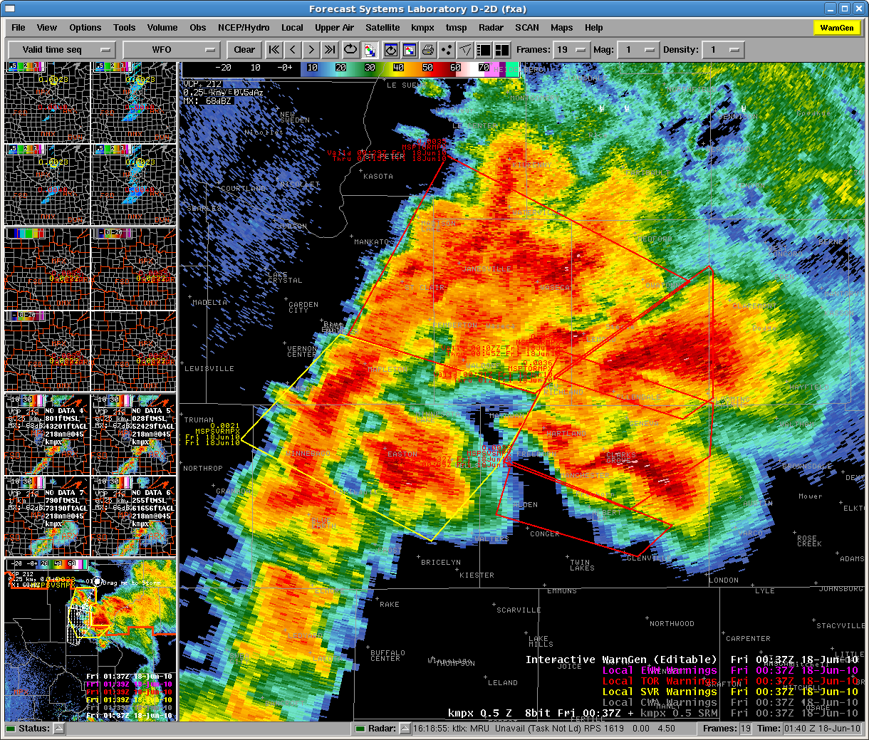
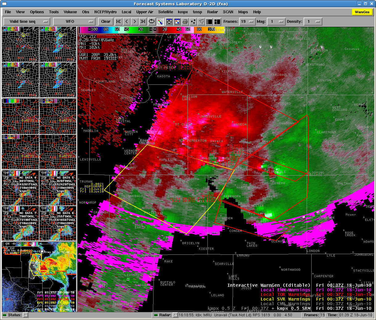
Whew!  What a way to finish up EWP2010.  I will post more pictures of our products and warnings on the weekly summary.  Just around 8pm, storms exited the FGF CWA, and our two forecasters there began their surveys.  In addition, a large rotating cluster of tornadic supercells raked across southern Minnesota near Albert Lea.  The radar presentation on that event brought back memories of what the Beloit Kansas supercell complex from 6/15/92 must have looked like:  “TORNADOES ALQDS”.   Note the 5 or 6 simultaneous TVSs!

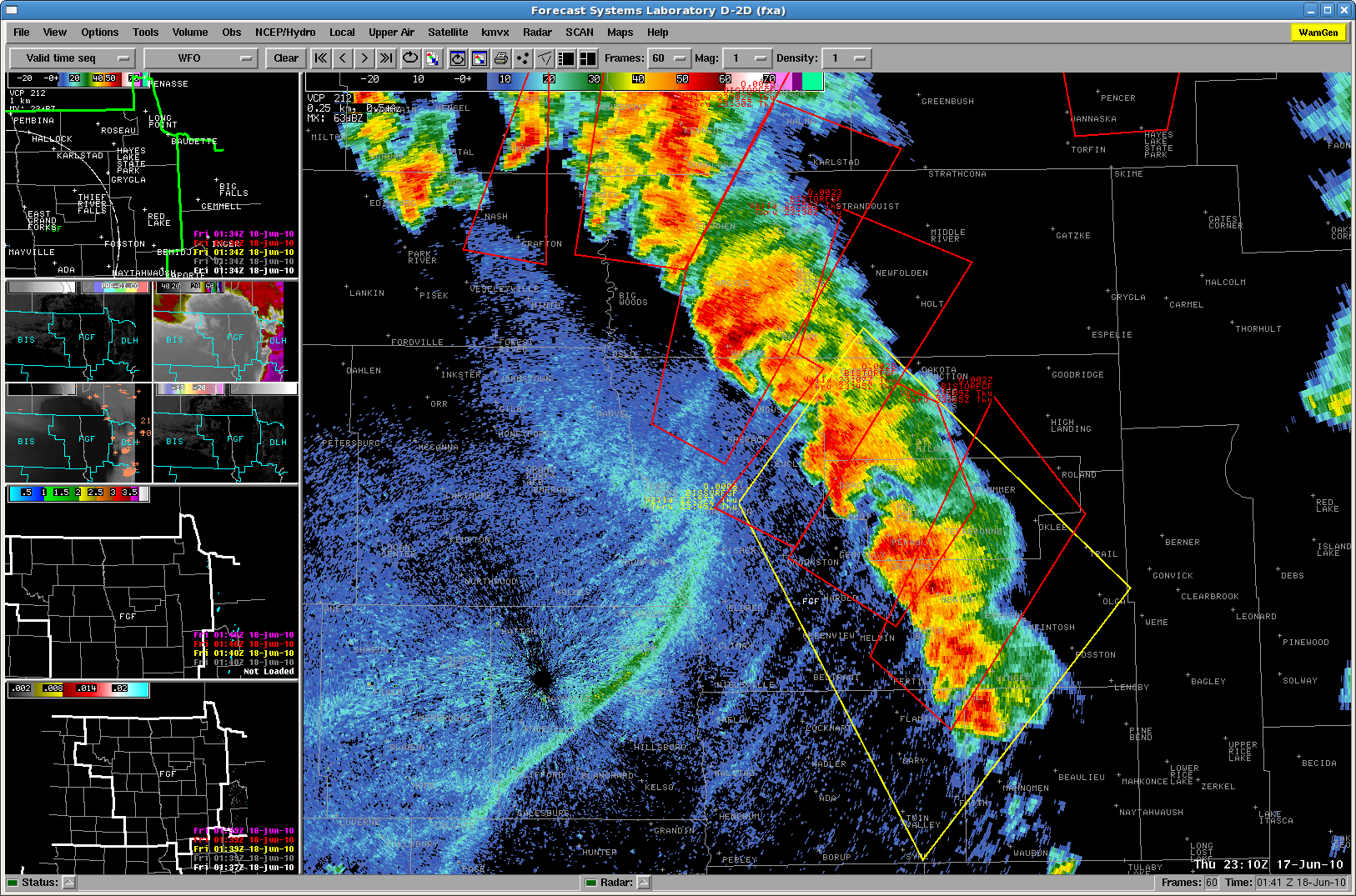
Our forecasters working the FGF (Grand Forks ND) WFO had to contend with “lines” of tornadic storms.  For example:

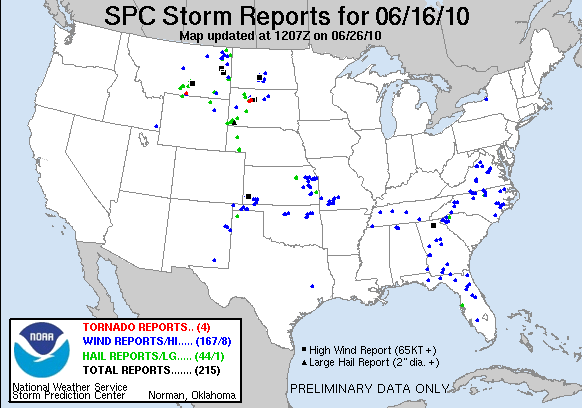
There have been 35 tornadoes so far reported on the SPC logs (some in BIS and DSM CWAs), and we expect that the number will increase greatly as all of the reports start filtering in.  This was by far the most active (non-Oklahoma) event for the Experimental Warning program in 4 years of HWT activities.  And to top off the success, there were barely any AWIPS technical issues at all – the heavily taxed system finally worked well!

Greg Stumpf (EWP Weekly Coordinator, 14-18 June 2010)

Tags: None

Live Blog – 17 June 2010 (7:30pm)

The tornado outbreak continues.  Our MPX WFO has been removed of a forecaster to do the archive case, so Jordan has stepped in to help.  We also continue with two mets on FGF. Significant tornadoes with damage have been reported in both CWAs.  One storm in particular near Albert Lea MN is a beast.  Our forecasters are doing a great job keeping up with the threats.  Later, we will compare their warning polygons with the official warning polygons.  Previews by the coordinators indicate there are major differences!

Greg Stumpf (EWP Weekly Coordinator, 14-18 June 2010)

Tags: None

Live Blog – 17 June 2010 (6:35pm)

Wow!  Been so busy, forgot to make a live blog post.  We have been working the tornado outbreak event as WFOs Minneapolis MN (MPX) and Grand Forks ND (FGF).  In the early part of the afternoon, we had two forecasters working MPX and the other two on the 5/24/08 archive case.  Greg Stumpf (Ops Coord.) decided to work the FGF himself, and was quite overwhelmed, but managed to issue a number of TORs on the storms there.  Isolated storms ahead of the dryline, as well as a line of tornadic storms on the dryline!  Here is a current picture of our active experimental warnings (NOTE:  These are unofficial warnings!).  On the left – multi-radar MESH (Max Exp. Hail Size).  On the right – 30 minute rotation tracks.

Greg Stumpf (EWP Weekly Coordinator, 14-18 June 2010)

Tags: None

Outlook – 17 June 2010

The last operations day for EWP2010 finds us operating in the Northern Plains/Midwest for the first time this spring.

The SPC has issued a MODT Risk for the Minnesota area in response to a strong negatively tilted trough and deep surface circulation moving through the area.  Attendant to the system will be a very unstable warm sector, warm front and occlusion with a trailing dryline/cold front.  Forecast soundings from the 17 UTC RUC valid for 00 UTC show very deep instability (3000-4000 J/kg).  Deep layer shear exceeds 50 kts, especially in the north part of the state.  Low-level shear also is very high, exceeding 30-40 kts in places.  Hodographs, especially over MPX’s northern half and DLH’s area are very favorable, with a hint of a Dan Miller sickle on some.

For today, we are going to start two forecasters right away on nowcast and warning operations for the Minneapolis MN (MPX) WFO.  Tornado Watches are already out for the area.

The two other forecasters who hadn’t yet done the 5/24/08 LMA archive case are doing so this afternoon.

Greg Stumpf (EWP Weekly Coordinator, 14-18 June 2010)

Tags: None

Daily Summary – 16 June 2010

Two parts today.

Part 1 (pre-600pm):  DC-LMA domain.  Our Sterling WFO (LWX) team issued a number of SVR warnings, mostly for wind.  Our State College WFO (CTP) had numerous AWIPS problems (no notifications), and there were no severe storms.

Part 2 (post-600pm):  Floater domain over the western half of South Dakota.  Two forecasters in the Rapid City domain, and one briefly in the Aberdeen domain.  Three severe storms, including one major supercell that produced prolific large tornadoes and was nearly stationary near Faith.  All systems worked well today.

Also during Part 2, one forecaster went through the 5/24/08 archive case.

Surveys were given to the two forecasters that issued most of the warnings today.

Greg Stumpf (EWP Weekly Coordinator, 14-18 June 2010)

Tags: None

Live Blog – 16 June 2010 (6:55pm)

OK – we just switched out LWX team to Rapid City SD (UDX) since the Virginia convection is petering out.  Several nice supercells are ongoing in the Rapid City area.

Meanwhile, our CTP team is now doing the 5/24/08 Oklahoma archive case.

Greg Stumpf (EWP Weekly Coordinator, 14-18 June 2010)


Tags: None

Live Blog – 16 June 2010 (6:05pm)

Our notification problems would not go away for two of our four workstations, the two running State College CWA.  Since that CWA was remaining quiet, we decided to move those two forecasters over to the Oklahoma LMA archive case for the remainder of the evening.

Our Sterling CWA team has had no workstation issues, and has been issuing on the order of 6-7 SVR warnings today.  However, it appears that the few storms are winding down and moving out of their CWA. The SPC never issued a watch for this area, despite the warnings (presumably – haven’t looked at the official warnings yet), and the 5% Tornado Risk in the 2000 UTC DY1 outlook.

For the evening, we may find them another CWA to operate, either State College (storms beginning to pick up to their west), or move to one of the High Plains locations.

Greg Stumpf (EWP Weekly Coordinator, 14-18 June 2010)

Tags: None