
Without 1-min imagery, this would be much harder to identify in a timely fashion.
Click for loop
Jason Williams
Official websites use .gov
A
.gov website belongs to an official government
organization in the United States.
Secure .gov websites use HTTPS
A
lock (
) or https:// means you’ve safely connected to
the .gov website. Share sensitive information only on official,
secure websites.

Real-time posts made during testbed nowcast and warning operations.
Without 1-min imagery, this would be much harder to identify in a timely fashion.
Click for loop
Jason Williams
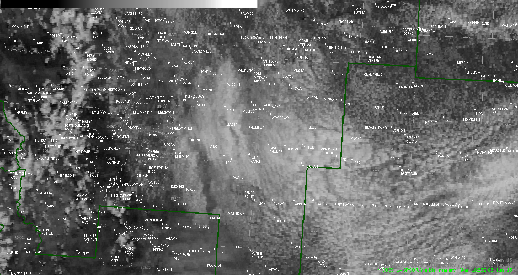
Since there is snow on the highest elevations of the Rockies, it’s interesting to see how CI handles that. I occasionally was seeing pink showing up and found that, indeed, CI tries to figure out snow contamination. It catches small parts of the snowcover, but doesn’t stay on them for particularly long periods (at least as of 1845z). I suspect the spatial resolution of the CI model plays a role in that.
Click for animation.

Jason Williams
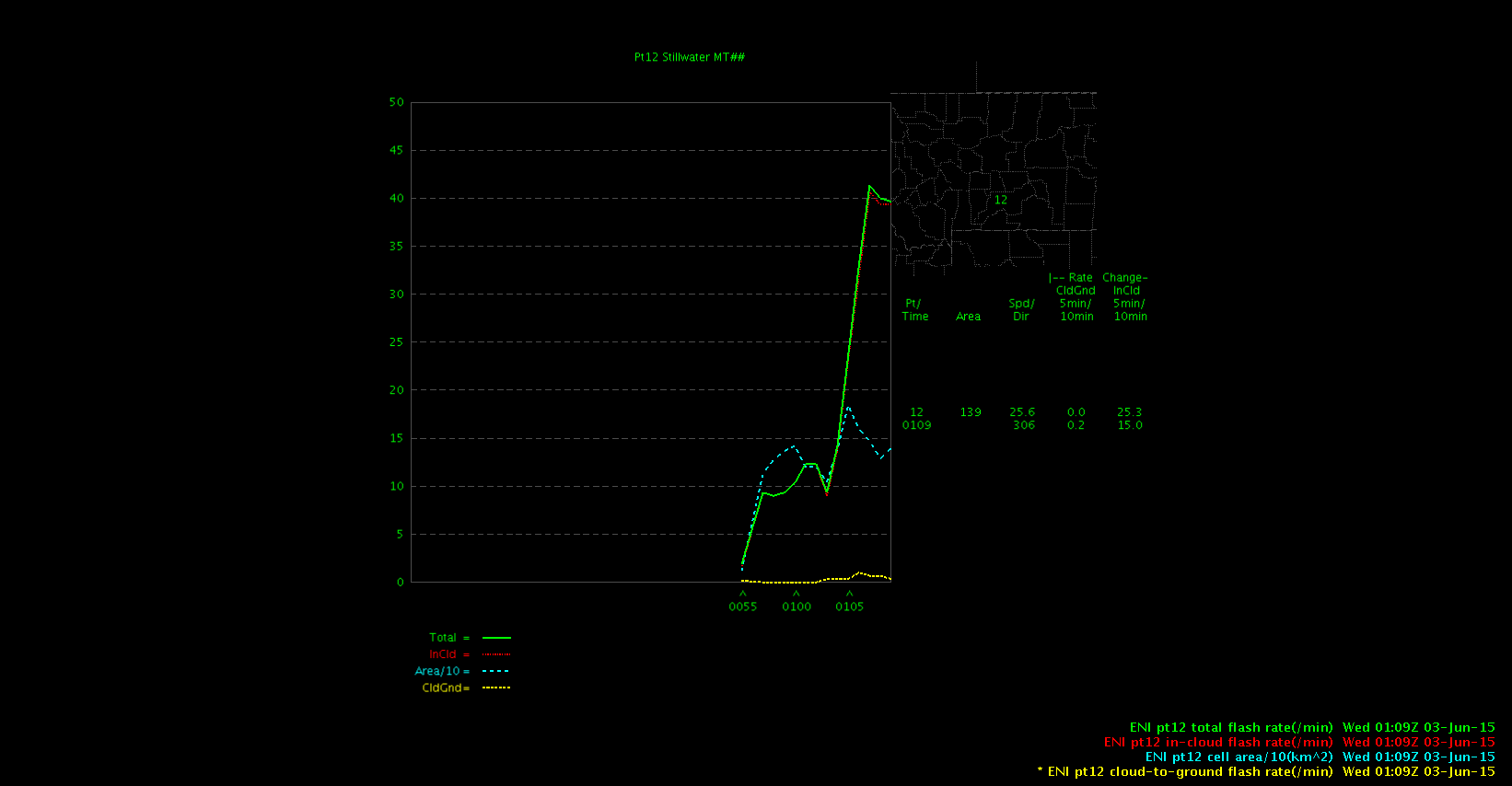
0109z – very large jump in lightning rate, but it was not due to the cell area having a big jump. Lots of factors increasing confidence in a SVR with this storm.
Jason Williams

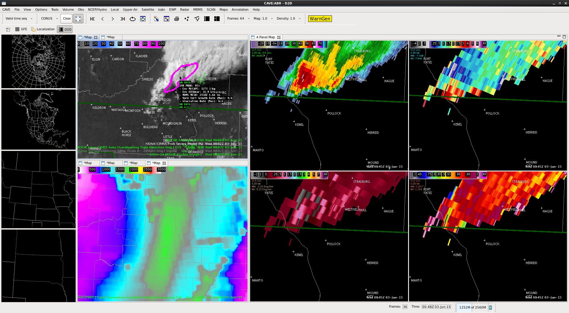
The ProbSevere algorithm jumped from 36% to 88% between 0052z and 0056z. At 0102z, a large TBSS appeared, so there was certainly lead time on that feature showing up.

Lightning has also increased enough to flag a Significant Thunderstorm Alert. While it didn’t initially look like storm was going produce much, it ended up intensifying – the ProbSevere definitely gave a few extra minutes of lead time.
Jason Williams

Storms are still festering in the NW BYZ CWA. This one near Hailstone Wildlife Refuge (okay, its name was a big factor for this post) went from 12% to 36% between 0046z and 0048z.
Lightning trends have not been impressive – only the northern storm, just outside the radar screenshot, has had a thunderstorm alert.

Jason Williams
I think ProbSevere has usefulness even after the storms initiate and even after they become severe. SCAN allows us to see the environmental read out around a cell, however the probsevere’s displays allows me to easily see the important information about the environment. i like this better than the scan display.
MacGyver

Hail reports ended being sub-severe, but it was good that there was finally confirmation that something was happening with the storm exiting the SE corner of the BYZ CWA. Radar was becoming increasingly difficult to use due to distance from radar, but the lightning data continued to show it maintaining its strength and perhaps even intensifying after 00z. This may sound a lot like my previous post, but I’m really impressed with how helpful this was on this particular storm. It’s worth reiterating that this product may have a lot of value when dealing with storms at a great distance from the radar site.
Jason Williams


ProbSevere was increasing after 2300z, and reached above 80% at the 2324z radar scan. However, the lightning data doesn’t show anything particularly notable as far as an increase in rate.
Hail potential is evident on radar, although ProbSevere MESH is only at about 1″. Given the marginal nature of the MESH and the lack of increase in lightning, this is a situation in which I would hedge toward not warning because of the addition of the experimental products. If I just had NEXRAD, I would have leaned toward warning, despite the distance from radar.
Jason Williams


Our southeast BYZ CWA storm keeps on going, but the lowest tilt is hitting it at more than 8500 feet AGL. Storm interrogation is obviously compromised at this distance.
However, the lightning trend on this storm has continued to climb, which would suggest that it continues to intensify (or, at the very least, maintain its strength). This is really helpful for a distant storm in which radar sampling is less useful.
Jason Williams


At roughly the same time as our big convection was happening with the high reflectivity and climb in lightning frequency, the overshooting top algorithm was triggered.
Image from 2210z.
Jason Williams