
Click for loop. You can see updrafts go up and goes along with the increase in lightning on the PGLM.
Jason Williams
Official websites use .gov
A
.gov website belongs to an official government
organization in the United States.
Secure .gov websites use HTTPS
A
lock (
) or https:// means you’ve safely connected to
the .gov website. Share sensitive information only on official,
secure websites.

Real-time posts made during testbed nowcast and warning operations.
Click for loop. You can see updrafts go up and goes along with the increase in lightning on the PGLM.
Jason Williams
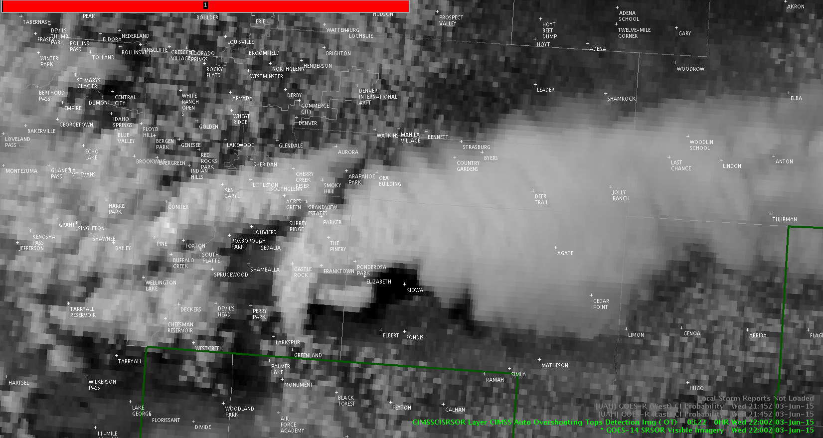
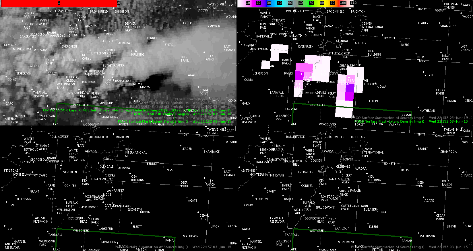
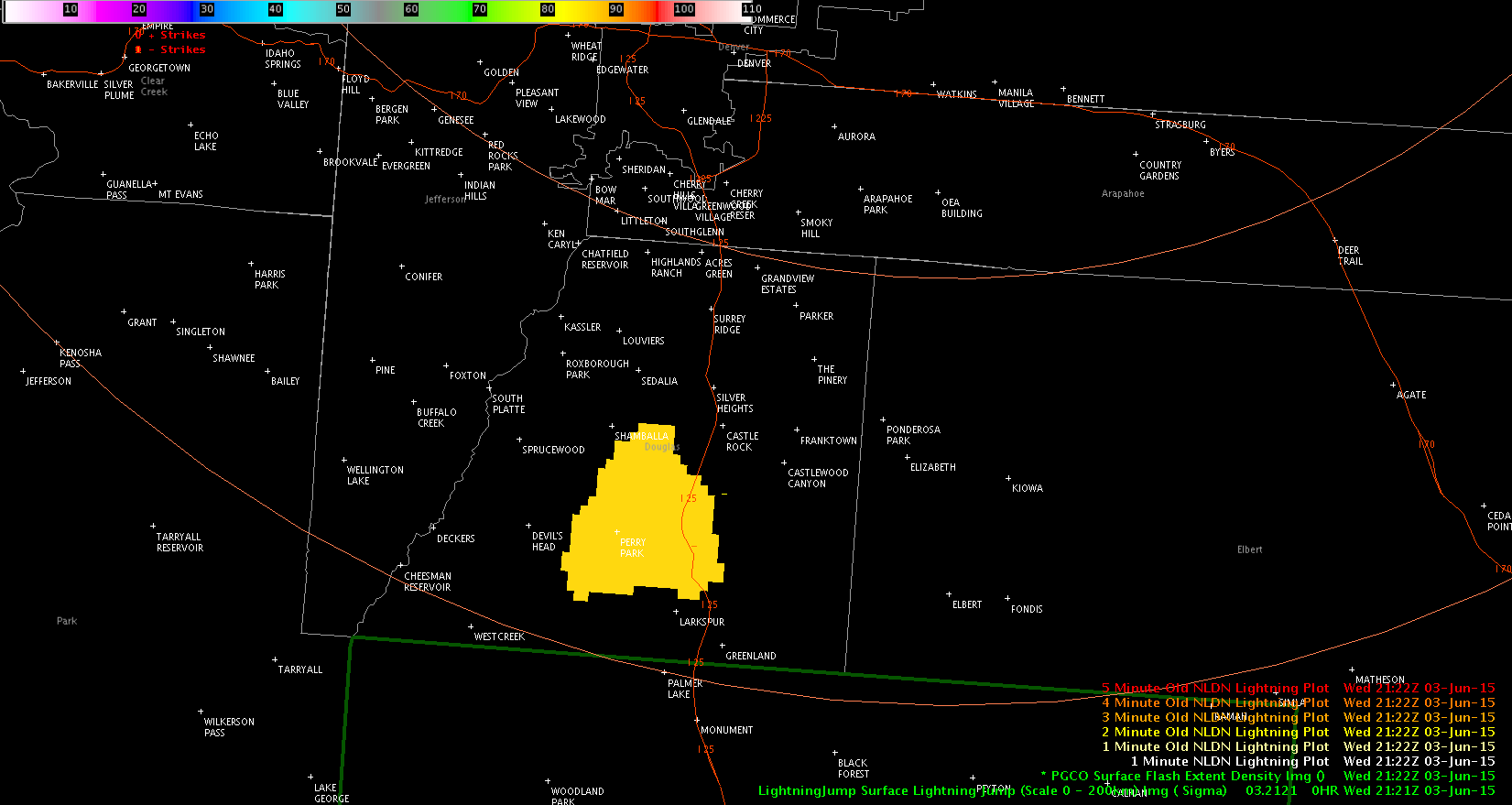
Lightning jump nearly coincident with yet another updraft (sat images are five minutes apart from one to another).
Radar reflectivity increased shortly thereafter. An aside: MRMS VII also jumped.
Jason Williams
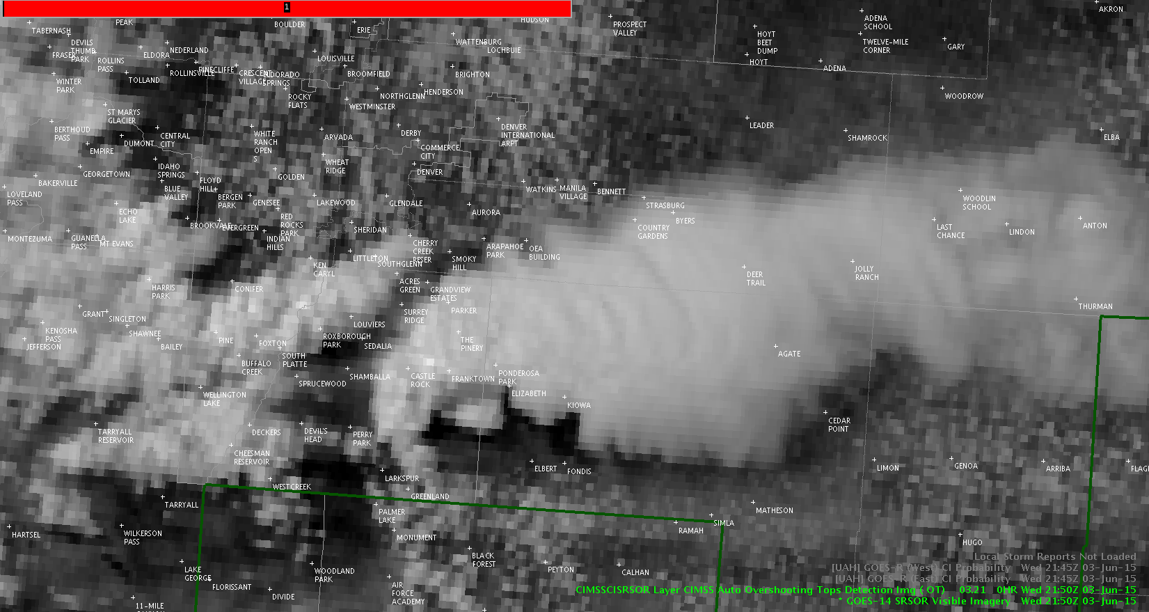
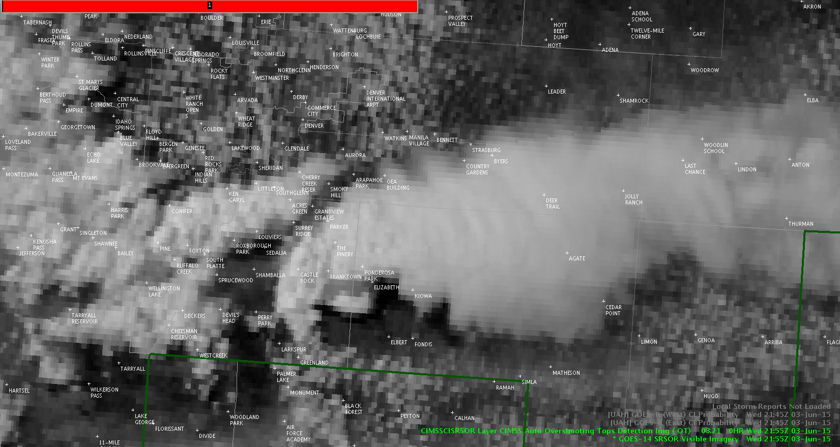
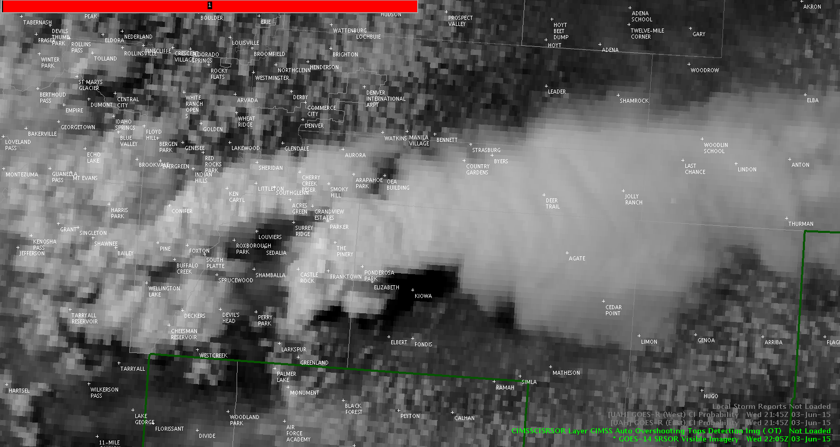
Click for loop – you can see another updraft shoot up on the west side of the storm.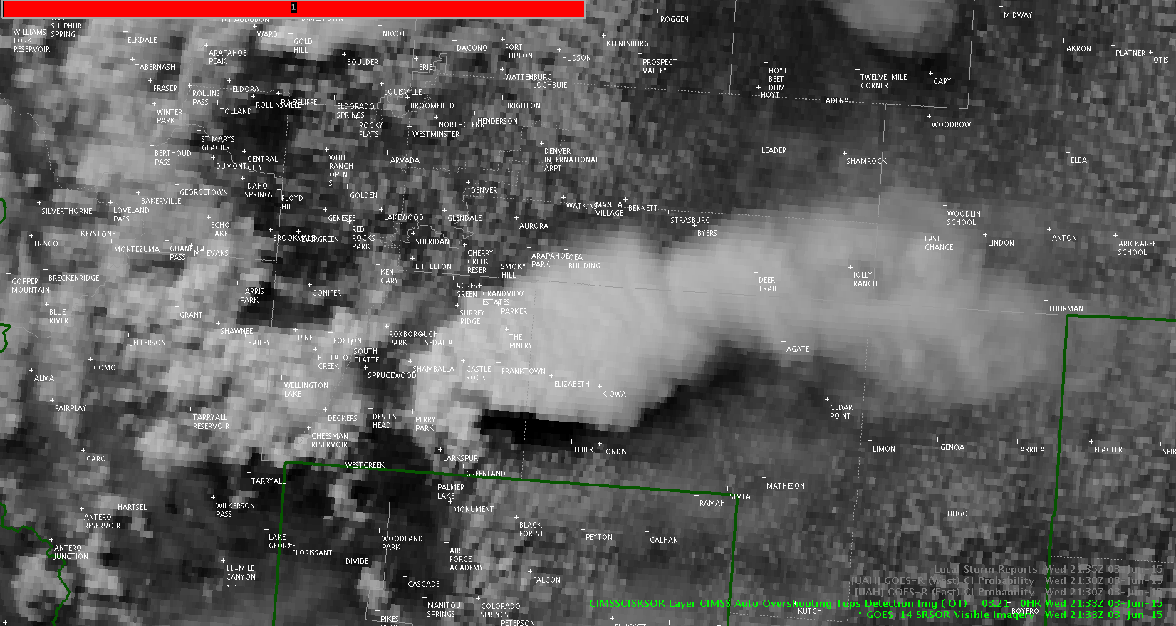
Jason Williams
Click for loop.
1 min vis shows the general flow of the cu field to the west, but the clouds to the south of the supercell show the strong inflow as they make a hard turn north.

Jason Williams
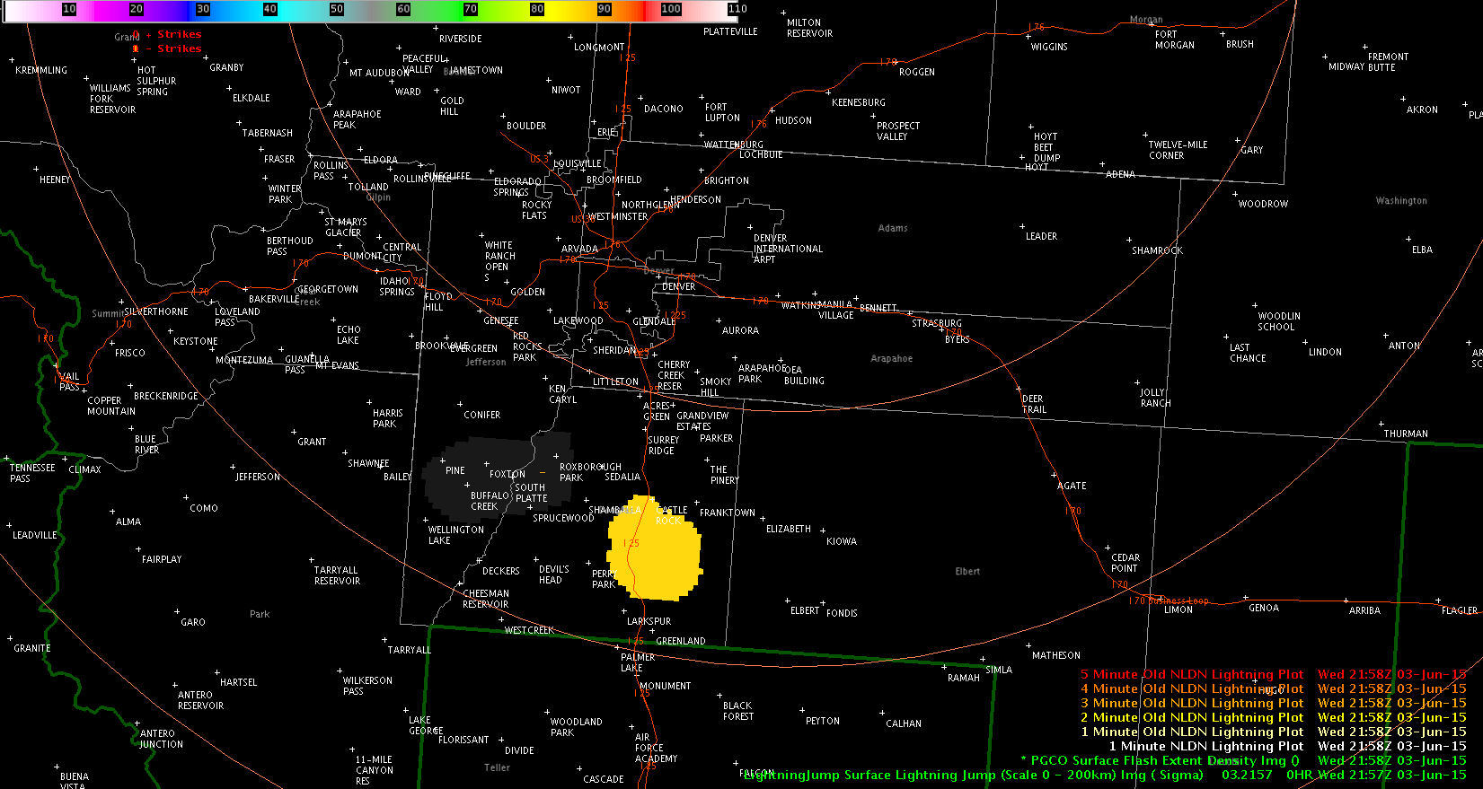
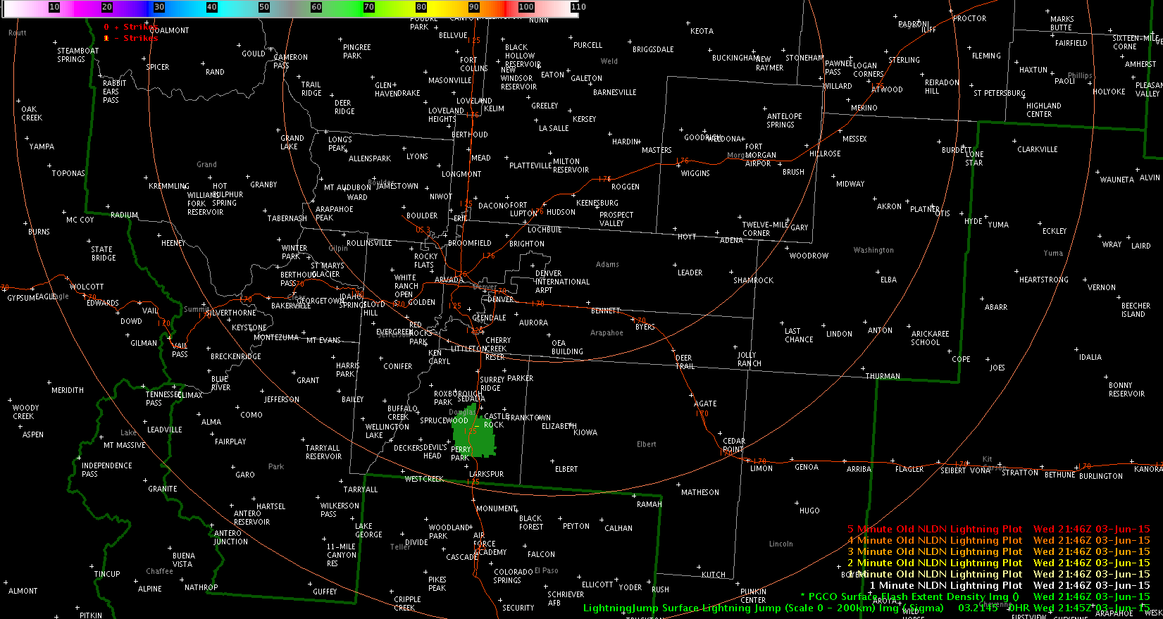
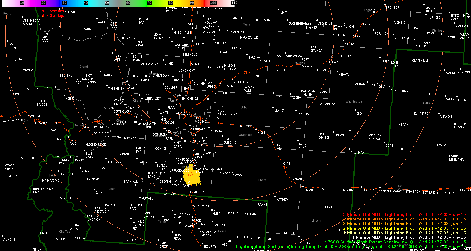
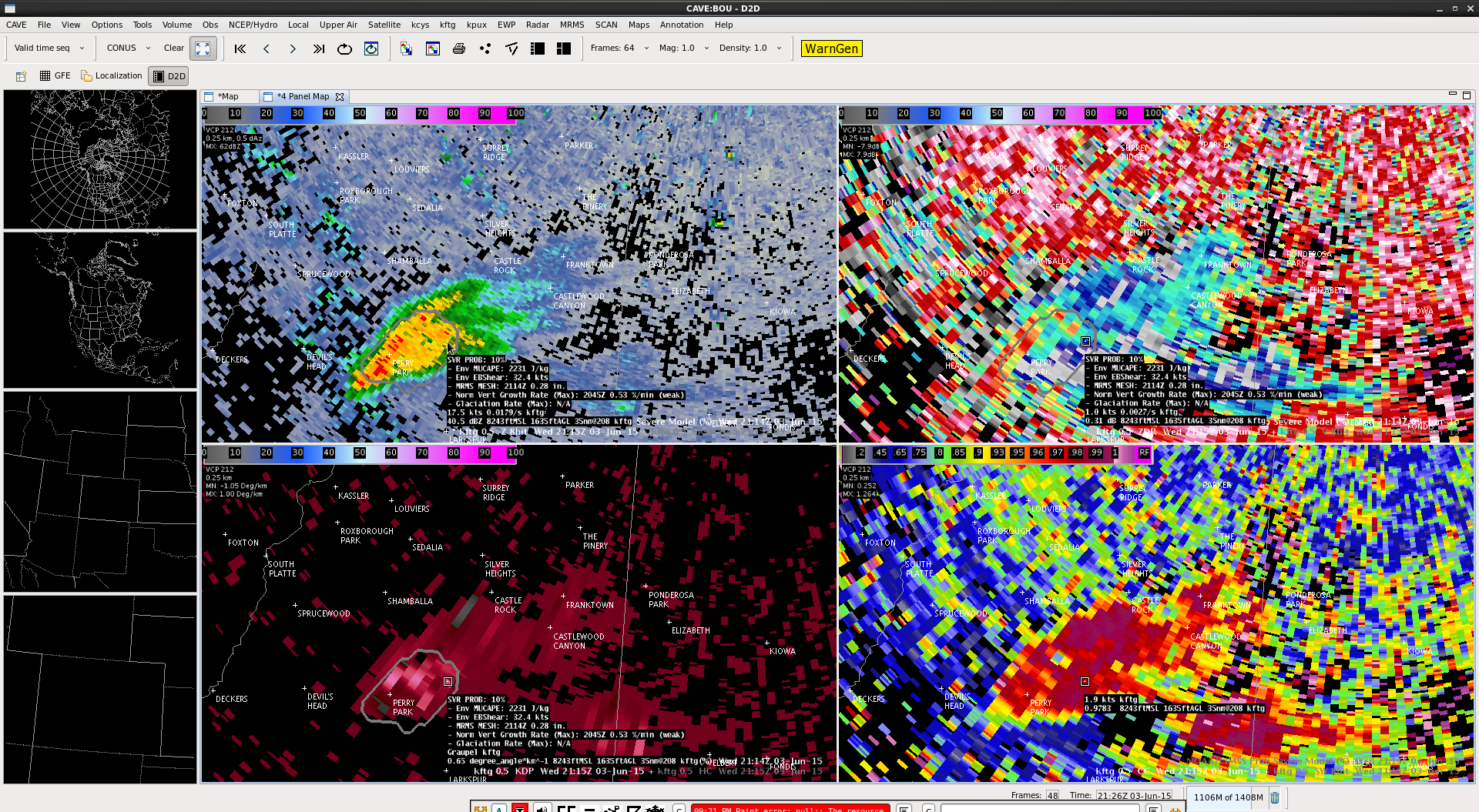
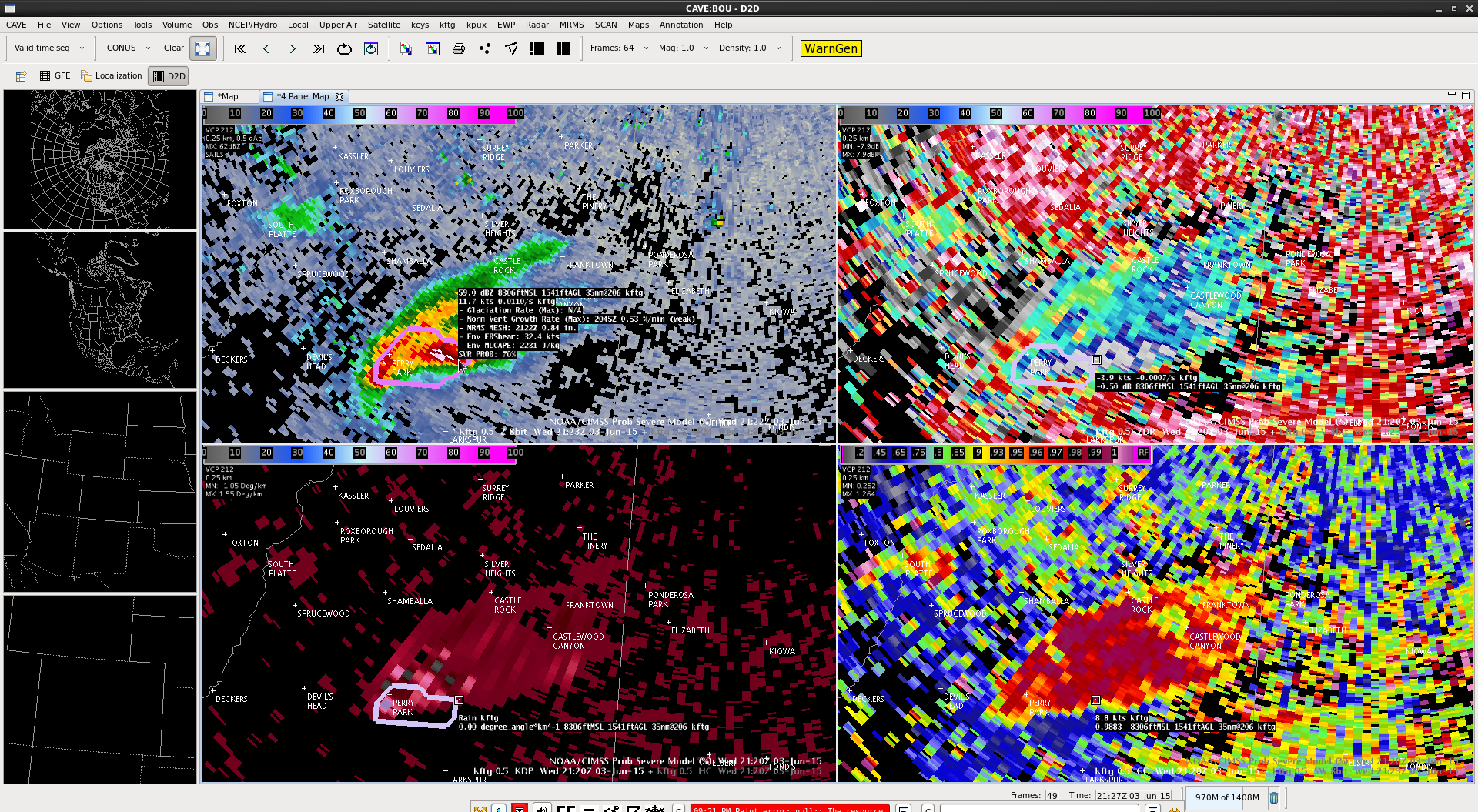
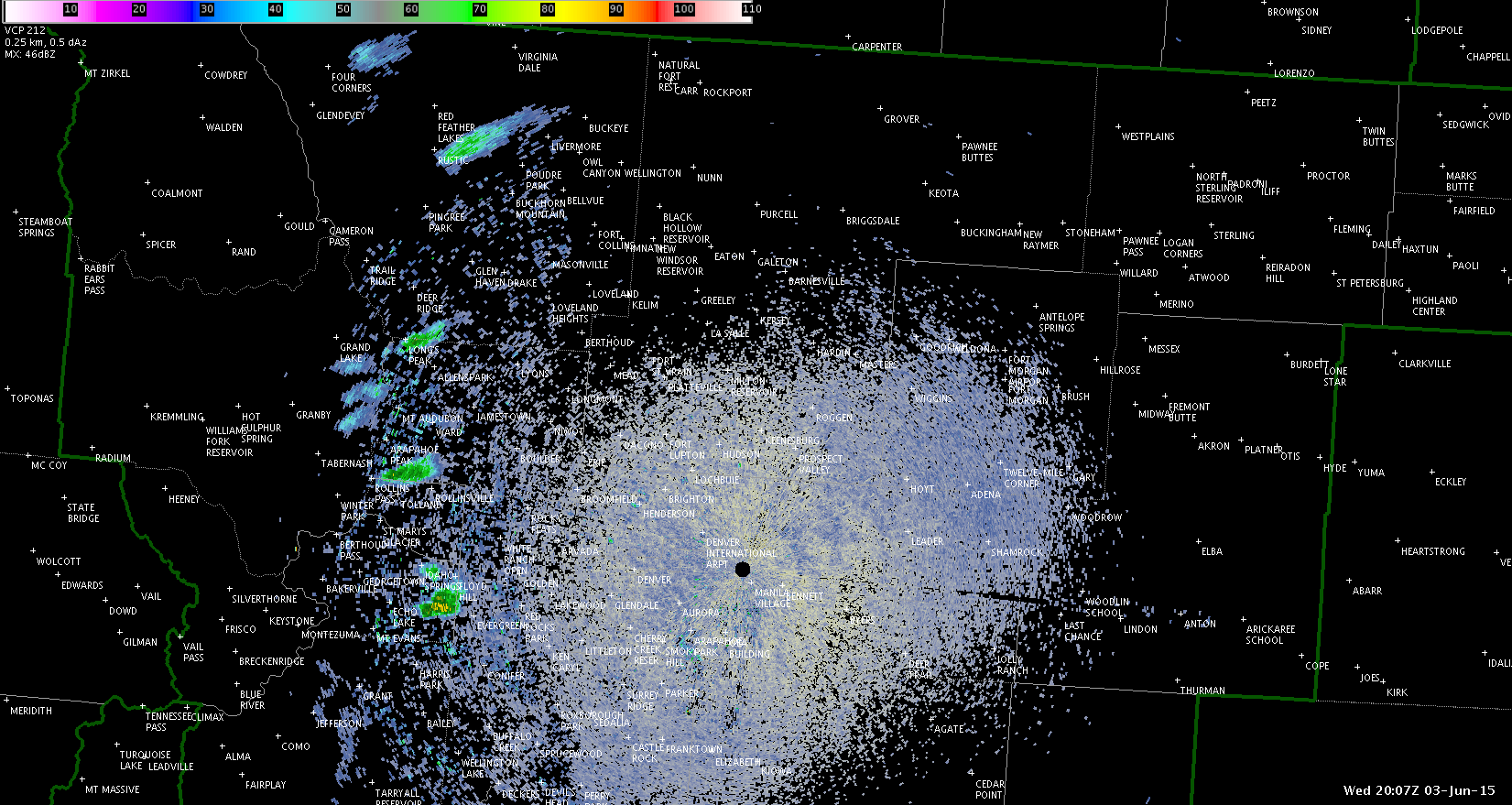
ProbSevere had a big jump – 10% at 2115z to 70% at 2122z and hitting 86% at 2126z.
TBSS evident on higher tilts.
Lightning jump of 3 sigma at 2122z.
Jason Williams
Click for loop.
1-min vis sat shows quick growth, which seemed to precede the appearance of the intensification on NEXRAD.

ProbSevere remains quite low, but has climbed to 14%.
Jason Williams
Over the past 15 minutes, we’re starting to get some reflectivity to fire west of Denver.
Interestingly, the CI product never flagged those (the exception would be the northernmost cell near Rustic). I wonder if it’s because the clouds had been festering for quite some time and thus never flagged them because it thought they had already initiated. Before 2000z, there was no reflectivity showing up (again, exception is the northernmost cell).
Jason Williams
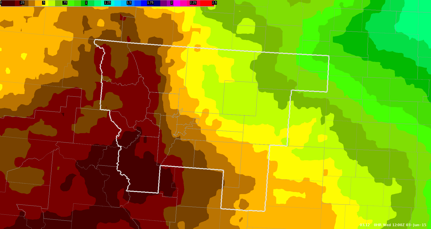
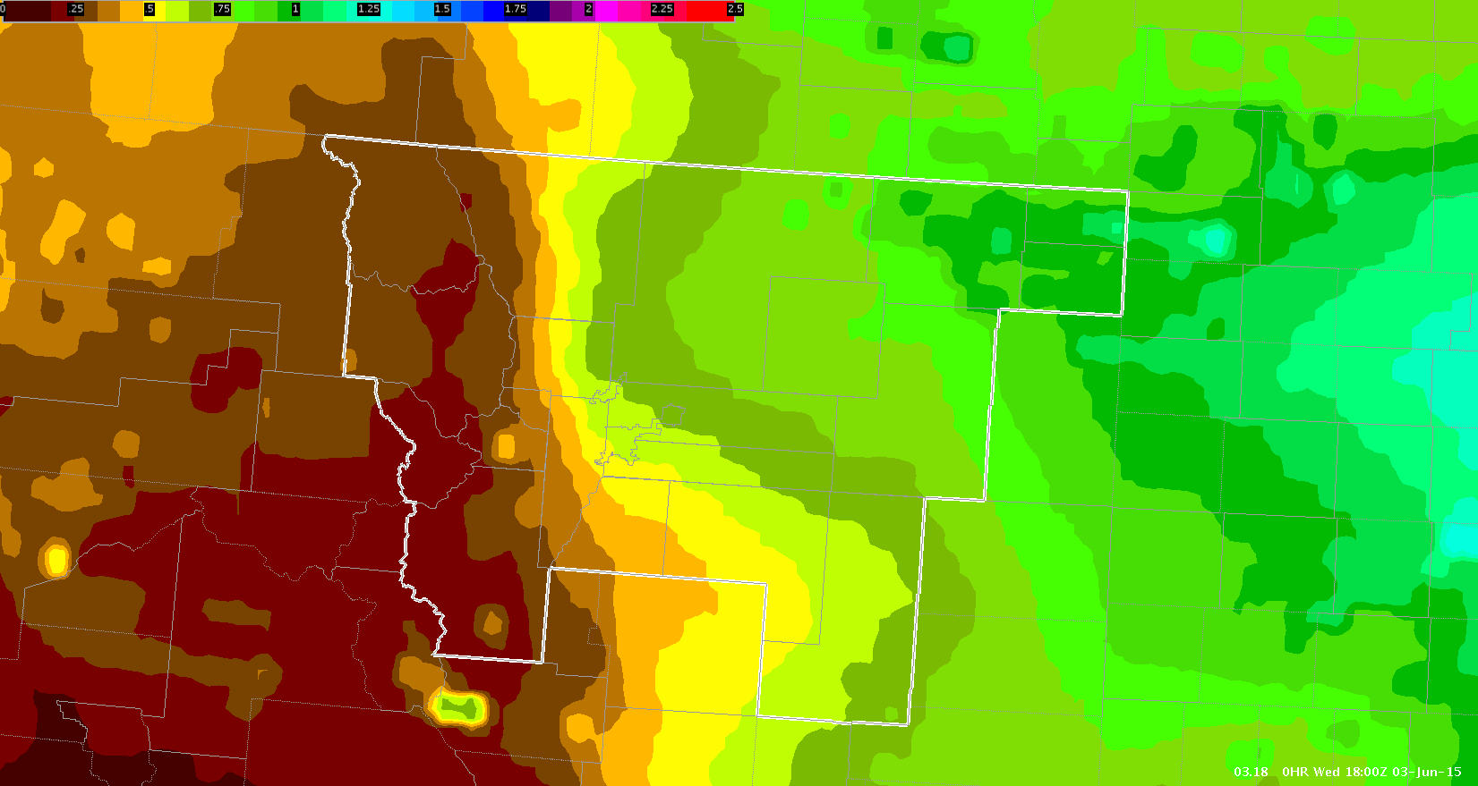
Discussion with meteorologist in the Cheyenne group had us look at the LAP PWAT product and compare it to the arc and area of clouds to its east to see how well they lined up. Indeed, GOES PWAT showed an area of considerably higher PWATs bulging west. It even did a fantastic job with the gradient. I have PWATS from 12z and 18z, showing the westward progress and then the gradient tightening as it approaches the mountains.
Jason Williams
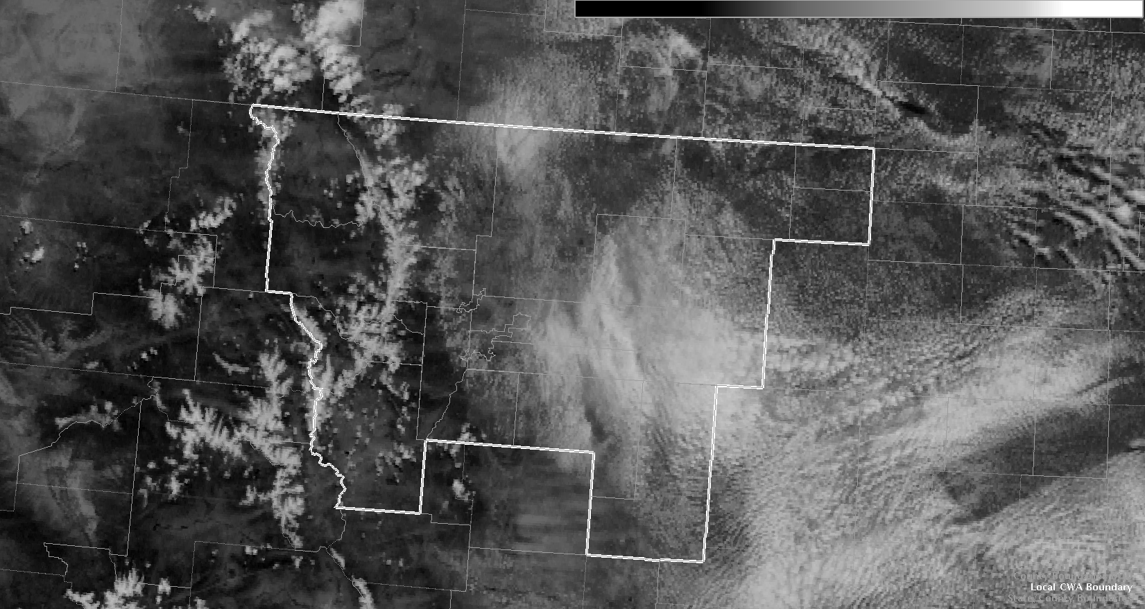
Looks like we have an arc of subsidence just to the west of a westward-moving cloud field in our central CWA. The cu field is a bit less robust just west of said cloud field.
The animation below (click to view) helps show it. For navigation, look from about Cheyenne to Denver.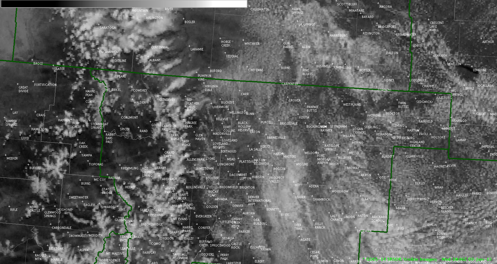
Its impact on storm development remains to be seen. Once again, we have a feature that would have been less apparent in anything less than rapid scan operations.
Jason Williams
CI on GOES-E had a cloud with a 68% chance of CI at 1823z; GOES-W did not have this. Using the topographical readout in AWIPS the elevation in that area is about 6000-8500 feet. The BOU NEXRAD did not show any echoes in its lowest tilts. That particular cloud element does not appear to have grown, per the 1min vis imagery.

Jason Williams