
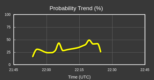
I noticed about a 10 minute break where probabilities briefly dropped off, and the probability trend data reset. I know this is based on 0.5 degree velocity data, but the midlevel mesocyclone has been persistent across the entire time period. -dryadiabat

Author: Thea
I really love the probability trends. Very helpful, because the legacy method is manual Vrot calculation and remembering scan to scan. This provides a much clearer picture of important trends. This is the Major County storm. -dryadiabat
TORP Values Still Modest
TORP values have been modest so far. Environment is favorable but higher LCL values than expected in the next hour or so, when the environment becomes very favorable for tornadoes as hodographs begin to elongate and discrete supercells move into richer low level moisture.


TORP Detections

On two instances, noticed false detections where there was no activity. Still showing low probabilities overall.
-FujitaReno
TORP Responding as Deep Mesocyclone Strengthens
TORP is responding to deepening/strengthening midlevel mesocyclone with increasing probabilities. -dryadiabat
Bill Lumbergh – 05/06/2024 Live Event
TORP Probs Incresing with as mid-level meso becomes stronger (38%)
Decided to issue a tornado warning at 42% with increasing trend, this was largely based on torp. Would not have done this with base radar data.
Issued a tornado around 2152z based on increasing TORP values in southern Woodward County
Quick Look at the Environment
Convective initiation has occurred along the dryline within a strongly unstable environment supporting intense convection over western Oklahoma. Visible satellite shows cumulus field displaced to the east, tied to richer low-level moisture and lower LCL heights. As storms move east into this more favorable environment and sufficient low level shear, low-level mesocyclones and tornadoes will become common with discrete supercells. Into the evening, a corridor of particularly favorable hodographs due to strengthening low level jet will occur over portions of central and north-central Oklahoma, supporting strong/long-track tornadoes even after dark. Will be watching experimental TORP, AzShear, and DvShear products closely during this evolution as part of this HWT experiment. So far, only one low-probability TORP indicated, but the near-term threat from an environmental standpoint is increasing. -dryadiabat
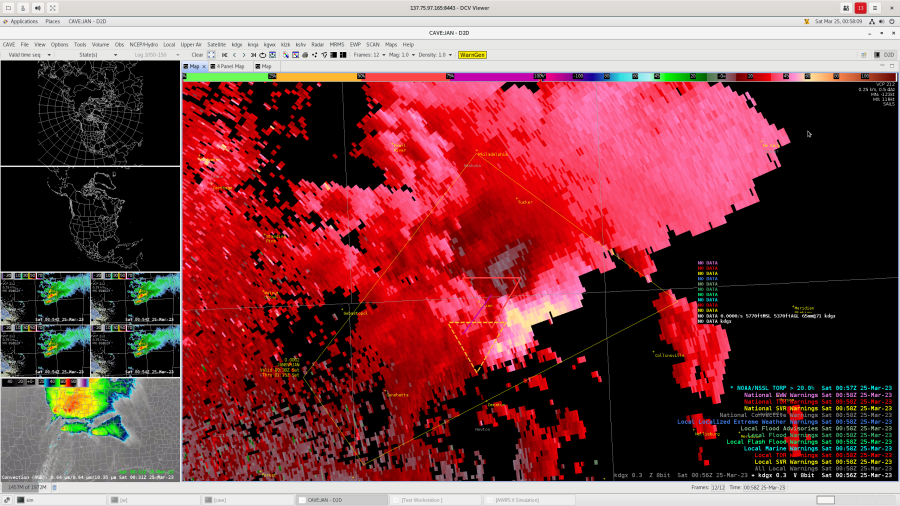
Monday Test Case
Having a way to just see the highest TORP probability triangle when multiple radars are selected would be beneficial (without having to manually deselect radars).
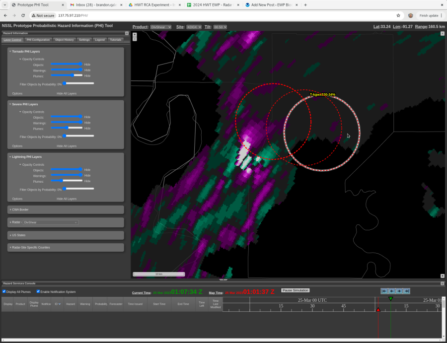

In the above screenshots, a damaging tornado was occurring. The strongest AzShear was within the Tornado PHI circle, but the strongest DivShear was not. In this case, the tornado was obvious from velocity data, but in marginal cases this could possibly lead to some confusion in where to focus attention.

Vrot according to the TORP for this storm was only 33 (not shown here). Turns out this is in m/s and not kts which is more accurate, though kts would be preferred. Either way, the units being displayed would be helpful.
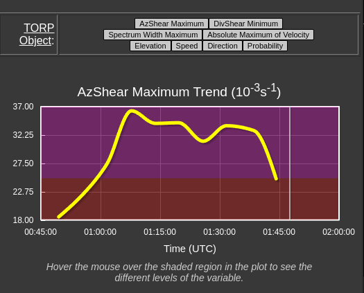
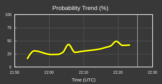
The time series charts are helpful for maintaining situational awareness throughout a storm’s life cycle and knowing what values are extreme, low, etc.
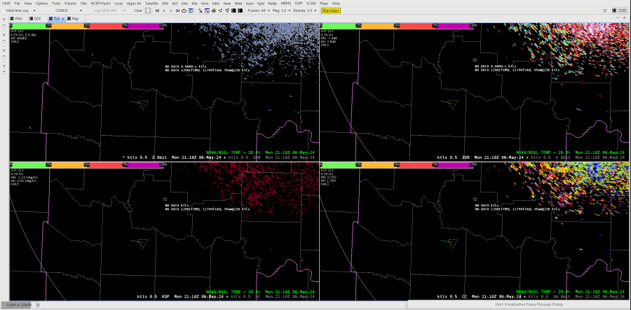
Detection: TORP & PHI

I’ve noticed a few instances where the PHI tool seems to outline an area before TORP. I could totally be interpreting this wrong, but I find that to be interesting.
-FujitaReno
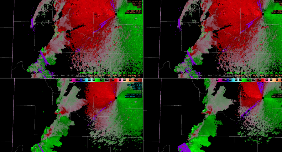
AzShear catches eye better than a velocity feature early on in tornado life
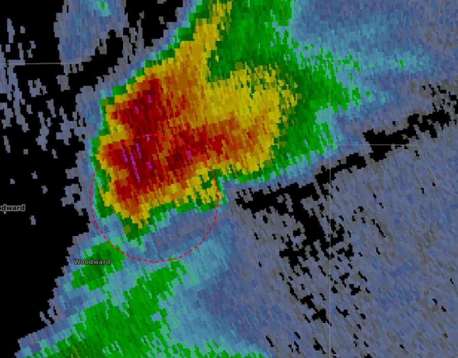
First thing I realized when analyzing AzShear side bye side with Velocity is that the AzShear feature catches the eye much better than a weaker rotation signature in Velocity. Here is an example: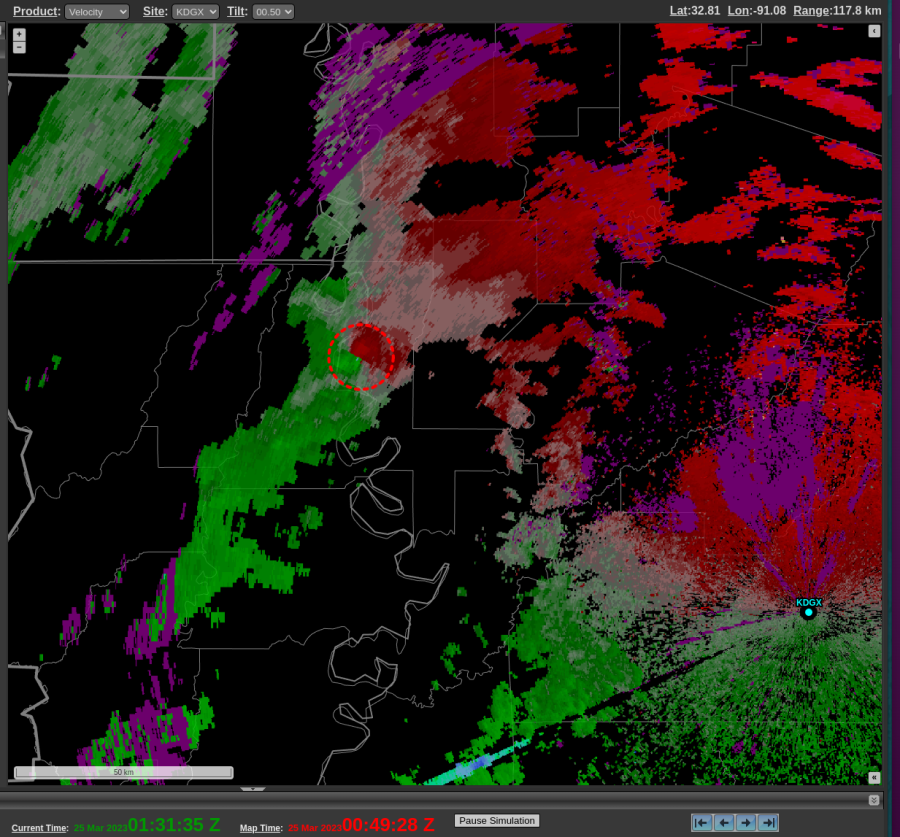
 If a forecaster was looking at a lot of activity going on around the CWA, a weaker velocity signature can be missed, but AzShear jumps out with the high (white) values. This circulation went on to strengthen quickly and to me the AzShear did a better job at showing that earlier in the tornadoes life.
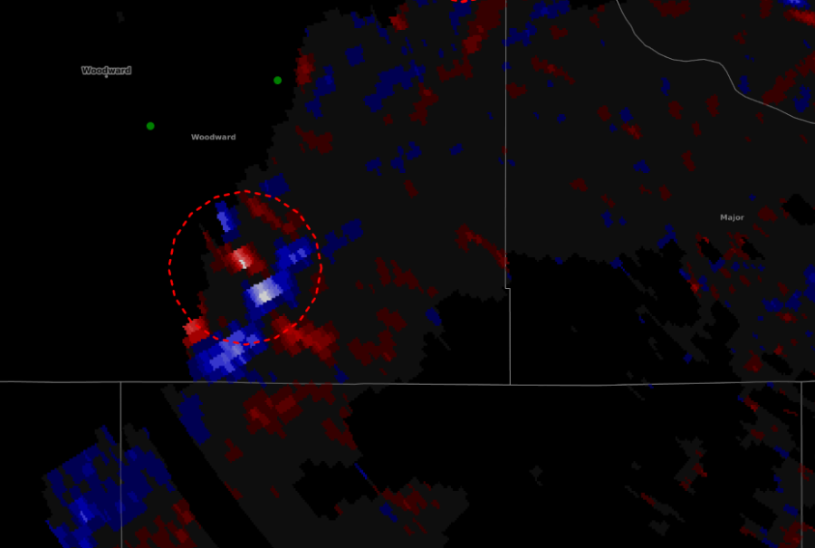
Another example, also involving TORP: Focusing on the weaker circulation in the following images, which is outlined by the TORP circle that is farther southwest. 0.5 Velocity again shows a weaker rotation that could be overlooked. That same scan though, AzShear is lit up along with TORP of 48%. This allowed me to look closer at that feature and I found a weak echo region and a higher reflectivity core aloft. Once again showing AzShear and TORP are good for situational awareness.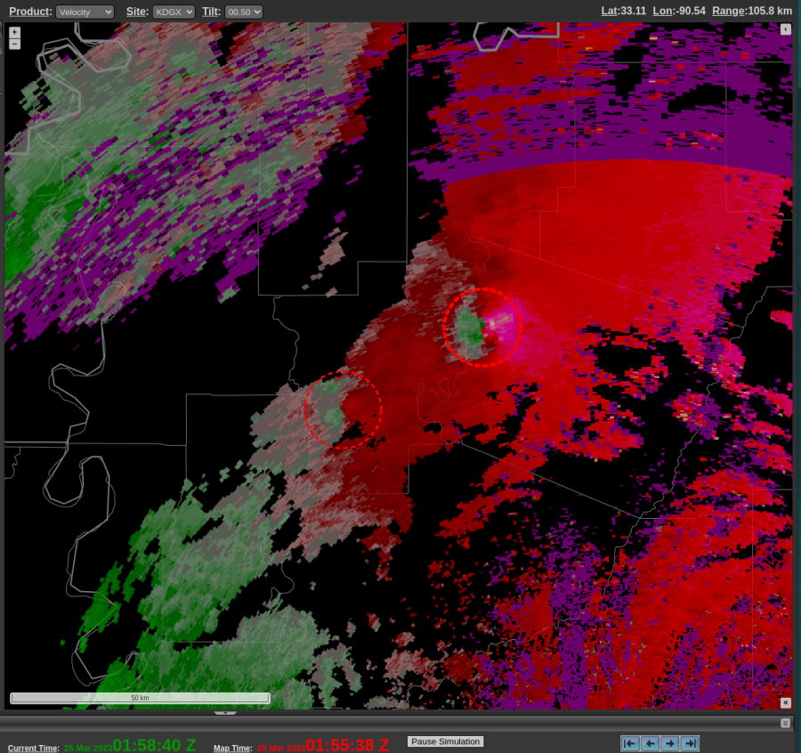

-Gary