Had to give a shout out to the utility of MESH as we received hail reports of 3 inch hail near the time of an impressive three body scatter that maximizes at the 2.4 degree slice.
ZDR_Arcophile

Had to give a shout out to the utility of MESH as we received hail reports of 3 inch hail near the time of an impressive three body scatter that maximizes at the 2.4 degree slice.
ZDR_Arcophile
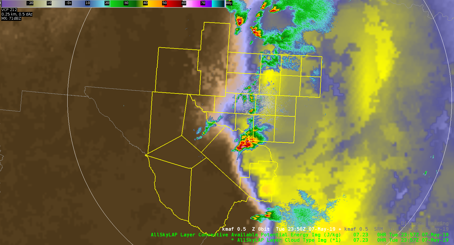
I have to give a shoutout to how impressively well ALLSkyLAP Layer CAPE identifies the dry line. I really like to overlay radar data with this.
ZDR_Arcophile
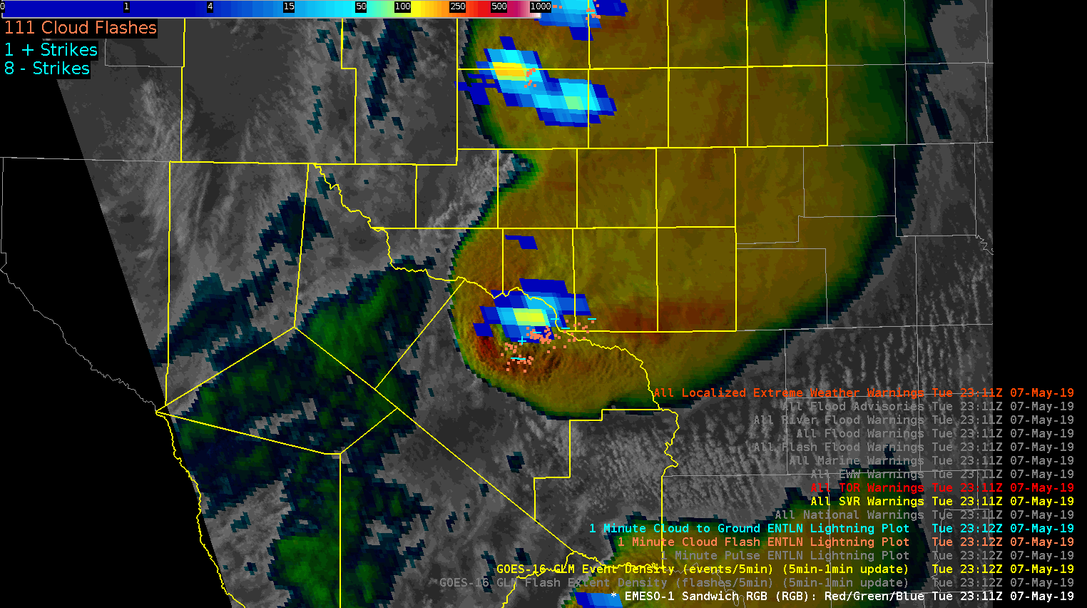
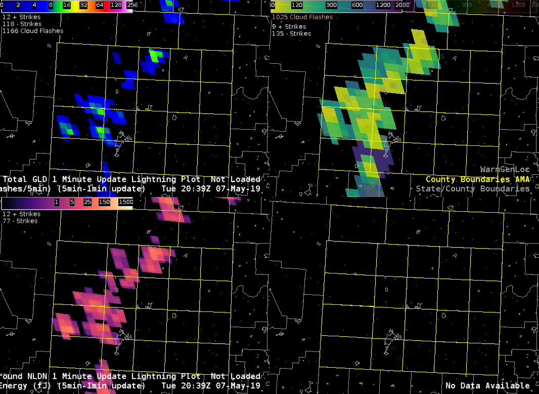
GLM Event Density increased and added to my situational awareness of a stronger updraft developing over northern Pecos County. Although the parallax issue was a slight nuisance, it was better at indicating overall increase in updraft strength compared to ENTLN.
ZDR_Arcophile
A few minutes prior to tornado touchdown, the NMDA comes through as superior to DMD and MDA. NMDA focuses in on a tighter circulation, although just above the lowest slice, as opposed to MDA and DMD.
ZDR_Arcophile
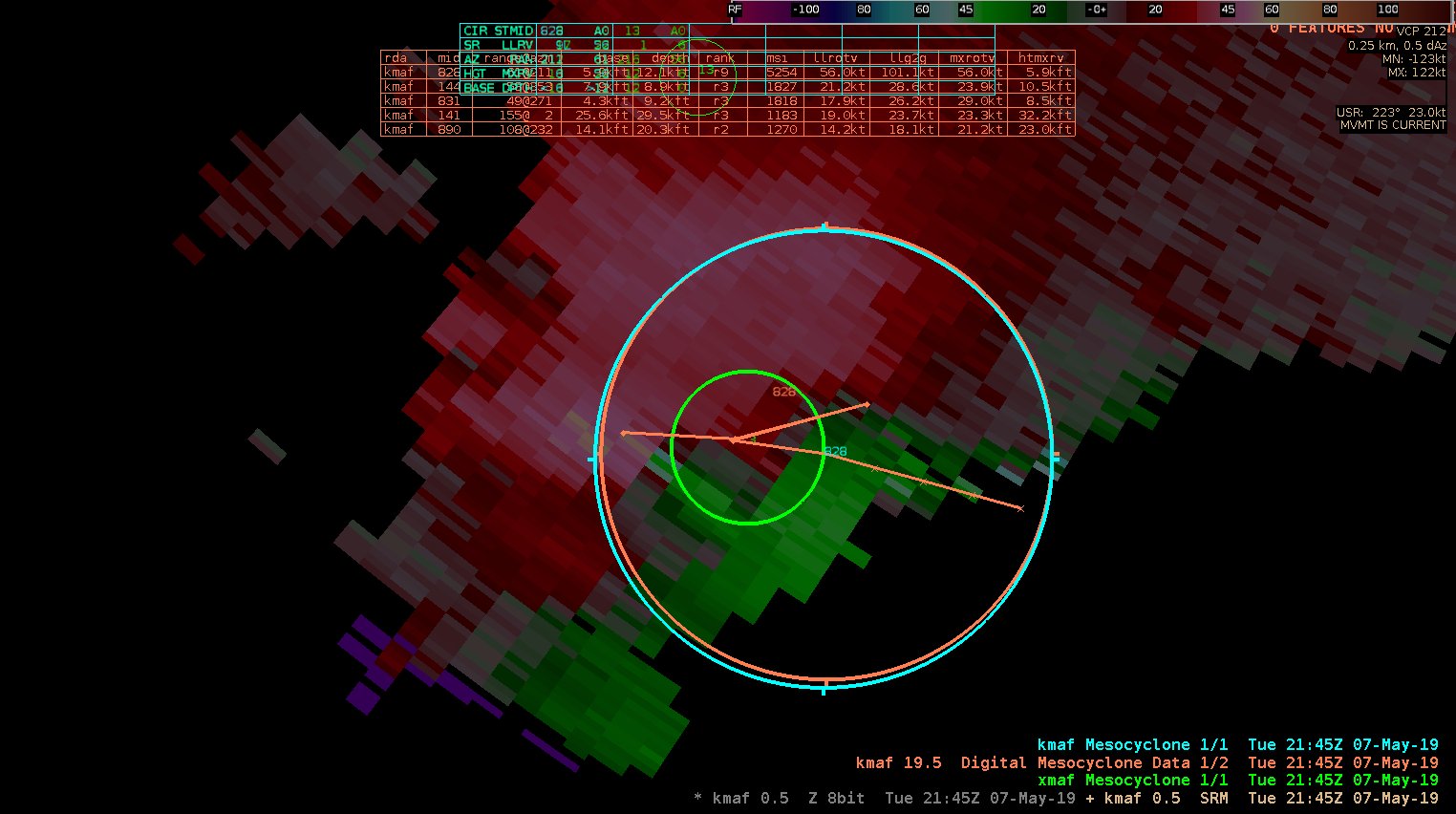
NMDA (in green) had problems picking up on the 1.3 slice circulation compared to DMD (in orange) and MDA (in cyan). This is a mid-level rotation at about 11K ft above sea level. This is about half an hour before tornado touchdown.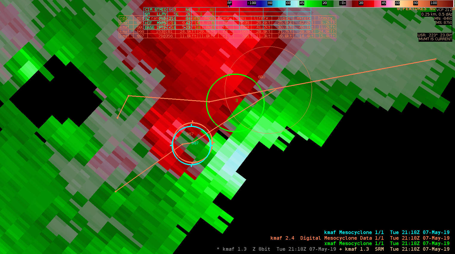
ZDR_Arcophile
Low-level AzShear clearly ramped up at least 20 minutes before confirmed tornado touchdown.

ZDR_Arcophile
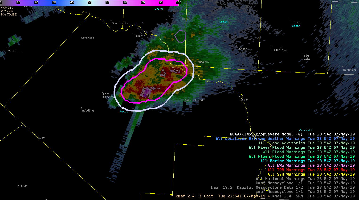
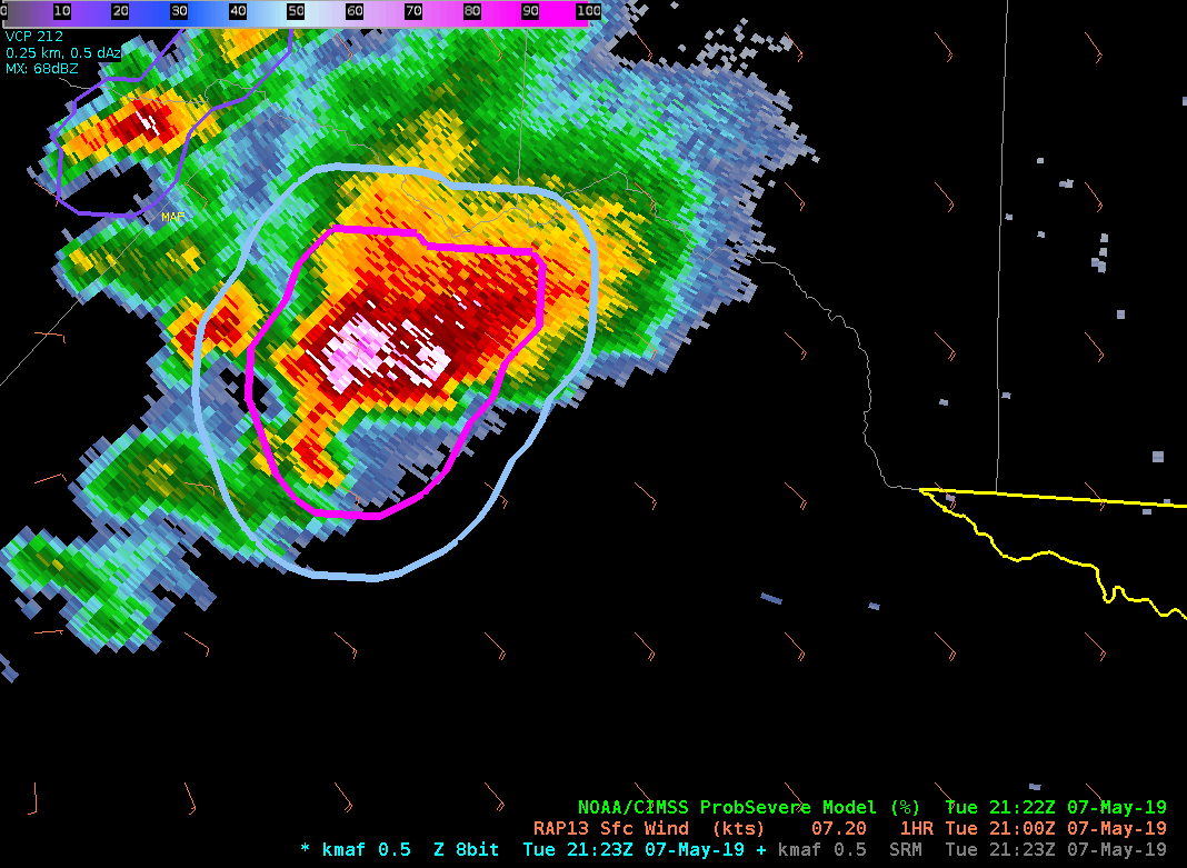
Quick ramping up trend of TOR prob strengthened my confidence in this TOR warning in northern Pecos County, despite lack of reports from rural area. Jumped from 16% to 44% to 63% to 78% within 4 scans.
ZDR_Arcophile
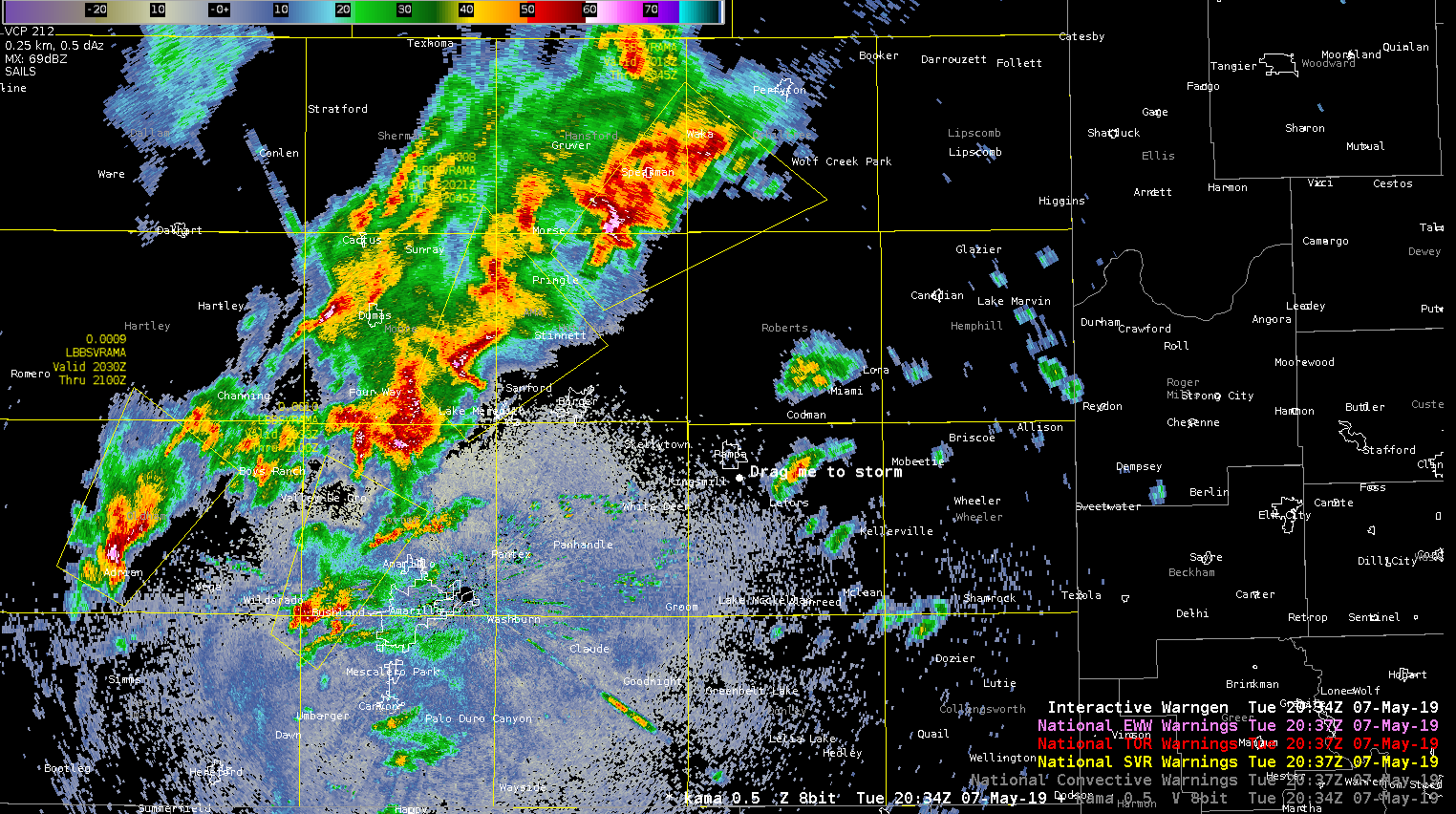
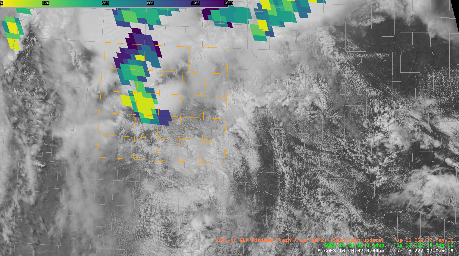
I’d been watching a multicellular cluster that was trailing a leading supercell to the north of Amarillo. Had been waiting on issuing due to ProbSevere and Mesh levels, but GLM FED increased and reflectivity / VIL /core height all responded so I issued a warning at about 2040Z
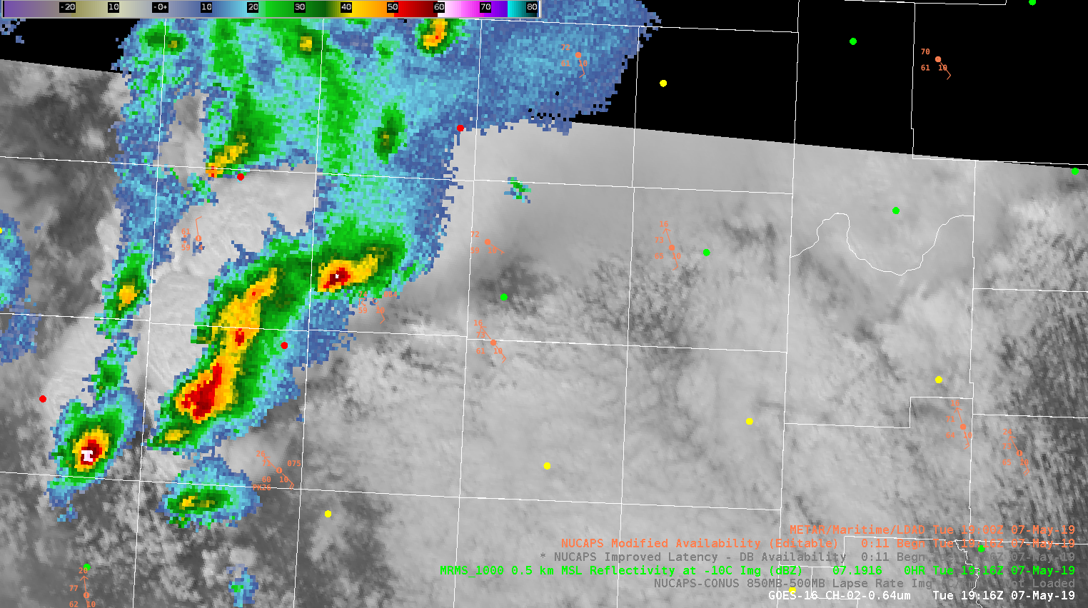
NUCAPS modified sounding doing a good job of representing the boundary layer in the near storm environment in the AMA CWA. Green dot ahead of cell in middle of image was selection point for provided sounding.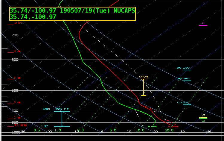
icafunnel
Good for situational awareness…Got caught looking at the Lake Meredith storm and new updrafts are quickly going up. to the south near AMA.