Cell No Longer Being Tracked in Time Series

The way the current time series is plotted makes it difficult to determine when the cell is no longer being tracked (i.e., the flash rate falls below a certain threshold). One way to see if it is no longer being tracked is to look at the Pt/time and compare it to the product time in the legend. If the product time in the legend is ahead of the Pt/time, then the cell is no longer being tracked and no more data will be added to the time series plot. Perhaps there could be a way to show that the cell is no longer being tracked so inexperienced forecasters could quickly determine this.

CellTrackOver

Ertel

Tags: None

GOES-R Convective Initiation

Trends with the GOES-R Convective Initiation product can be useful to find areas for potential convective initiation.

Here is an example where the concentration and values of convective initiation pixels increased across west central Florida:

CI_Sat1

CI_Sat2

The forcing and shear was very weak, so finding areas where convective initiation was expected was non-trivial.

An hour later, substantial radar echoes developed across that part of Florida:

CI_Radar1

CI_Radar2

This tool could be very useful in weakly forced environments, where there is uncertainty in areas of convective initiation.

Polarimetric Researcher

Tags: None

NUCAPS Accuracy

NUCAPS data has come in and it was compared to earlier soundings out of TBW. The two weaknesses of NUCAPS was controlled for by selecting a data point outside the current cloud cover. The data for temperature and dew point had to be modified.  The data was compared well to earlier sounding, demonstrating a similar profile.  Cape grew adequately as expected based on current thunderstorms and afternoon convection taking place.

UFFSU

nucaps sounding

Tags: None

Earth Networks Lightning Display

The lightning data CAN be helpful. Tracking a developing cell lightning data can help alert a forecaster to a highly charged storm that can impact the public. It is difficult to have faith in the lightning storm alerts when lightning is the only variable considered. The shear environment is weak in western Florida, but there is certainly charge. In the case displayed in the image, Severe Prob did also indicate a higher percentage of becoming severe (>70%). Still, this lightning data might supplement a forecast for developing storms, but it cannot be considered alone. The display is also quite messy. The selected image showers two pink boxes overlapping over one another. A third, larger box alerting to a dangerous thunderstorm is also clouding the display.

051215 earth networks1

UFFSU

Tags: None

ProbSevere Low with SVR MESH & LTG Time Series

Here is an example just outside the PIH CWA that shows a cell with very low ProbSevere (~1%), but with MESH of 1.26 in. It appears the low ProbSevere is a result of Env MUCAPE of only ~350 J/KG. Base radar analysis showed that this cell did strengthen, with a very brief period of 50 dBZ to ~ -25 C.

ProbSevereLowHighMESH

The pulse nature of the cell can also be seen in the total lightning time series. Where a brief period (~10 min) of > 10 flashes per minute was observed, before quickly dissipating.

PulseTimeSeries

Ertel

Tags: None

Sig #2 Using ProbSevere

Another thunderstorm rapidly intensified with ProbSevere increasing from 2% to 90% in 16 minutes:

Florida_Sig2-1 Florida_Sig2-2 Florida_Sig2-3 Florida_Sig2-4

Further integration showed ~60 dBZ at -20C (from MRMS). Therefore, this storm was probably close to severe criteria. I decided to issue a significant weather advisory (polygon on all images) for strong winds of 50 to 55 mph and nickel size hail with the assistance of ProbSevere.

Polarimetric Researcher

Tags: None

Significant Weather Advisory in Florida Using ProbSevere

ProbSevere was very useful to show a collapsing thunderstorm in central Florida.

Initially, ProbSevere ramped up from 2% to 71% within 20 minutes:

Florida_Sig-1

Florida_Sig-3

Florida_Sig-4

This gave me insight to further integrate the storm for severe potential.

However, on the next scan, the ProbSevere decreased to 57%: Florida_Sig-5

This was followed by another decrease to 39%:

Florida_Sig-6

At this point, I assumed the rapid decrease in ProbSevere indicated that the storm was collapsing. Analysis of the base data suggested this as well. I decided to make a warning decision to issue a significant weather advisory (the polygon drawn on every image) for gusty winds (due to the potential collapse of the storm) and nickel size hail.

Indeed, the core did collapse on the next scan:

Florida_Sig-7

This demonstrates that ProbSevere might be useful not only for growing thunderstorms, but collapsing thunderstorms (and their associated risk of strong winds) as well.

Polarimetric Researcher

Tags: None

CI Prob and Coastal/Sea Breeze Thunderstorms

There is a dominant southeasterly flow across southern Florida.  This dominant flow will interact with a sea breeze developing early afternoon along the Gulf Coast. Forecasters struggle daily with where exactly these sea breeze storms will develop (close to the coast or a bit inland?). Once initial cumulus clouds start developing, the CI Probability placements seem right on target. One can follow cloud development from satellite to shower and thunderstorm development on radar (note the radar data is off in the thumbnail, but subsequent rain development was tracked and monitored) verifying CI Prob in this instance. Thunderstorms have formed right alone the coast (along and west of I-75).  This is very helpful and pretty specific given how close I-75 is to the coast in this area.

051215 CI Prob verifies along coast

UFFSU


Tags: None

Pocatello, ID 1830 UTC

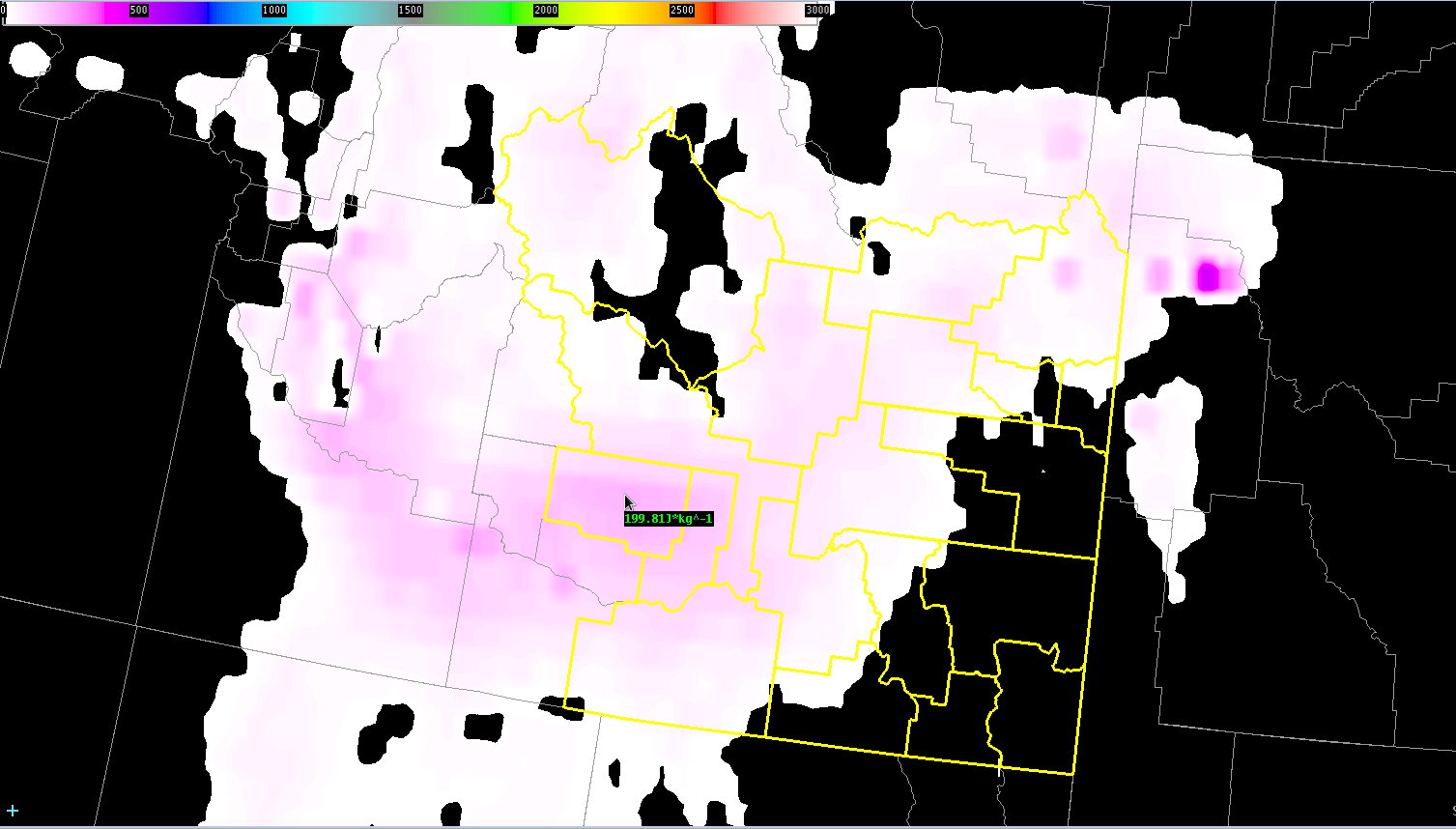
Current conditions over the PIH CWA appear to be only marginally favorable for severe convection as region comes under the influence of large upper level low. Instability is the main limiting factor with CAPE values remaining AOB 500 J/KG…with current CAPE values based on the GOES sounder AOB 200 J/KG, although they have been increasing.

GOES CAPE from 17 UTC

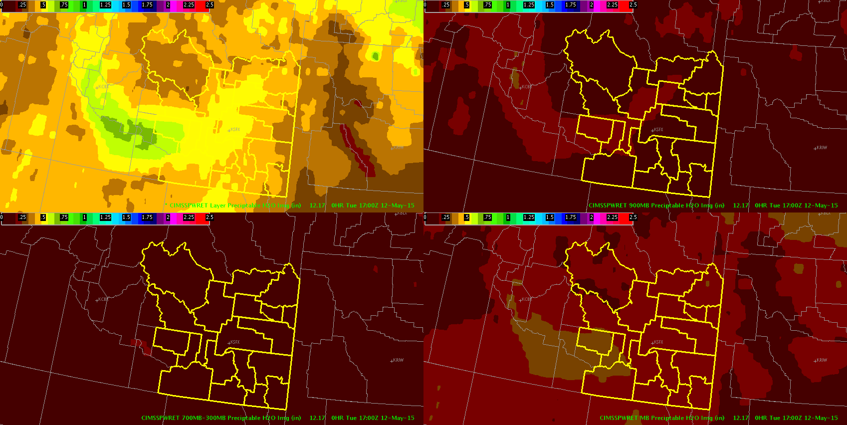
Deep layer shear is generally b/w 30-40 kts, which could allow for any storms that do form to become briefly organized. Layer PWATs (based on the GOES product) in the western portion of the CWA are near the 75% (~0.6 in) and are mostly confined in the 900-700 mb layer.

PWATS17z

Overall, expect marginally severe wind gusts to be the main threat with any stronger storms that develop.

Ertel

Tags: None

Storm Growth, Evolution in Prob Severe

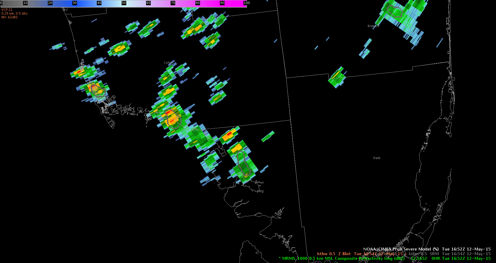
There are coastal thunderstorms in Monroe and Collier counties in southwest Florida indicating low severe probability initially.

Collier Co cell prob severe 051215 low

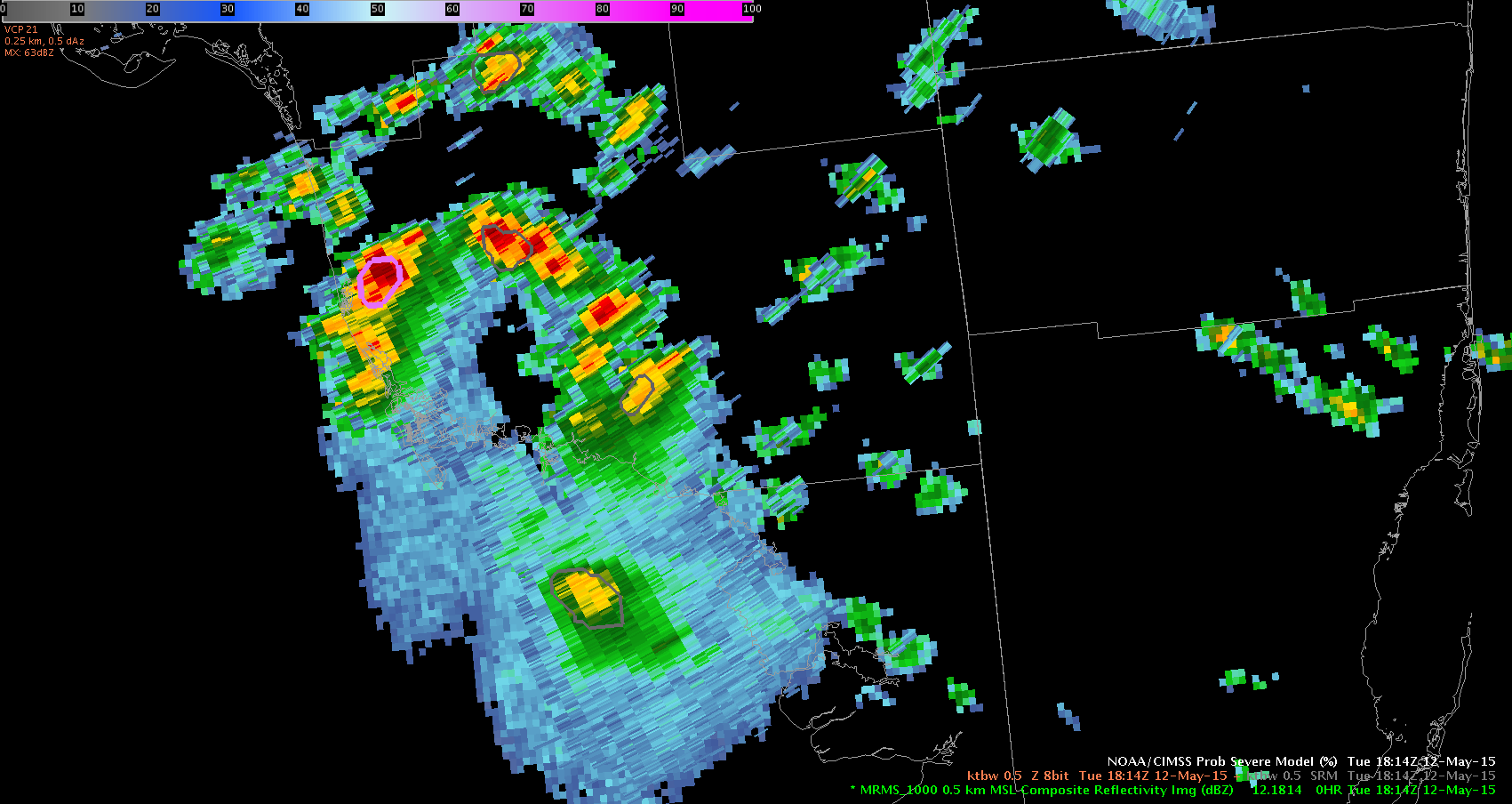
Interestingly enough, the sample indicated extremely high cape, low shear, but the qualitative descriptor for storm growth indicated ‘strong.’ I followed this storm from approx 1652z and watched storm development. Even though severe limits might have been low, the storm did continue to grow (which was indicated).  By 1820Z you can see the storm has remained onshore moving NNW into nw Collier County. The thunderstorm continued to grow indicated by the qualitative descriptor. This hit a 72% probability of going severe at it’s height, before subsequently pulsing down. Still, the descriptor was accurate and helpful in identifying storm growth. Interestingly enough, these cape values do not come close to matching interpolated cape values from the other GOES product (much lower).

Collier Co cell prob severe 051215 72percent

UFFSU

Tags: None