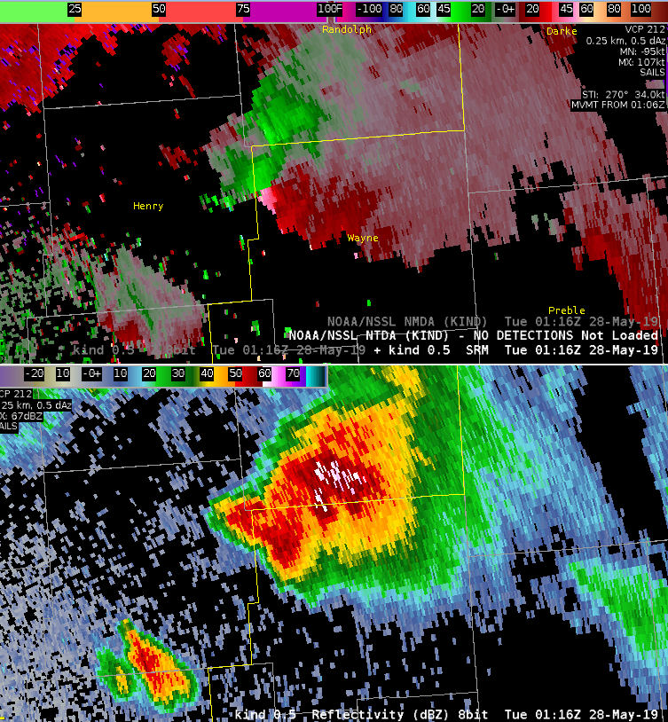
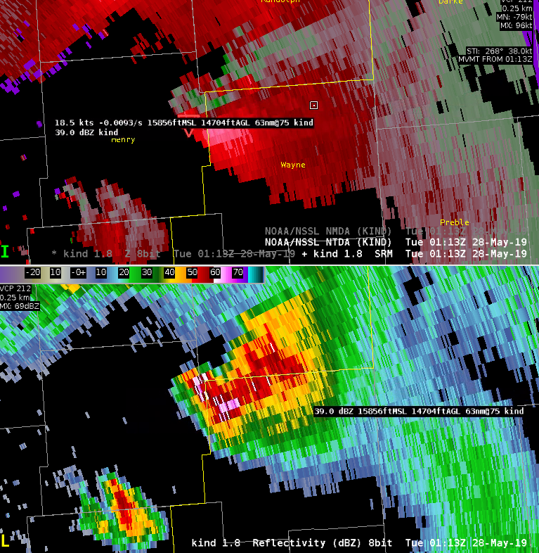
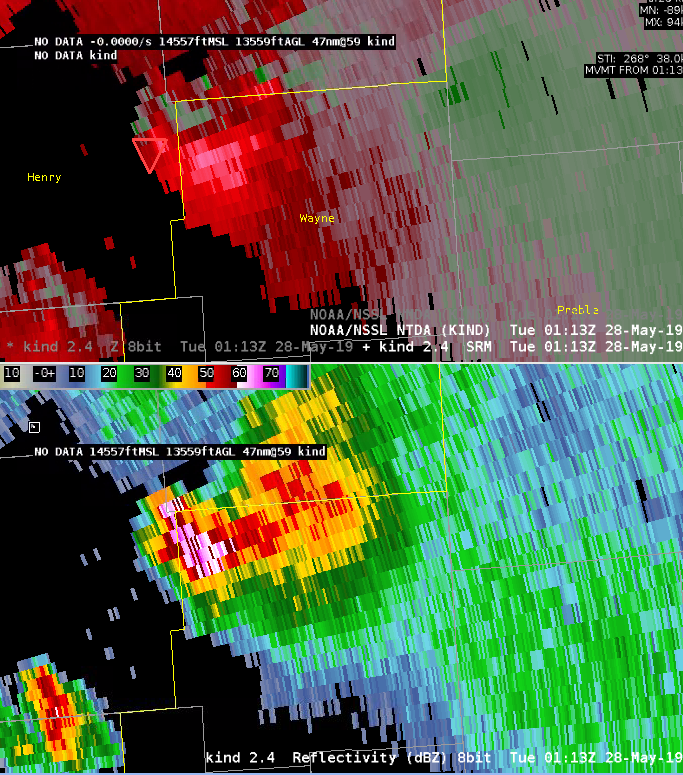
0119Z
The supercell cluster coming into Wayne County, Indiana, is exhibiting solid rotation on the lowest slice. NTDA from KIND/KILN are both showing values in the 80% range. Both radars are also indicating two separate mesocyclone detections, and a qualitative analysis of the storm does suggest two separate updrafts and storm cores. As one would expect, the southern core (the newer development) is driving the NTDA detection which matches with the location of the southern NMDA detection. This makes sense conceptually, as the tornado potential will be much greater with the unimpeded inflow associated with the southern core.


0157Z
A broken cluster of supercells is now entering the state of Ohio. Radar data is largely quite mottled and the majority of the NMDA detections are weak, but there are a lot of them — including in places where conceptually you would not really expect a circulation to exist. There are data artifact issues, related somewhat to the distance from the KILN radar, and also perhaps related to the complex interaction between different parts of different supercells and storm clusters. This would likely be a case where extremely weak / transient detections might be desired to be toggled off under a certain threshold. NMDA detections on the strongest circulations have not necessarily been stronger detections, but NTDA detection probabilities have been tracking fairly well with where tornadoes appear most likely to occur.

0237Z
Both the NTDA and NMDA are making high-end detections in Miami County, Ohio, near West Milton. The NTDA has had values >95%, and at times >99%, with this tornado. Perhaps more interesting is that this is the first case I have yet seen in which the NMDA has shown such a consistent, high-end, well-tracked detection across a span of 10-15 minutes — with extreme (>0.03) values of AzShear. Overall, the NMDA algorithm doesn’t seem to trip into the higher values very frequently, so it really calls your attention to it when it does.

0302Z
A messy storm evolution has occurred in Auglaize County, with some kind of hybrid QLCS / supercell structure based on Z/V data. Although qualitatively, the velocity data is not particularly impressive, the NTDA has done a very nice job at consistently detecting a tornadic signal from around 0241Z to 0251Z. A tornado did occur at this location, including a TDS that was apparent along the same track of the NTDA detection just a few minutes later. This is a very good detection by NTDA, correctly identifying a tornado in an area where eyeballing the velocity data would not yield as much certainty.

–Insolation