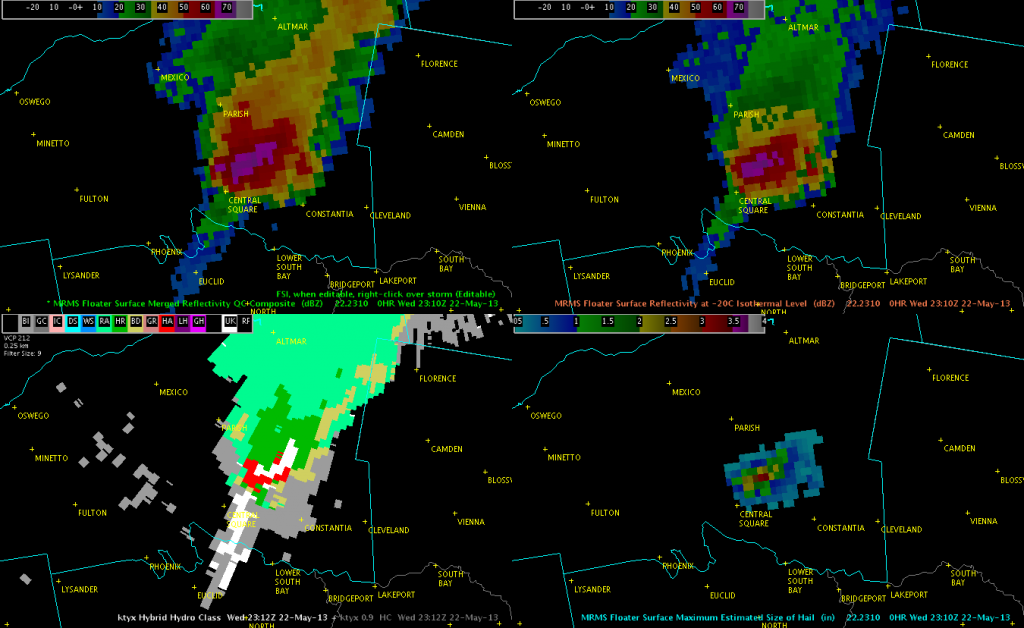
A very impressive-looking storm produced severe hail in Oswego and Oneida Counties earlier today. A report of golf ball size hail was received at 2310 UTC near the town of Central Square, which was the largest hail report received while the storm was in the BUF CWA. Below is an image of MRMS and KYTX radar data at that time. The MRMS reflectivity at -20C had reached values as high as 71 dBZ at this time! Additionally, MRMS MESH values had reached a maximum of 3.31 inches. Interestingly, the HSDA did not indicate the presence of large or giant hail, although there were areas of UK, or uknown classification.

While severe thunderstorm warnings had been ongoing with this storm since 2144 UTC, the steady increase in MESH and reflectivity values at -20C prompted me (the warning forecaster) to issue a new thunderstorm warning with a mention of 2-inch hail. Granted, we never got reports that large, although that doesn’t necessarily mean it didn’t happen. Anyway, this was the theme on this day…where the MESH appeared to overestimate the size of hail to an extent, and probably more so as the hail became larger, while the HSDA underestimated the size, or else due to some issues with the algorithm was assigning a UK classification.
Kris and Eric

