

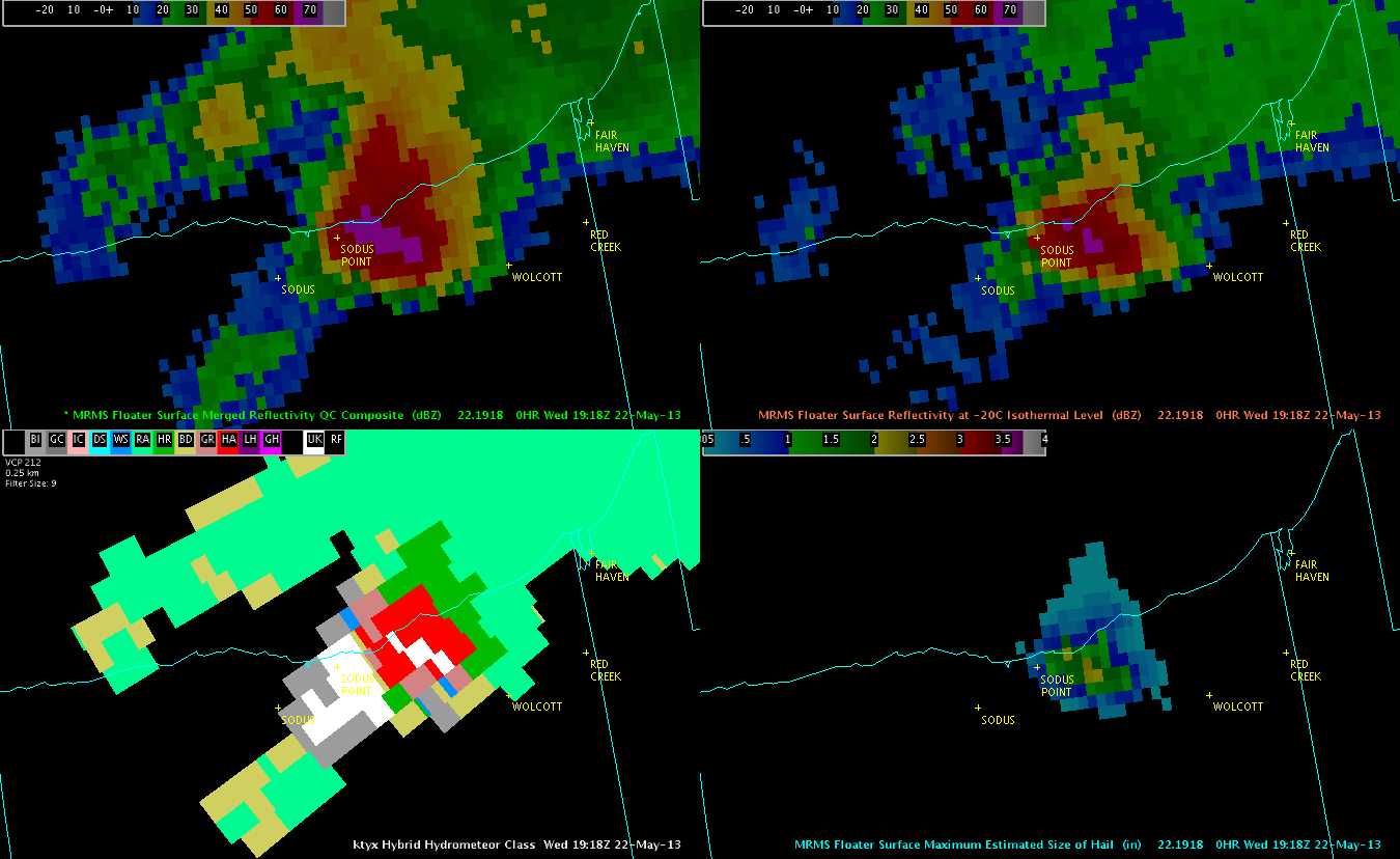
Okay, today we’re in the same region we left last night…back in NY baby! Well, it’s upstate NY, but the baby still applies. =) Anyway, here we are nearing 330 pm EDT, and MRMS data are already suggesting severe hail in a storm moving just south of Lake Ontario in Wayne County. Notice the MESH in the four panel in the image below (lower right). This cell showed very quick development with >1 inch hail beginning at 1914 UTC as shown below. At the same time, reflectivity values of 59 dBZ were colocated with the cell. However, the HSDA data only indicated hail and rain (red colors, lower left).

MESH Values over 2 inches then appeared at the 1918 UTC MRMS product update. Notice that 65 dBZ values were indicated by the MRMS -20C reflectivity product. However, the KTYX HSDA product still just indicated a sub-severe hail/rain combination.
Based on these data above, we issued a Severe Thunderstorm Warning for hail at approx 1930 UTC, although we may have been a little late getting out due to still setting up and “getting oriented”. Although it’s not shown here, the KBUF HSDA data also did not indicate large or giant hail. The MRMS data appears to be performing fairly well so far, but we’ll watch for these trends into the afternoon.
So, what happened? Well, we just got a report of quarter size hail valid at 1918 UTC, 2 miles east of Lake Bluff in Wayne County. So far, it appears that the MESH may be overestimating the size of hail slightly, with the HSDA from the KTYX and KBUF radars are underestimating a little. Nevertheless, we’ll continue to monitor for reports.
Kris and Eric
UPDATE!! We got a delayed report of golf ball size hail from Wayne County at 1936 UTC. Perusing back through the data, it looks as though the MESH product did quite well, indicating 1.73 inches at 1934 UTC and 1.65 inches at 1936 UTC. However, the HSDA still showed just rain and hail without the large and giant hail mention.