
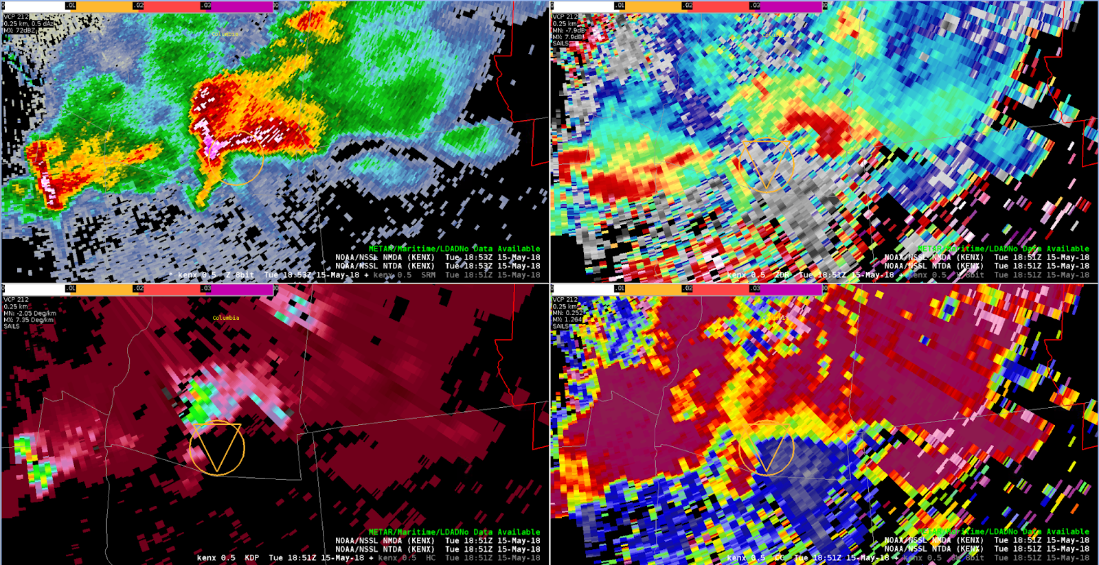
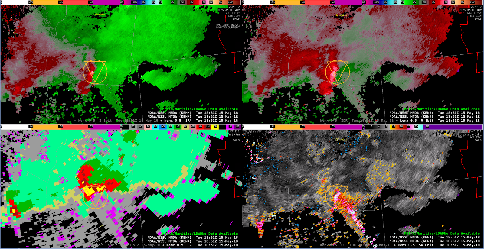
A well developed supercell was moving ESE south of Albany. The radar is not in a great location for this storm; while close, it is having to shoot through a very significant hail core. This is creating a very large TBSS coincident with the location of the low level mesocyclone. The NTDA is showing probabilities generally less than 60% (and in many cases, between 30 and 40%), but I expected to see higher numbers. Suspect the lower probs are due to velocity issues related to the TBSS. Subjectively, I would definitely have a Tornado Warning out for this storm.
– Rabbit