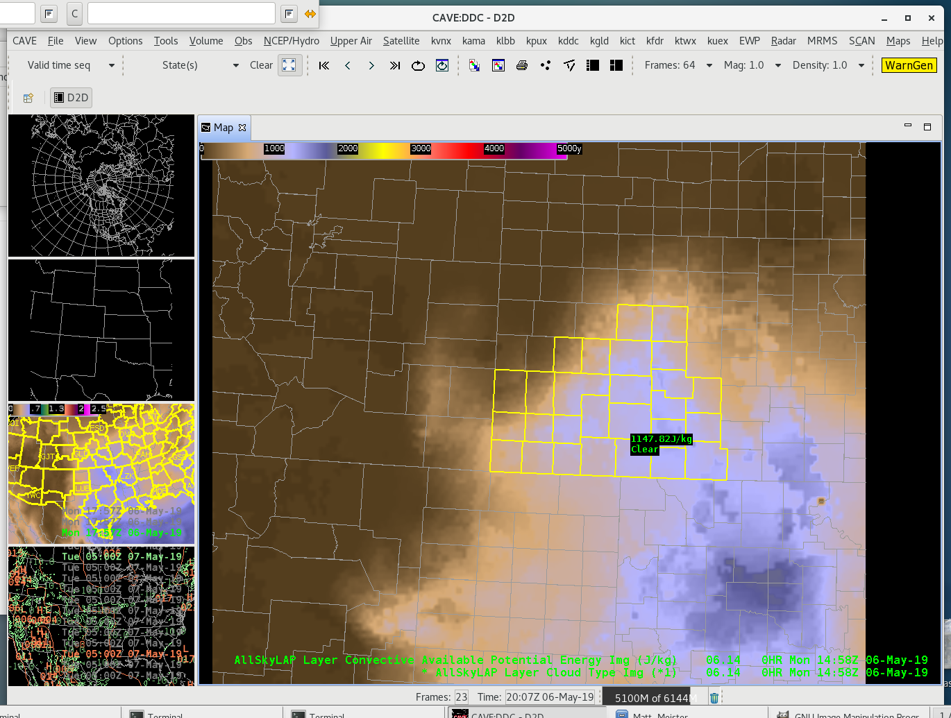
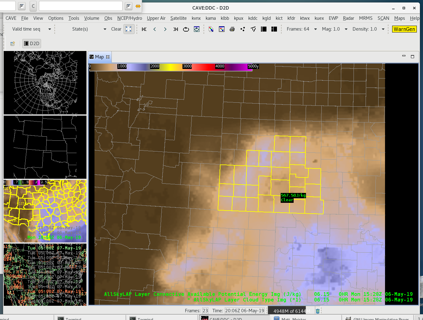
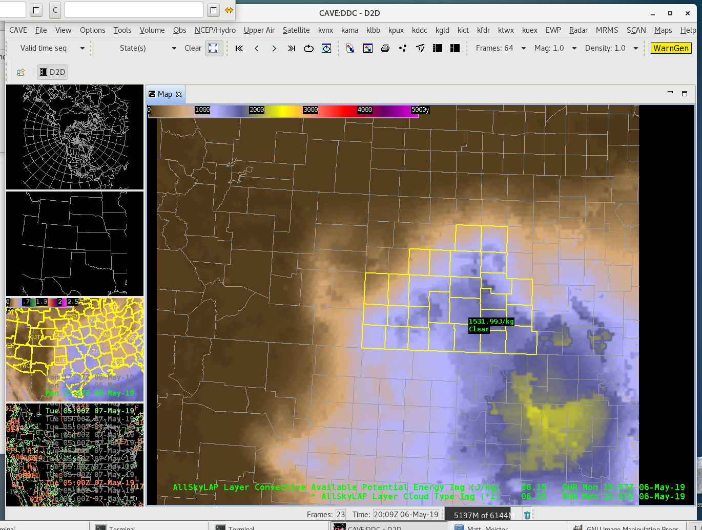
Interesting CAPE value drop off
During the first opportunity to sit at AWIPS-II and familiarize myself with the different datasets to be evaluated during the EWP, I noticed an interesting drop off of CAPE values from the All-Sky suite.
Over the course of an hour, the All-Sky CAPE values oddly drop off by about 2/3 betweem 1458Z and 1528Z, only to rise again in the next frame available at 1557Z. While understanding that atmospheric conditions, such as a propagating storm could cause a drop, analysis of the morning doesn’t indicate the presence of such conditions.
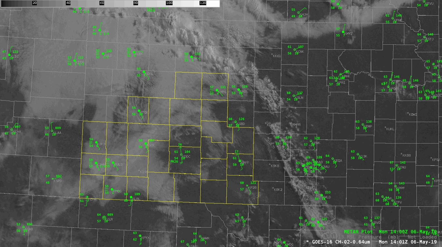
A visible satellite loop of the 0.64 micro channel from GOES-16 shows early morning stratus dissipating between approximately 14-16Z. During this time, the stratus burn off is indicative of the boundary layer beginning to mix out with the sunshine and surface plots corroborate with warming temperatures.
As I’m unable to find anything meteorologically that would support the CAPE drop and rise over 60 minutes, it’s a little concerning as a forecaster too see a jump like this the first time using it. I thought this would be good to point out as a first blog post.
-icafunnel