Skip to content
U.S. Flag icon

An official website of the United States government

Here’s how you know

building icon

Official websites use .gov
A .gov website belongs to an official government organization in the United States.

lock icon

Secure .gov websites use HTTPS
A lock ( Lock Locked padlock icon ) or https:// means you’ve safely connected to the .gov website. Share sensitive information only on official, secure websites.

  • Home
  • About
  • HWT Home
  • EWP Home
  • Participant Info
  • Facebook
  • Twitter
  • Instagram
  • Youtube
  • Flickr

EWP Blog

Spring Experiments & Beyond

  • Home
  • About
  • HWT Home
  • EWP Home
  • Participant Info

PGLM and vis sat

Posted in Live Blogs, Pseudo GLM on June 3, 2015 by Kristin Calhoun.

GLM_and_vis

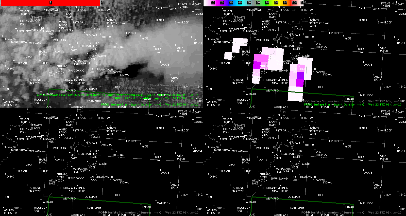
Click for loop. You can see updrafts go up and goes along with the increase in lightning on the PGLM.

Jason Williams

Tags: None

Post navigation

« High amounts of CG lightning across central Wayne Cty (JAX)
Cycling Supercell: SRSO and Lightning Jumps. »

Search the entire NSSL site »

Posts by Date

Posts by Category

  • AllSky (13)
  • Area Forecast Discussion (AFD) (12)
  • AzShear (180)
  • CG Ltg Probability (3)
  • CPTI (4)
  • Daily Summaries (103)
  • DSS (59)
  • Experimental Warning Thoughts (by Greg Stumpf) (22)
  • Forecaster Thoughts (76)
  • General (1,066)
  • GLM (123)
  • GLM DQP (10)
  • GOESR (59)
  • GREMLIN (68)
  • HWT (159)
  • Lightning Jump Algorithm (60)
  • LightningCast (126)
  • Live Blogs (1,149)
  • Mesoscale Discussions (42)
  • News (453)
  • NMDA (22)
  • NUCAPS (93)
  • OCTANE Speed Sandwich (148)
  • Operations Status Message (58)
  • Optical Flow Winds (23)
  • Outlooks (102)
  • PHSnMWnABI (92)
  • ProbSevere (171)
  • Pseudo GLM (16)
  • SPG2022 (68)
  • SPG2023 (92)
  • SPG2024 (94)
  • SPG2025 (83)
  • Total Lightning (22)
  • WAS*IS (1)
  • Webinars (2)
  • Weekly Summaries (40)

Tags

3DVAR ABI All-Sky All-Sky LAP ATPW AzShear CPTI Day Cloud Phase DSS EWP GLM GOESR-Cloud Top Cooling GOESR-Nearcast GOESR-Satcast HWT2022 IR LightningCast lightning jump LJA MRMS NMDA NTDA NUCAPS Optical Flow Winds OUNWRF PGLM PHSnMWnABI ProbSevere ProbTOR RGB Simulated Satellite total lightning Total lightning tracking tool TPW Visualization

Weather Links

  • Live Chaser Cams
  • Live News Camera
  • OK Mesonet
  • OU Hoot
  • RAP Weather
  • SPC Forecast Tools
  • SPC Forecasts
  • WDSSII Real-time

Meta

  • NSSL Home Page
  • Contact NSSL
  • Disclaimer
  • Privacy
  • Accessibility
  • FOIA
  • USA.gov
  • Login
NSSL Home  ·  Contact NSSL  ·  Disclaimer  ·  Privacy  ·  Accessibility  ·  FOIA  ·  USA.gov  ·  Login