

2138 UTC 18 May 2021 KEWX
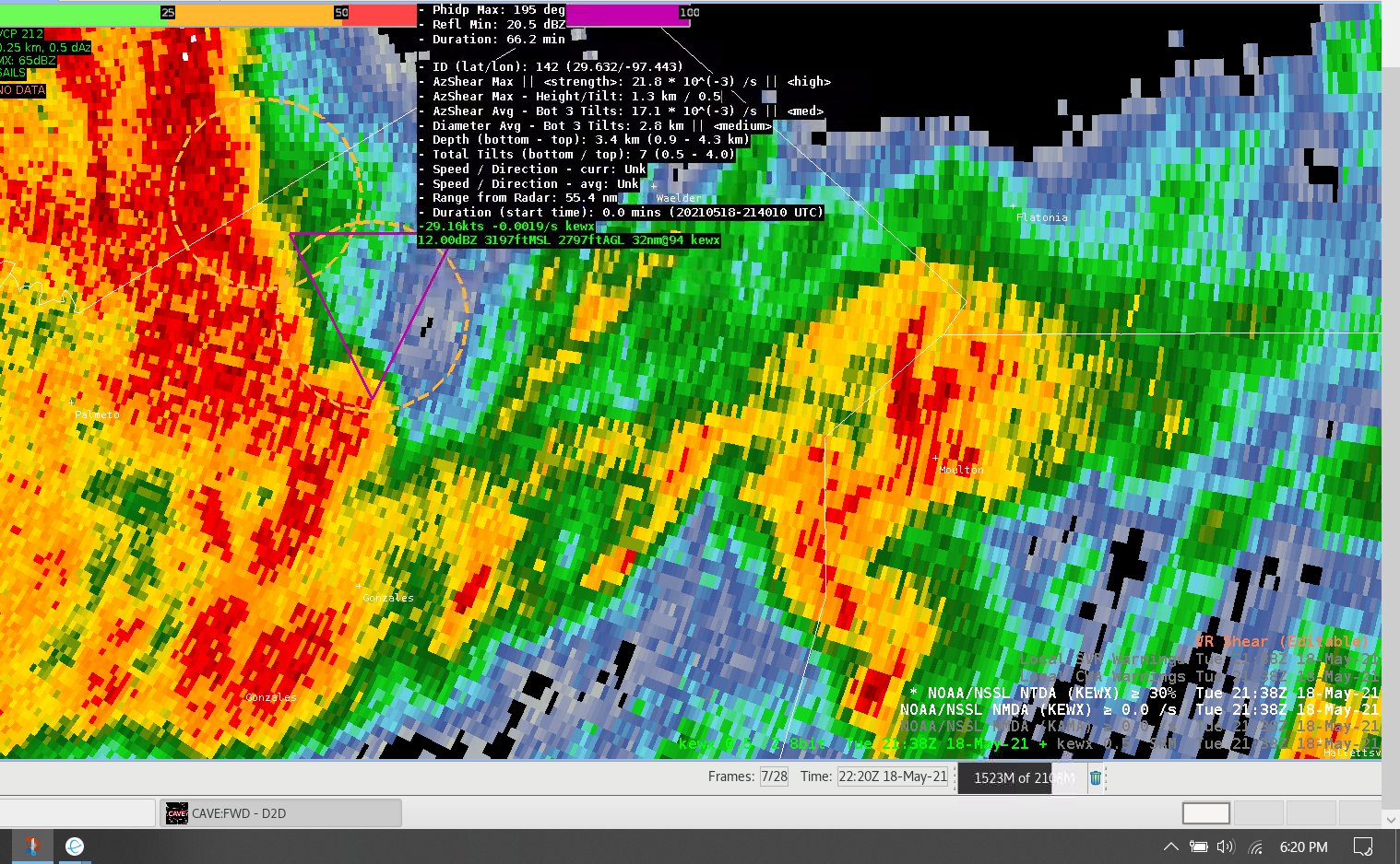
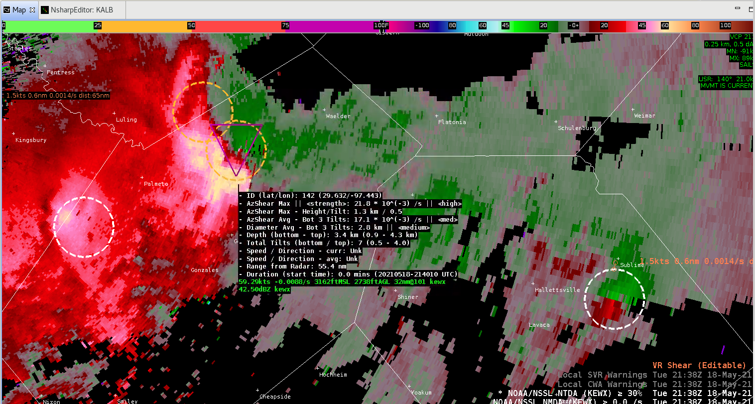
KEWX radar was definitely the most active in the mid afternoon on Tuesday. A QLCS segment formed along or just north of the city with initially multiple circulations along the line with 6 weak to modest NMDA circulations along the line. One circulation looked like a mesovortex on the leading edge along the line (Fig. 1). The NTDA percentage shot up to 83-84%. The NMDA was in the medium range with a “high” as AzShear max. The total tilts from the bottom to top was 0.5-4.0 DEG (7 tilts). It was at a decent range from the radar at 55 nm. It definitely looked like a SVR was needed with a tornado tag. I would have been tempted to issue aTOR. A consistent time continuity of the MESO would have increased my confidence despite the “High” tornado probability. The couplet was dominated by outbound velocities based on the SRM data (velocities > 60 kts). It was nice that the NMDA and NTDA values were co-located. Also notice with the outflow a new cell fires (Fig. 2) in the second image (SRM velocity data). The circulation was narrow, compact and gate-gate in terms of the couplet velocities that the WFO KEWX office issued a TOR on that cell.
– Yoda777