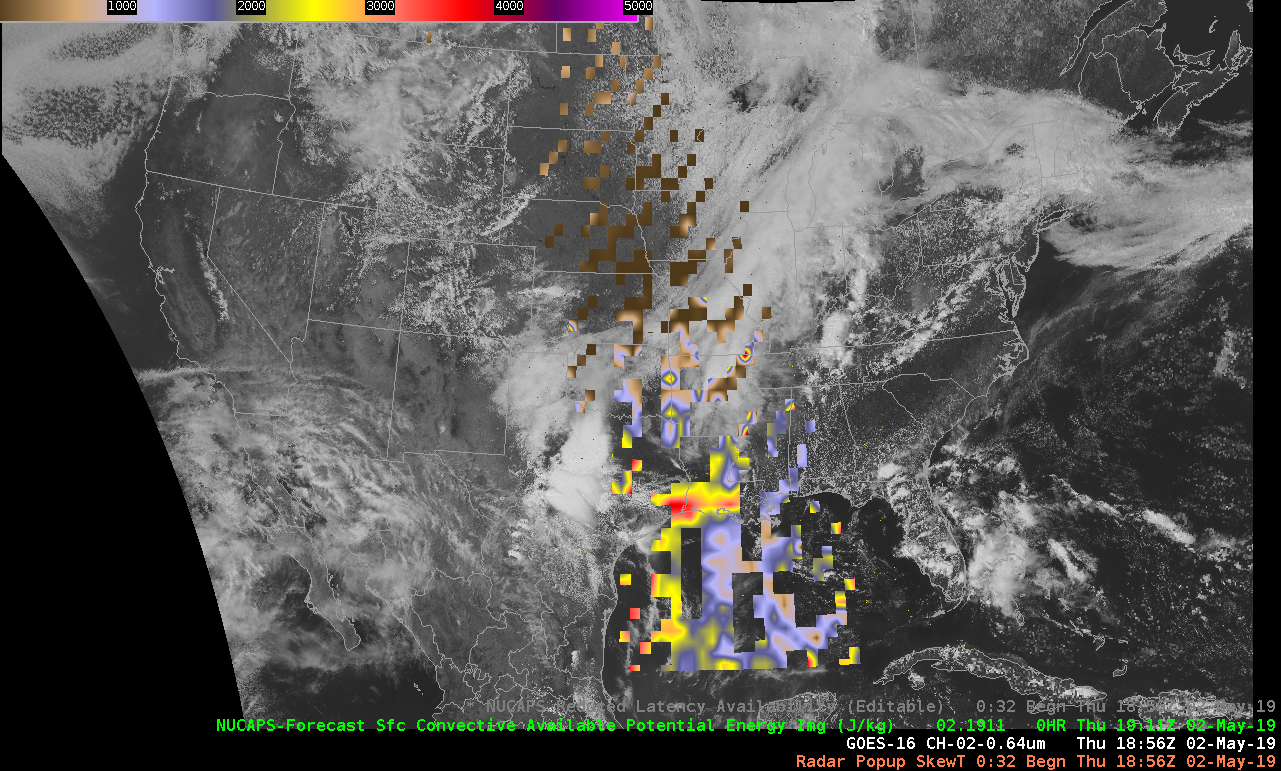
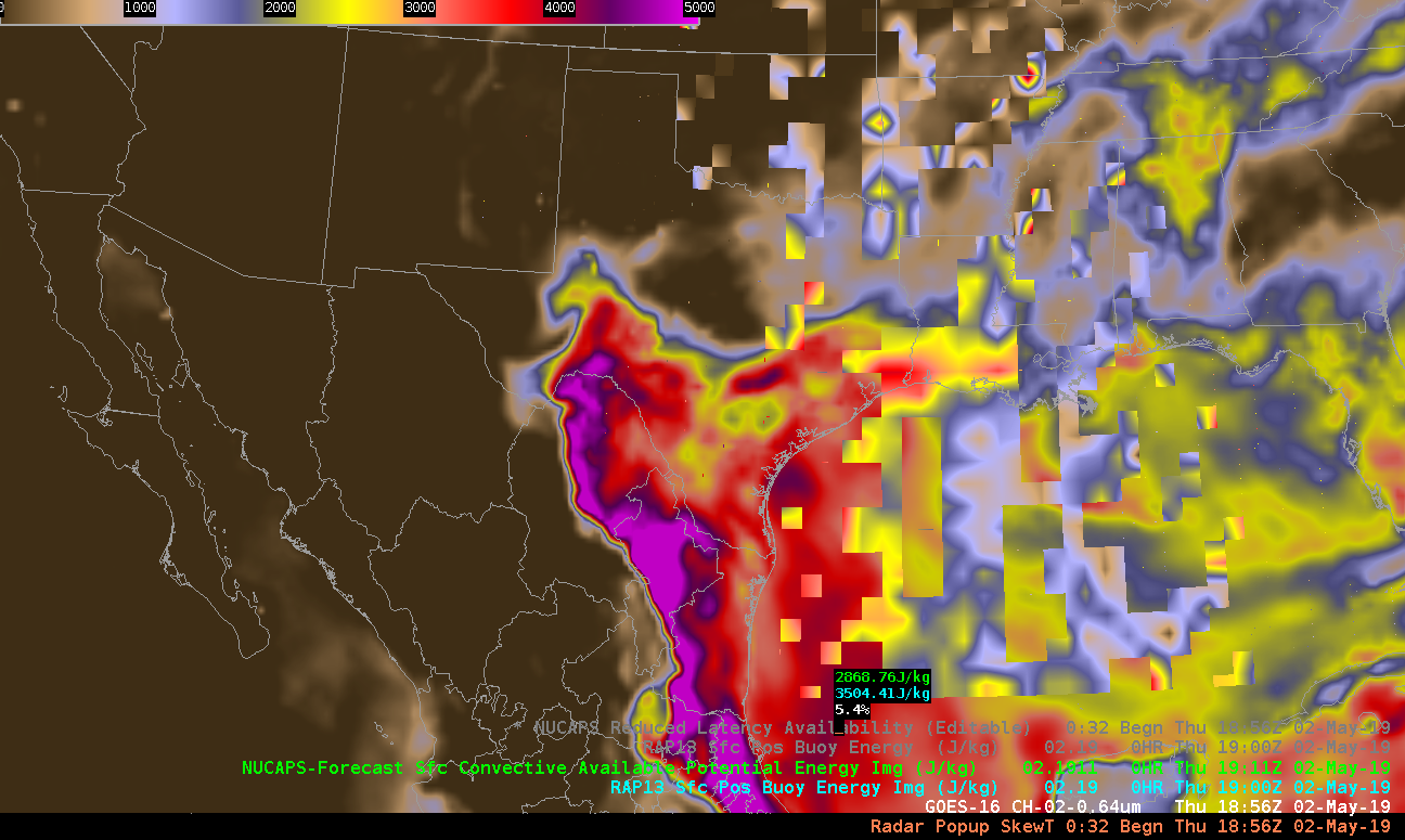
NUCAPS offer a way to get a vertical profile of the atmosphere across the US. However, in areas where soundings were not “retrievable” it can leave many of the products with large holes in them.

A great application would be some type of algorithm that fills in the “data holes” Two ways to approch this would be:
- Linear interpolation between the grids
- Use a model such as the RAP to fill in the gaps

A smoothing of some sort would still benefit the product above, but this would be of great benefit to forecaster’s trying to determine the afternoon environment. (Note: I think it would be beneficial to include a mask that said whether the data was from NUCAPs or a model in each location if a product like this was developed. All in all, this is a useful product, but it needs some further refining.
South Beach
