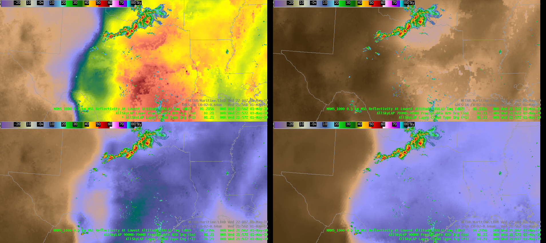
As many have already mentioned, the new All-Sky LAP layered PW and CAPE products are very useful tools for mesoanalysis and quick identification of key meteorological gradients (I bet my grandmother could ID the dryline below…). Earlier today, these products seemed to pick up on the outflow boundary that stretched from SE AR into southern OK/northern TX. It was extremely subtle and slightly offset from the actual boundary, but if you looked just right you could see it (tried to get a good animation, but the contrast is lost so you’ll have to take my word for it…). The color table provided for these products, specifically the PW products, make identifying key/obvious boundaries easy, but the more subtle things are easily missed. I would caution anyone from using them for anything other than IDing the main players, unless the color table could be tweaked to enhance those low-to-mid range values (~0.4 to 0.8). I’m not sure it’s worth exploring given these products are 6km resolution, I was just surprised to see the subtle reflection of the outflow boundary. Perhaps I’ll play around with the color tables now…
–Stanley Cupp