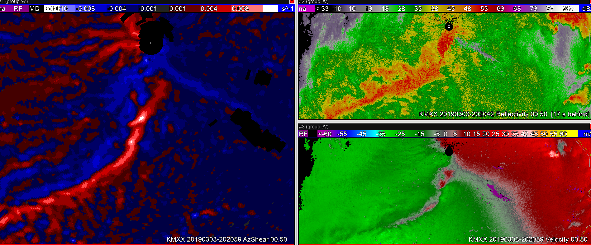
A quick look at the single radar AzShear product vs. the merged 0-2km product for a QLCS event. The single radar AzShear is far more granular and brings my attention to specific points of the line to interrogate further. However, the merged product is washed out…As a result, it’s potential utility to highlight areas of interest is degraded. Perhaps it would be most useful for general trends, but for storm-scale interrogation it leaves me wanting.
I do think the single radar AzShear product has promise with respect to increasing lead times, especially for QLCS circulations. But without other cases to examine, I can’t say for sure. It does show promise (especially when coupled with base velocity and spectrum width) with highlighting the areas of interest a scan or two before velocity couplets develop.
–Stanley Cupp
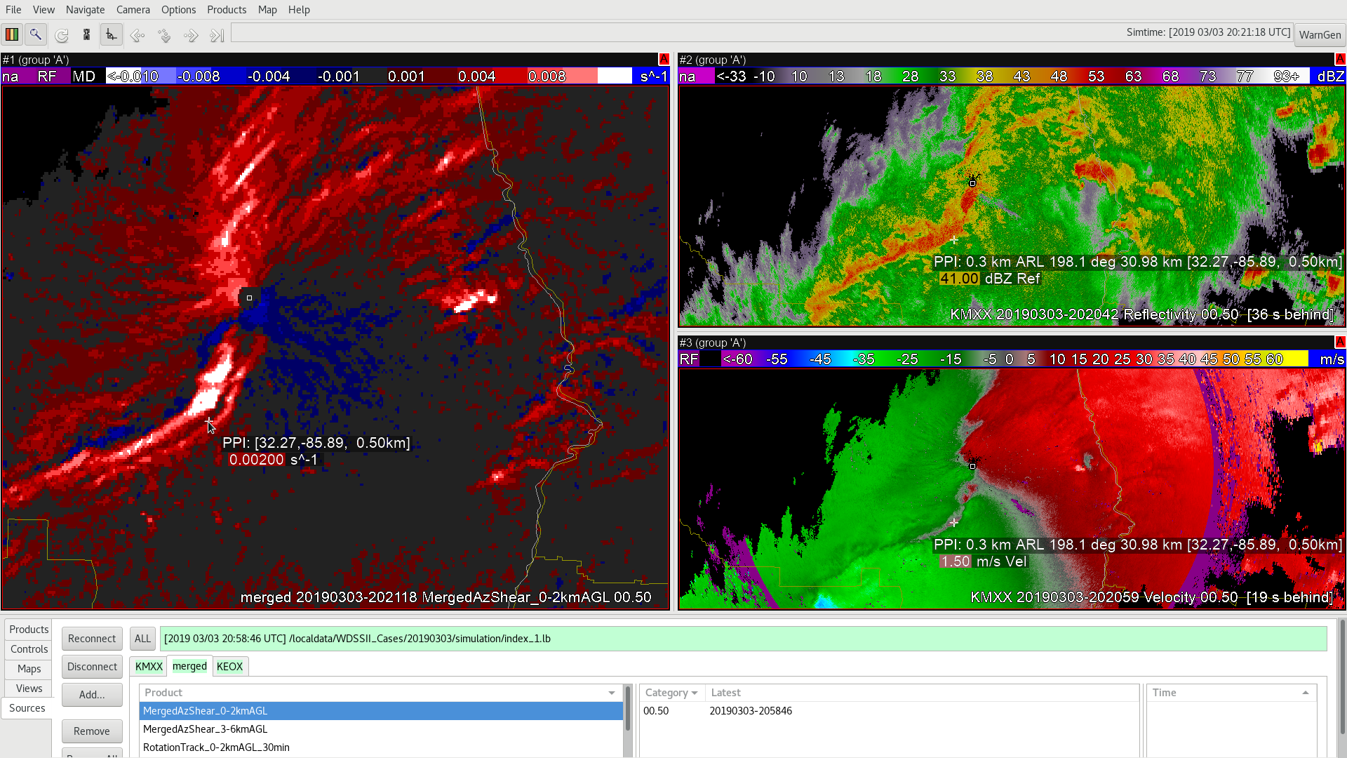
2021z merged 0-2km AzShear (left): very messy and washes out a lot of the storm-scale features. Also shows a leading area of shear ahead of the main line. This is likely due to SAILS cuts and different scanning modes for the radars used in the creation of the product. Something to watch out for in future events – this is an artifact that needs to be identified when using this product.
2020 KMXX AzShear highlights 2 main areas of interest along line of convection
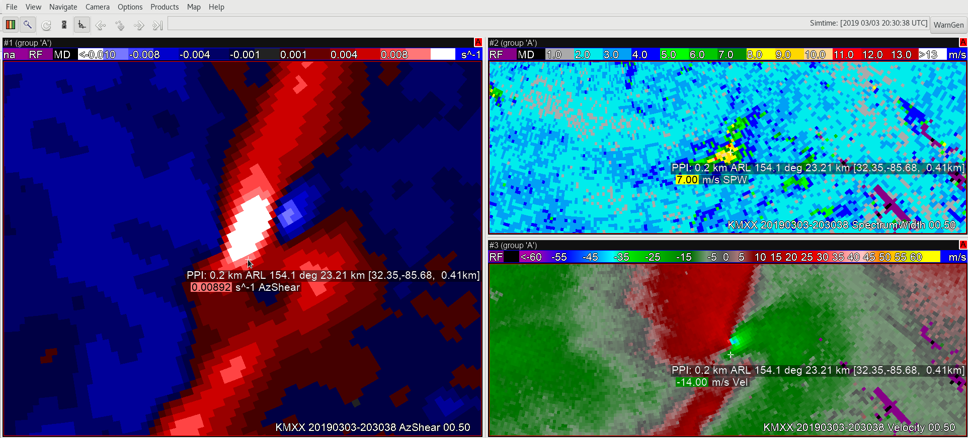
2024z: AzShear and velocity begin to show that the southern most of the 2 areas is becoming an increasing concern. Would likely have a tornado warning out at this point, if not the prior scan (especially given the favorable environment). Spectrum Width (top right) also helps diagnose the increased velocity signature on the southern most area compared to the northern one.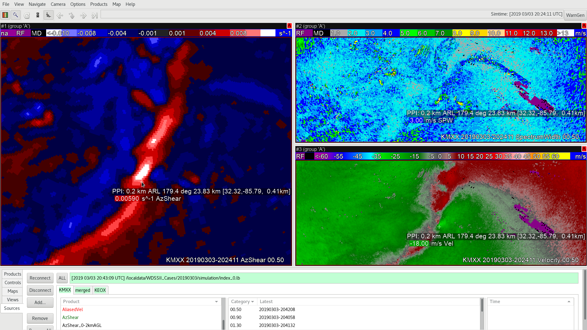
And by 2030, a distinct velocity couplet developed