

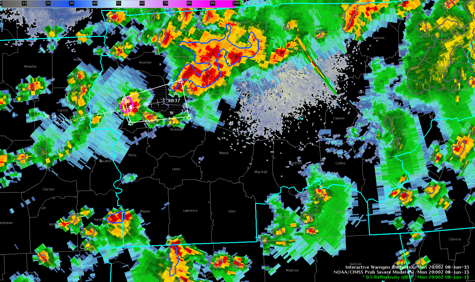
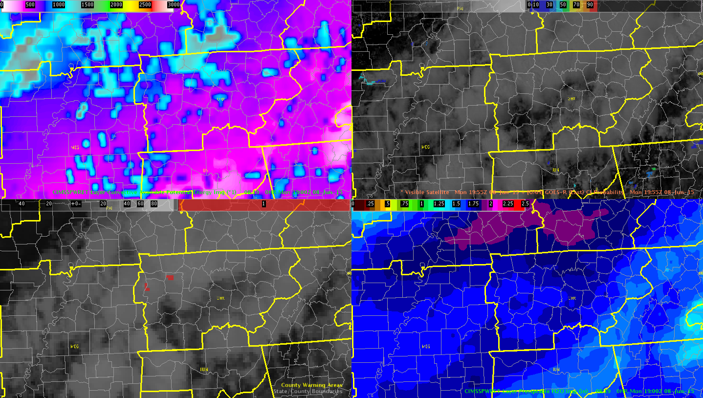
Issued a warning on cell over Humphrey’s County…storm was in an environment that had already produced storms with severe hail. Noticed that it had not yet produced an overshooting top but looked close using the one minute Super rapid scan imagery also noticed local maximum area of cape out ahead of where the storm was developing with clear skies
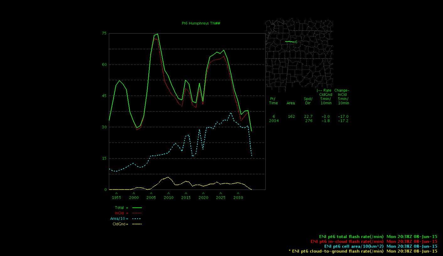
Notice the lightning jump on the ENI time series…this may have added urgency to issue a warning had I used it to begin with. Did get wind damage reported and power outages with this cell.
Inthecards