

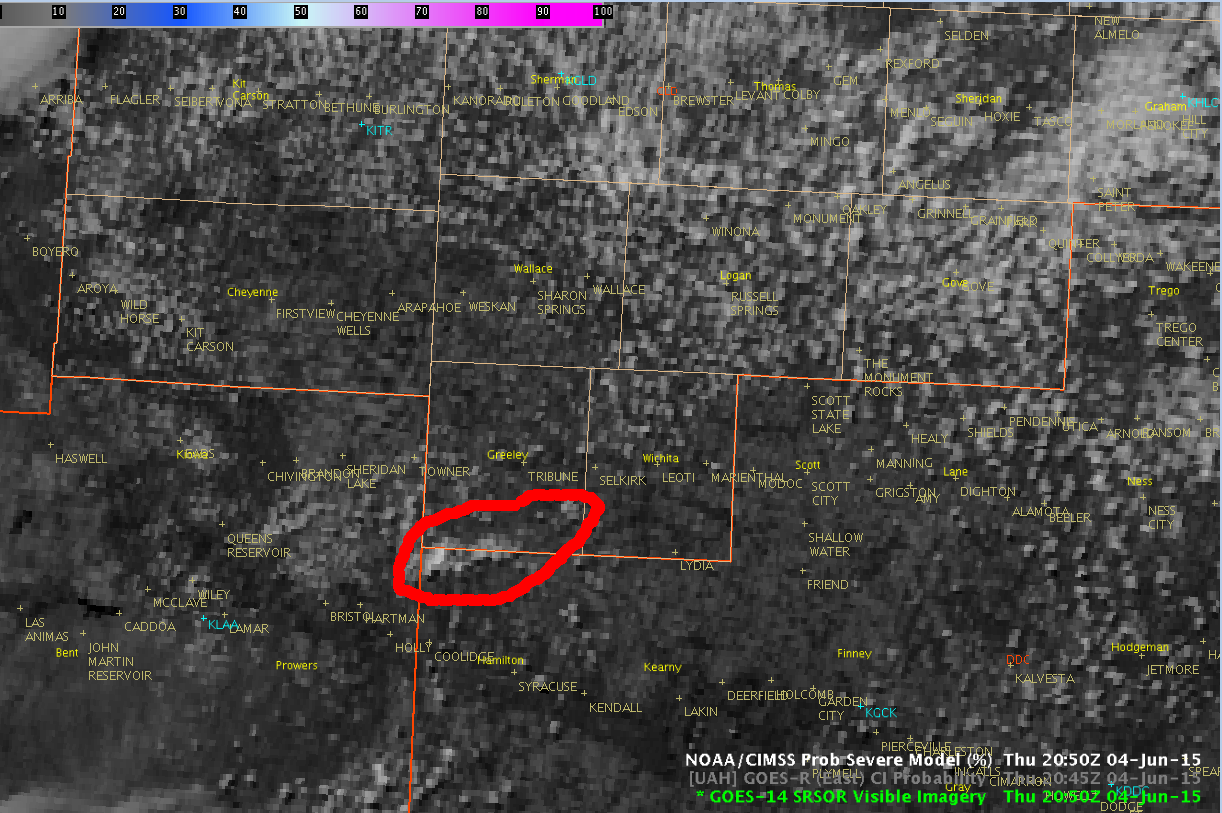
GOES-14 1-minute visible satellite data showed a towering cumulus that tried to grow across southern portions of Greenley county at 2050 UTC…
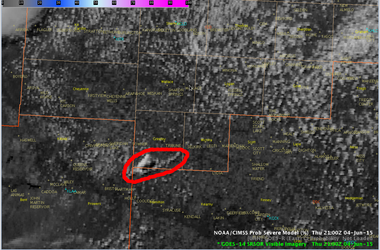
which started to build nicely over the next 10 minutes…
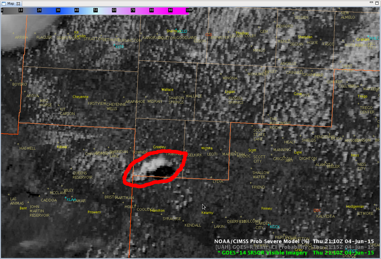
and grew further, showing what looked like a nice anvil top at 2110 UTC.
However, the low level southeast winds clashed with the stronger mid level southwest winds, which tore the top of the thunderstorm away from the low level convection just 10 minutes later.
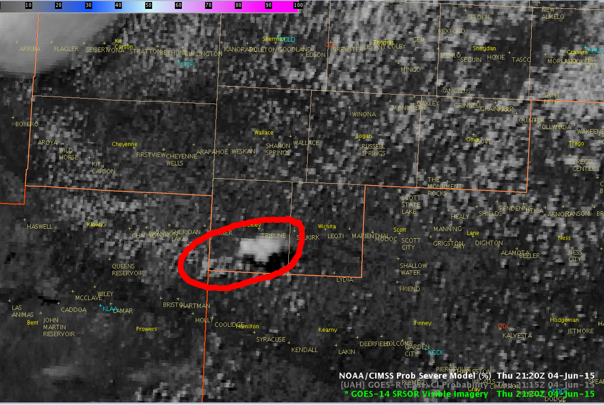
A light shower was noted on KGLD radar at 2118 UTC near the southern Greenley county border that quickly dissipated.
CoonieCatEye/Jason Williams