

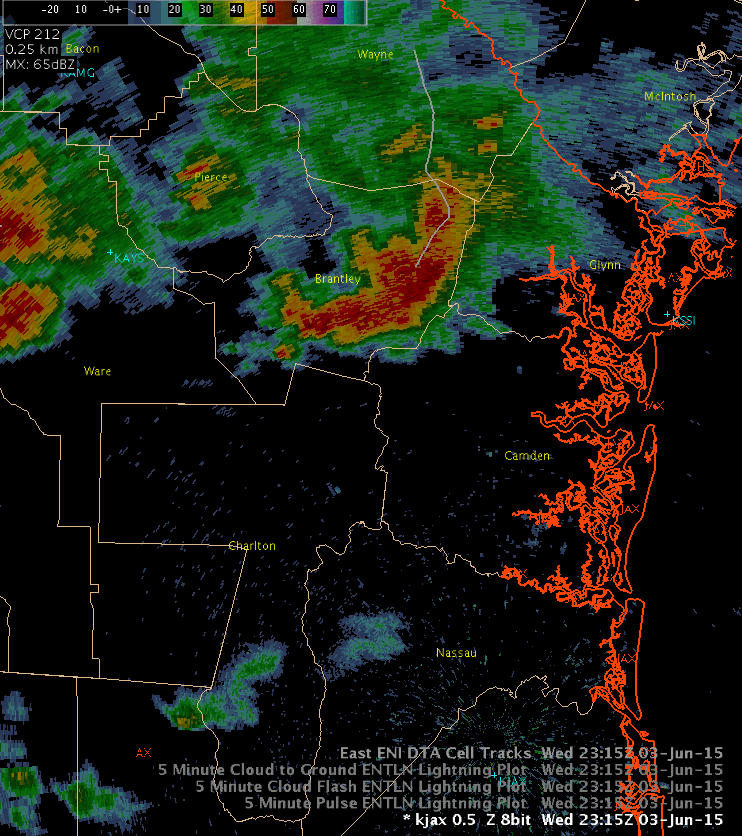
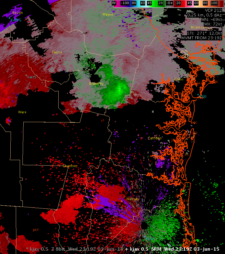
While monitoring the cell as it shifted SE out of Brantley county, which also had large amounts of total lightning for several volume scans, I noticed that an inflow notch had begun to develop on the backside of the storms. Having taught many SKYWARN sessions for our CWA, I knew this was indicative of a low level inflow jet working into the storms. I also noticed that the low level SRM was increasing. When you see the loop of both the 0.5 degree reflectivity and SRM, you will see the bulge working south out of the storms. Based on this, I issued an SVR for northwestern Camden county at 730 PM EDT, expiring at 815 PM.
WFO JAX received a spotter report of a tree down due to strong thunderstorm winds at 755 PM EDT one mile N of Tarboro. Verified!
CoonieCatEye