Skip to content
U.S. Flag icon

An official website of the United States government

Here’s how you know

building icon

Official websites use .gov
A .gov website belongs to an official government organization in the United States.

lock icon

Secure .gov websites use HTTPS
A lock ( Lock Locked padlock icon ) or https:// means you’ve safely connected to the .gov website. Share sensitive information only on official, secure websites.

  • Home
  • About
  • HWT Home
  • EWP Home
  • Participant Info
  • Facebook
  • Twitter
  • Instagram
  • Youtube
  • Flickr

EWP Blog

Spring Experiments & Beyond

  • Home
  • About
  • HWT Home
  • EWP Home
  • Participant Info

Lightning jump, 1 min vis support BOU cell reintensification

Posted in Lightning Jump Algorithm, Live Blogs on June 3, 2015 by Kristin Calhoun.

2145LJ2146LJ

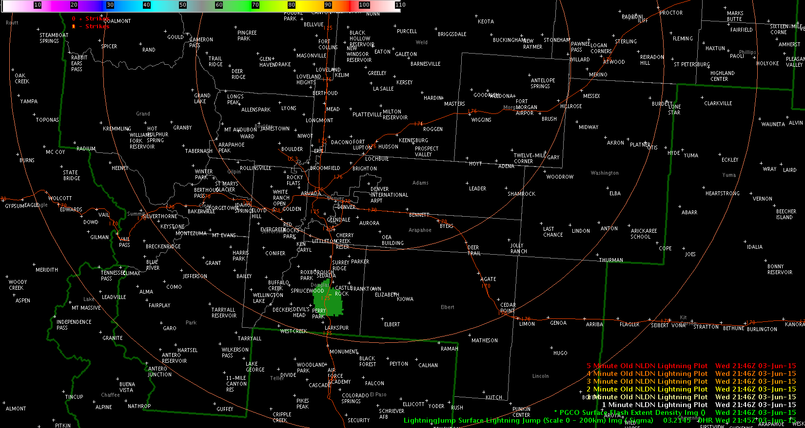
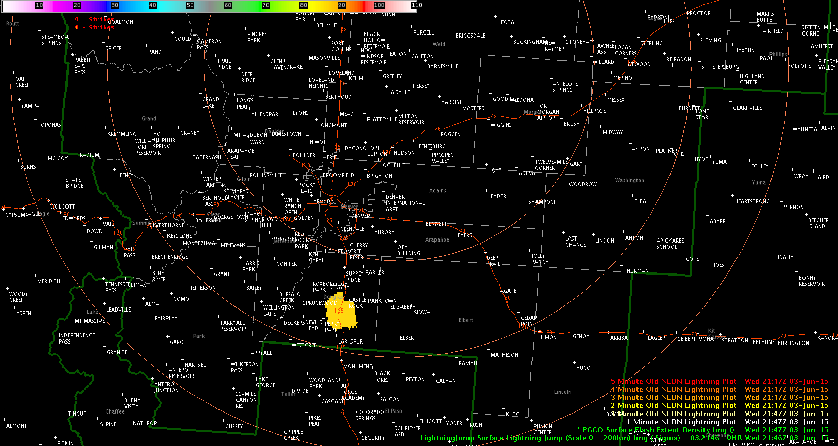
Click for loop – you can see another updraft shoot up on the west side of the storm.10minloopvis

Jason Williams

Tags: None

Post navigation

« Boulder, CO: 1st SVR.
Early cell splits have shown left dominant cases as most persistent »

Search the entire NSSL site »

Posts by Date

Posts by Category

  • AllSky (13)
  • Area Forecast Discussion (AFD) (12)
  • AzShear (180)
  • CG Ltg Probability (3)
  • CPTI (4)
  • Daily Summaries (103)
  • DSS (59)
  • Experimental Warning Thoughts (by Greg Stumpf) (22)
  • Forecaster Thoughts (76)
  • General (1,066)
  • GLM (123)
  • GLM DQP (10)
  • GOESR (59)
  • GREMLIN (68)
  • HWT (159)
  • Lightning Jump Algorithm (60)
  • LightningCast (126)
  • Live Blogs (1,149)
  • Mesoscale Discussions (42)
  • News (453)
  • NMDA (22)
  • NUCAPS (93)
  • OCTANE Speed Sandwich (148)
  • Operations Status Message (58)
  • Optical Flow Winds (23)
  • Outlooks (102)
  • PHSnMWnABI (92)
  • ProbSevere (171)
  • Pseudo GLM (16)
  • SPG2022 (68)
  • SPG2023 (92)
  • SPG2024 (94)
  • SPG2025 (83)
  • Total Lightning (22)
  • WAS*IS (1)
  • Webinars (2)
  • Weekly Summaries (40)

Tags

3DVAR ABI All-Sky All-Sky LAP ATPW AzShear CPTI Day Cloud Phase DSS EWP GLM GOESR-Cloud Top Cooling GOESR-Nearcast GOESR-Satcast HWT2022 IR LightningCast lightning jump LJA MRMS NMDA NTDA NUCAPS Optical Flow Winds OUNWRF PGLM PHSnMWnABI ProbSevere ProbTOR RGB Simulated Satellite total lightning Total lightning tracking tool TPW Visualization

Weather Links

  • Live Chaser Cams
  • Live News Camera
  • OK Mesonet
  • OU Hoot
  • RAP Weather
  • SPC Forecast Tools
  • SPC Forecasts
  • WDSSII Real-time

Meta

  • NSSL Home Page
  • Contact NSSL
  • Disclaimer
  • Privacy
  • Accessibility
  • FOIA
  • USA.gov
  • Login
NSSL Home  ·  Contact NSSL  ·  Disclaimer  ·  Privacy  ·  Accessibility  ·  FOIA  ·  USA.gov  ·  Login