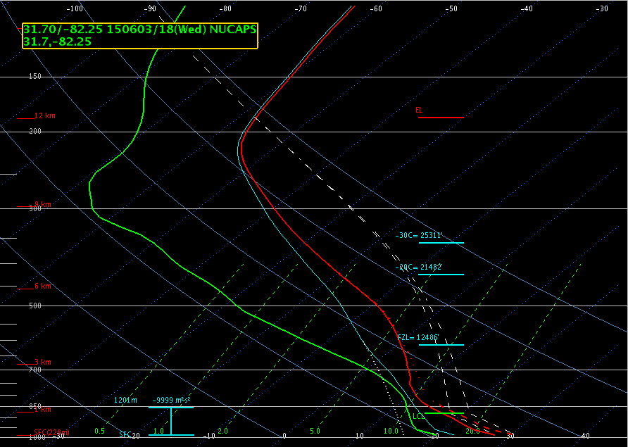
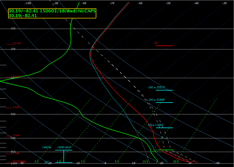
I took a look at the NUCAPS soundings for the locations circled in green below. Both locations had a bit of contamination from cumulus, but there wasn’t much cirrus over the areas so after modifying the T/Td of the soundings with nearby METARS, I felt that they represented the environment pretty well. In my initial environmental analysis using CIMSS and SPC data, I had noticed that moisture was higher in the northern portion of the FA. The NUCAPS soundings showed this as well with drier air aloft in the sounding from the central part of the FA versus the sounding further north. I also used the two soundings to compare the amount of instability and the sounding further north had higher CAPE than the sounding in the central part of the FA. This was consistent with my initial analysis as well.
Having the NUCAPS soundings available was important to my situational awareness in this particular case. I could see where these soundings would also be useful in other parts of the country as well. At my office in Columbia, SC, we do not have upper air and there really aren’t any upper air sites close by, so having these available would be extremely beneficial.
 Modified NUCAPS sounding from Appling County (northern FA).
 Modified NUCAPS sounding from Baker County (central FA).
-Helen Hunt


