

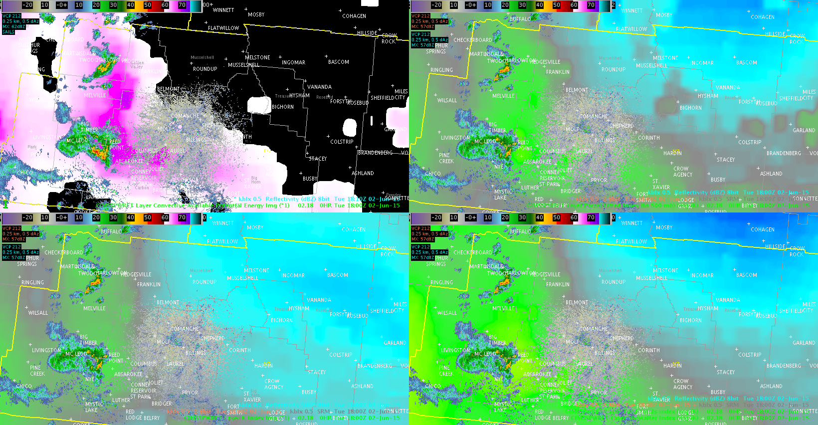
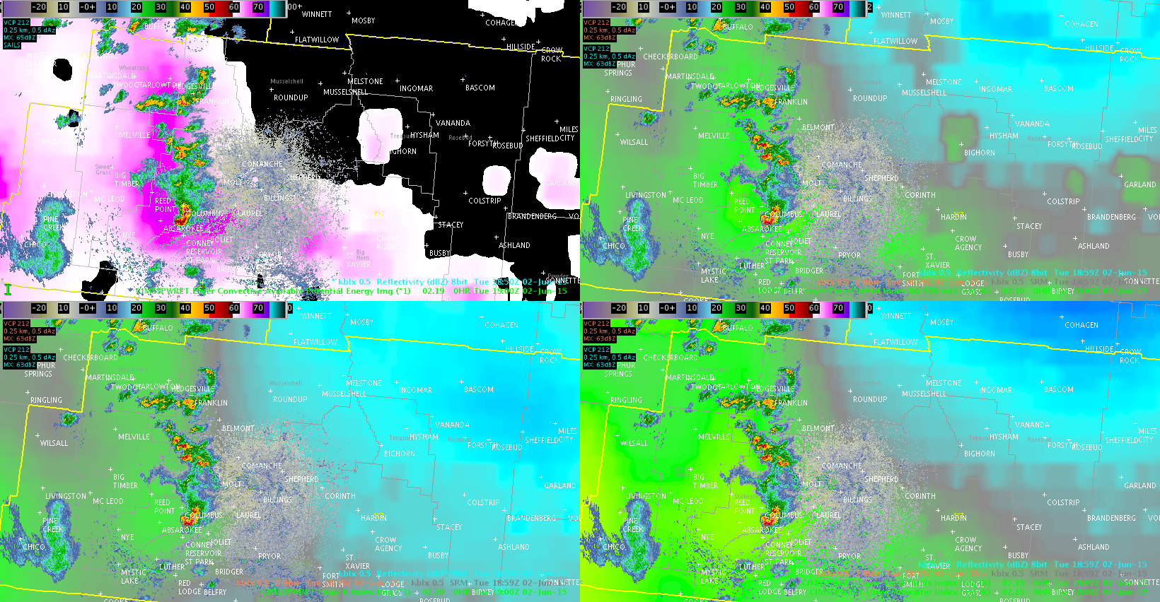
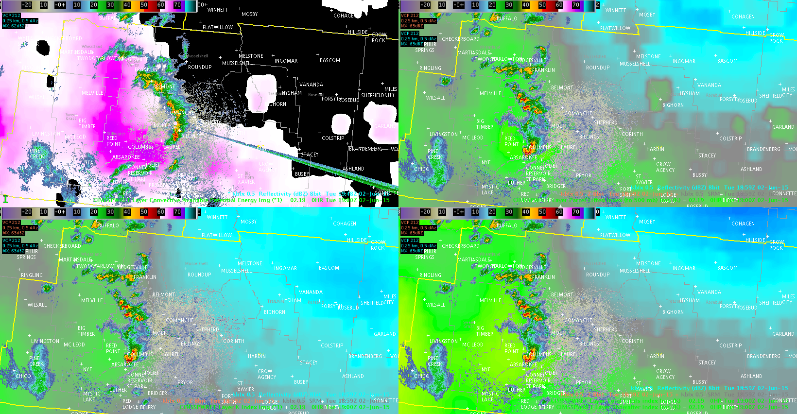
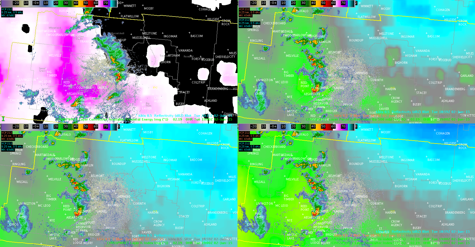
The four images show the progression of the storm cluster in the BYZ CWA in relation to the GOES LAP CAPE (upper-left panel). The storms appear to have intensification as they move NE; while one could look at the better proximity to the radar for this, the increase in lightning would suggest that there was indeed intensification (see previous post on lightning rate).
The northern end of the line has become stratiform and has been completely without lightning since 2011z; the southern cell started losing lightning at about that time and has since had very little (if any) on the one-minute ENTLN data. The ENI DTA went away at 2023z and no alert boxes have been present since then.
It appears the LAP CAPE product performed well in relation to how the storms evolved as they moved NE.
Jason Williams