Cirrus Affecting Convective Initiation Product in Kansas

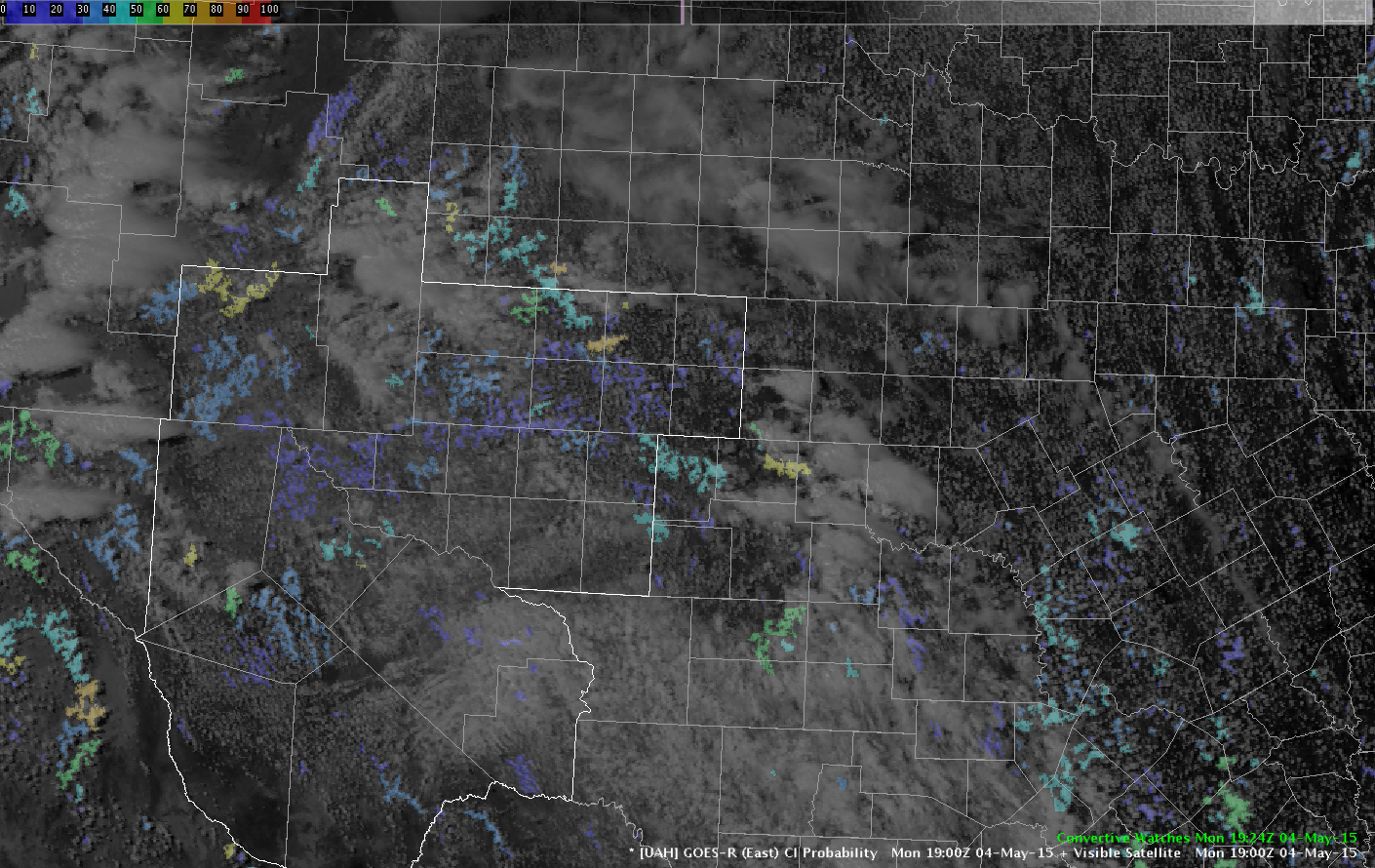
Was hoping to use the Convective Initiation (CI) product closer to the area in eastern Kansas, but unfortunately cirrus in the area limited the ability to use the product.  The first image below (1730Z Visible Satellite) indicates the product was trying to indicate convection development, but then cirrus really started to contaminate the area and led to no highlights as the convection started to develop (middle image at 1830Z). The bottom image (1900Z) shows more mature convection on visible satellite. -SRF

20150504_1730Z_CI_Kansas

20150504_1830Z_CI_Kansas 20150504_1900Z_CI_Kansas

Tags: None

Changing Colors

As always, the first order of business when you’re working at a new office or AWIPS system – build build build! Currently working on procedures and my personal favorite, custom color tables. If I was thinking ahead I would’ve brought some from home.

One of the color tables I always change: CAPE. The default “gridded data” color table that AWIPS loves so much just doesn’t fit well.

Before: CAPE_before

That magenta really stands out, as if I really care about areas of zero CAPE.

After:

CAPE_after

Much better! I did something similar for the Lifted Index: making everything above about 2C transparent.

Now back to the real fun: convection blowing up in my CWA Du Jour (Midland, TX) and clearing AlertViz banner after AlertViz banner.
-V. Darkbloom

Tags: None

Initial Look at Some of the EWP Products

After taking 20+ plus minutes looking through all of the data, I found several useful products but unfortunately there is limited uses in my area (OAX).  Thus far, mainly seeing rain across the region with some thunderstorms starting to develop to the south in eastern Kansas.

20150504_1900Z_OAXRadar

-SRF

Tags: None

Initial thoughts on convection at Topeka ~19Z

A quick glance at the surface obs and SPC mesoanlyses indicates a weak boundary located across the Topeka CWA, stretching WSW to ENE.

050415_KTWX_GOESR_Conv4panel

GOES-R layer CAPE indicates the sharp instability gradient across the CWA with CAPE near 1300 J/KG for southeastern counties (Coffey/Anderson/Franklin) with a few hundredths of CAPE for the northwestern counties where weak showers/thunderstorms pushed through the area earlier today. Convective Initiation suggests low probability of formation moving into the south-central portions.

050415_KTWX_AllTiltsWeakConvLightning

KTWX radar indicates weak convection across Dickinson county with minimal lightning activity (less than 5-7 flashes/min and 1-2 CGs over the past 30 mins). These storms have greater potential for future development as they move east towards greater instability as noted in the GOES-R products.

Brick Tamland

Tags: None