Towering Cu 1 min SRSOR data

The 1-min SRSOR shows a towering cu over the ILM forecast area this afternoon. Out of all the scattered showers/thunderstorms, the 1 minute data easily shows which thunderstorm is rapidly growing. The KLTX radar data confirmed by 50 dbz up to 28 kft. The lead time by the SRSOR was probably 5 to 10 minutes ahead of the radar data.

1min_sat_ILM

ILM_radar_towering_cu


George

Tags: None

Deep thoughts on CI product

Sometimes CI is good. Sometimes CI is bad. -The End

Based on use over the past 4 days the product seems to be most successful in cases of isolated to scattered convection earlier in the day. In cases of more widespread convection with complex storm motion and multiple cloud decks moving in multiple directions it seems to get “confused” and becomes less reliable and less useful overall.

I do think it’s biggest strength is in helping to maintain situational awareness about developing convection…especially during the early stages of a convective event.

-snowstrm

Tags: None

CI Hampered by Cirrus Shield

Working on NC, and looking for developing cumulus, CI seemed as though it was ‘turned off’ due to glaciation over a large part of the area with underlying boundary layer cumulus.

CI was overheard saying “I am so turned off by ice clouds”

Rocky


CI

Tags: None

GOES-R LAP algorithm performance in MHX

17z GOES R LAP algorithm cape field (fig 1)had best utility on picking up on instability in areas with thin cirrus (fig2).  Due to developing convection along the cold front and convective debris…areas further to the west had lower detected CAPE values. In actuality…the depicted tight instability gradient and target for convective development should have been about 100 miles to the west as seen in fig 3 (SPC mesoanalysis) Something forecasters have to keep in mind with this product.

Fig 1

LAP cape mhx 17z

Fig2

17z satellite mhx

Fig 3


Screenshot-SPC Hourly Mesoscale Analysis - Mozilla Firefox

Pickles

Tags: None

UAH Convective Initiation Success

The 1815 to 1830z UAH Convective Initiation probabilities for a line of towering cumulus along the cold front along NC/SC border spiked from 40 to 70 percent. 20 to 30 minutes later, the KLTX radar showed a developing thunderstorm for that cluster.

CI_radar_2

CI_radar_1


George

Tags: None

ILM-RAH early trends

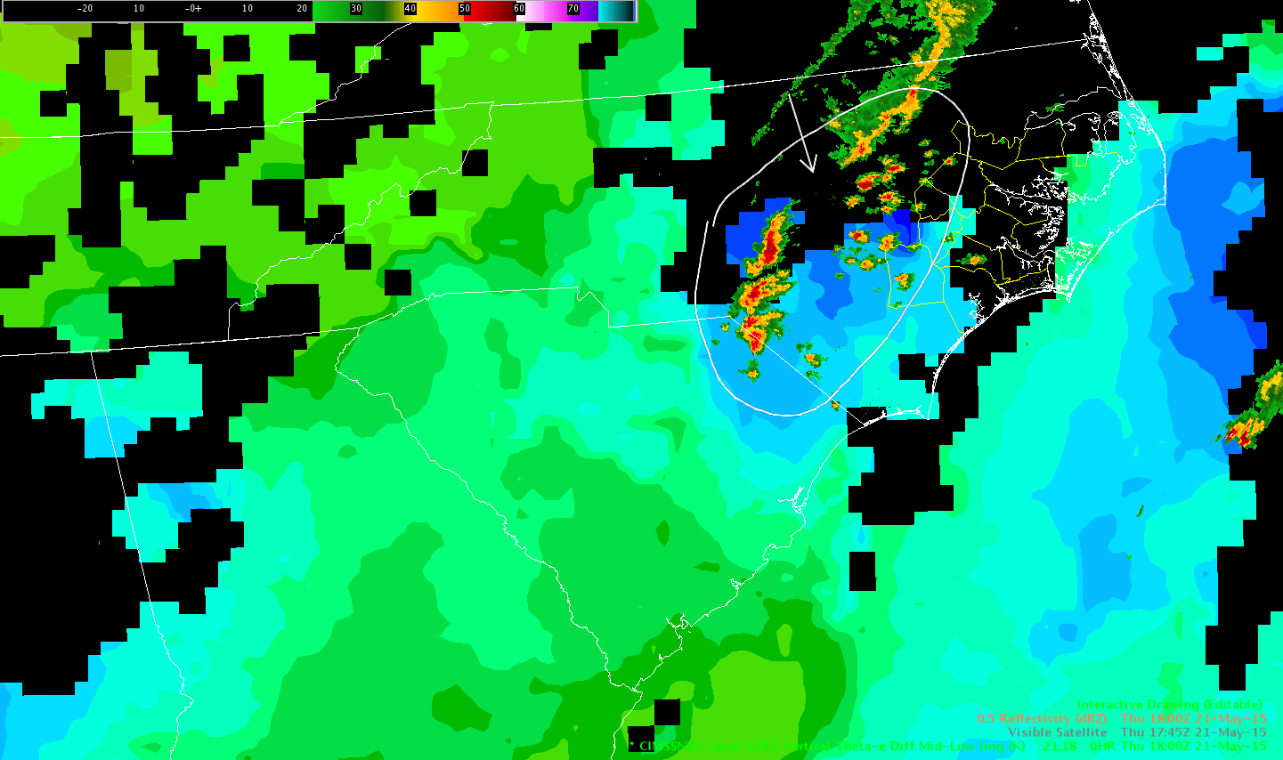
ILM shift began around 18Z.  Disorganized clusters of convection  in Central NC at this time, with widely scattered strong cells, tracking east.  Mostly in RAH, one near the very northern edge of the ILM CWA.  Anticipating some more storm development in Northeast South Carolina and existing storms growing into the CWA.

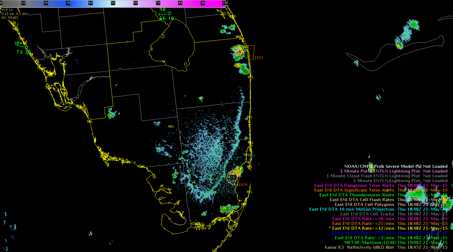
Substantial downward trend in Hoke County (10) cell noted after reaching DTA threshold.  Robeson Co cell (11) dropped below tracking threshold, and not as a result of cell definition.

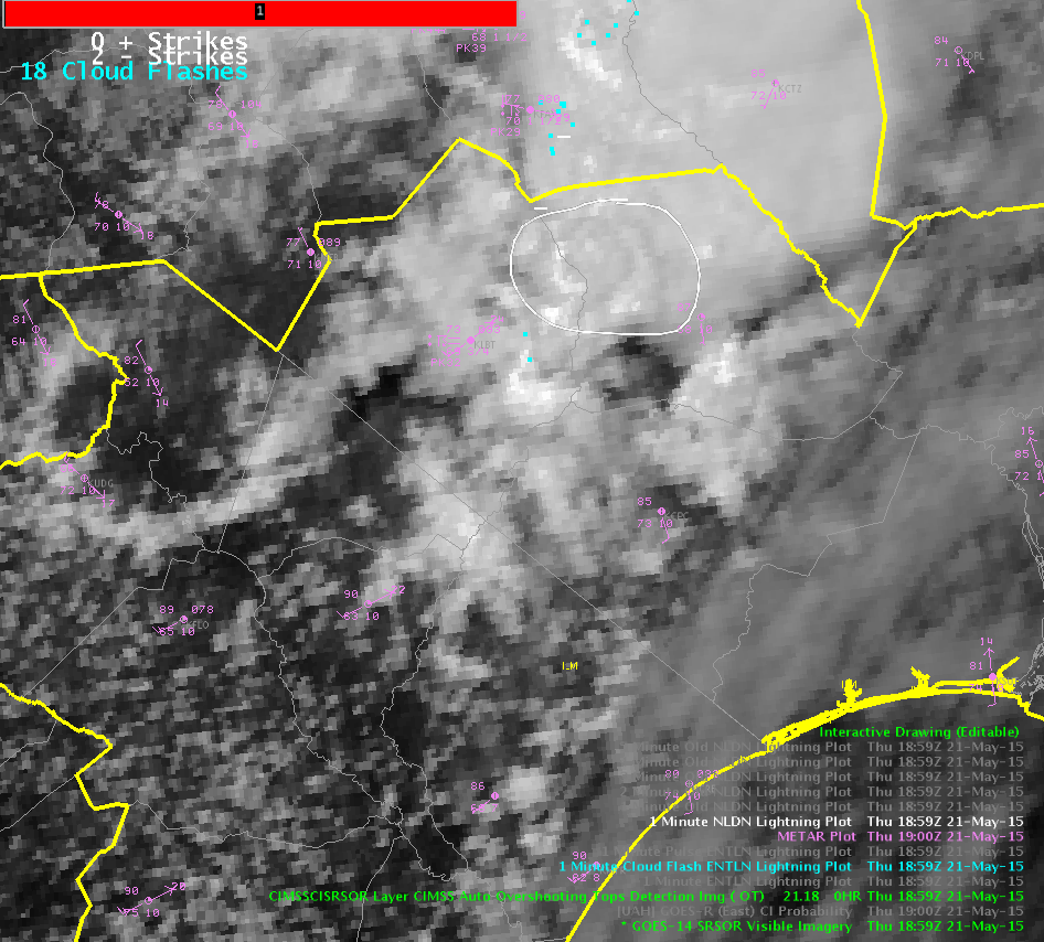
SRSOR overshooting top detected for a few scans around 1827Z on Harnett Co/Cumberland Co Cell (9).  Only overshooting top in the Carolinas to this time.

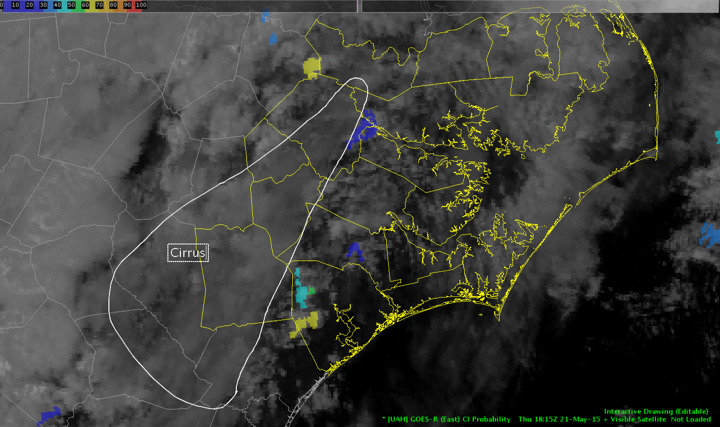
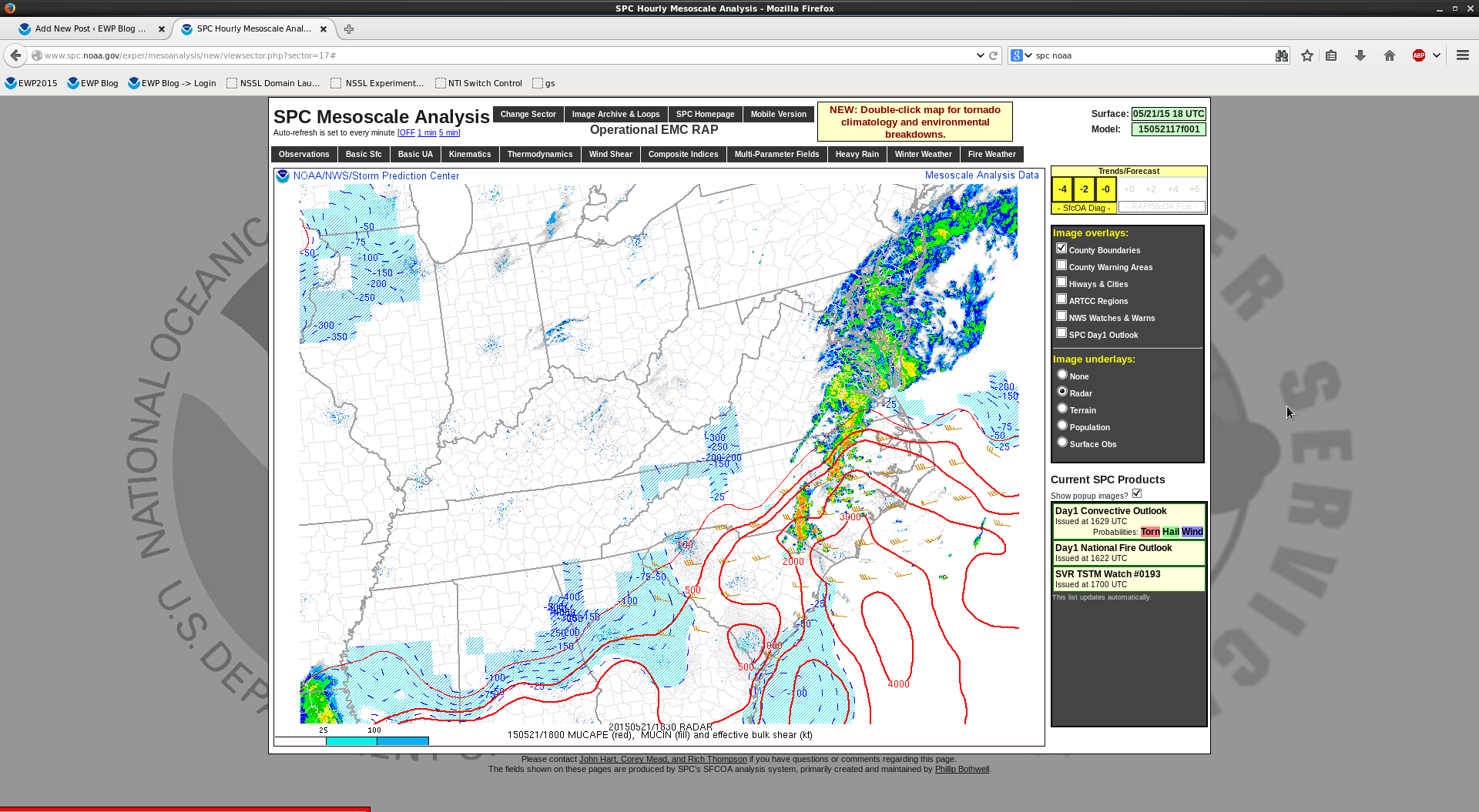
Will consider this when evaluating if new cells can maintain updraft strength.

This corresponds to decreases in Prob Severe, too.

0521 ILM ENI trend 10521 RAH overshoot
[Click to animate]

-Holaday

Tags: None