

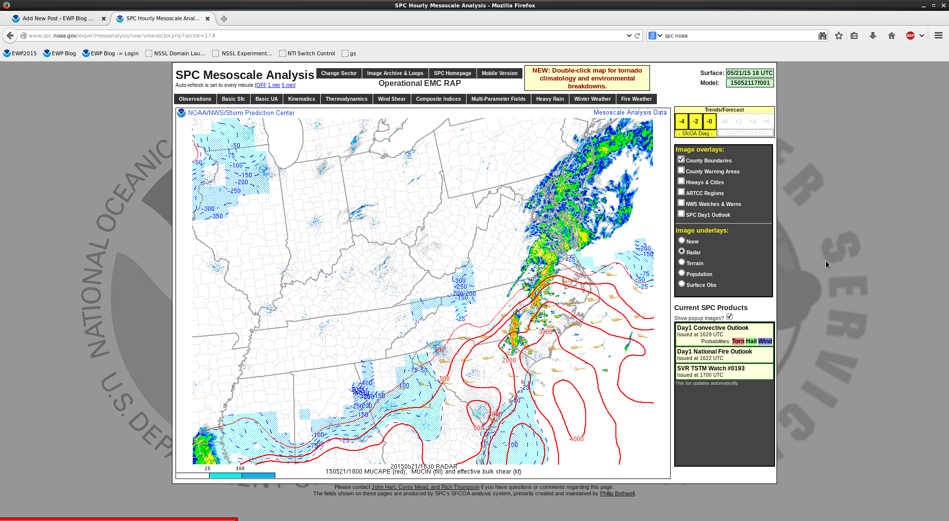
17z GOES R LAP algorithm cape field (fig 1)had best utility on picking up on instability in areas with thin cirrus (fig2). Due to developing convection along the cold front and convective debris…areas further to the west had lower detected CAPE values. In actuality…the depicted tight instability gradient and target for convective development should have been about 100 miles to the west as seen in fig 3 (SPC mesoanalysis) Something forecasters have to keep in mind with this product.
Fig 1
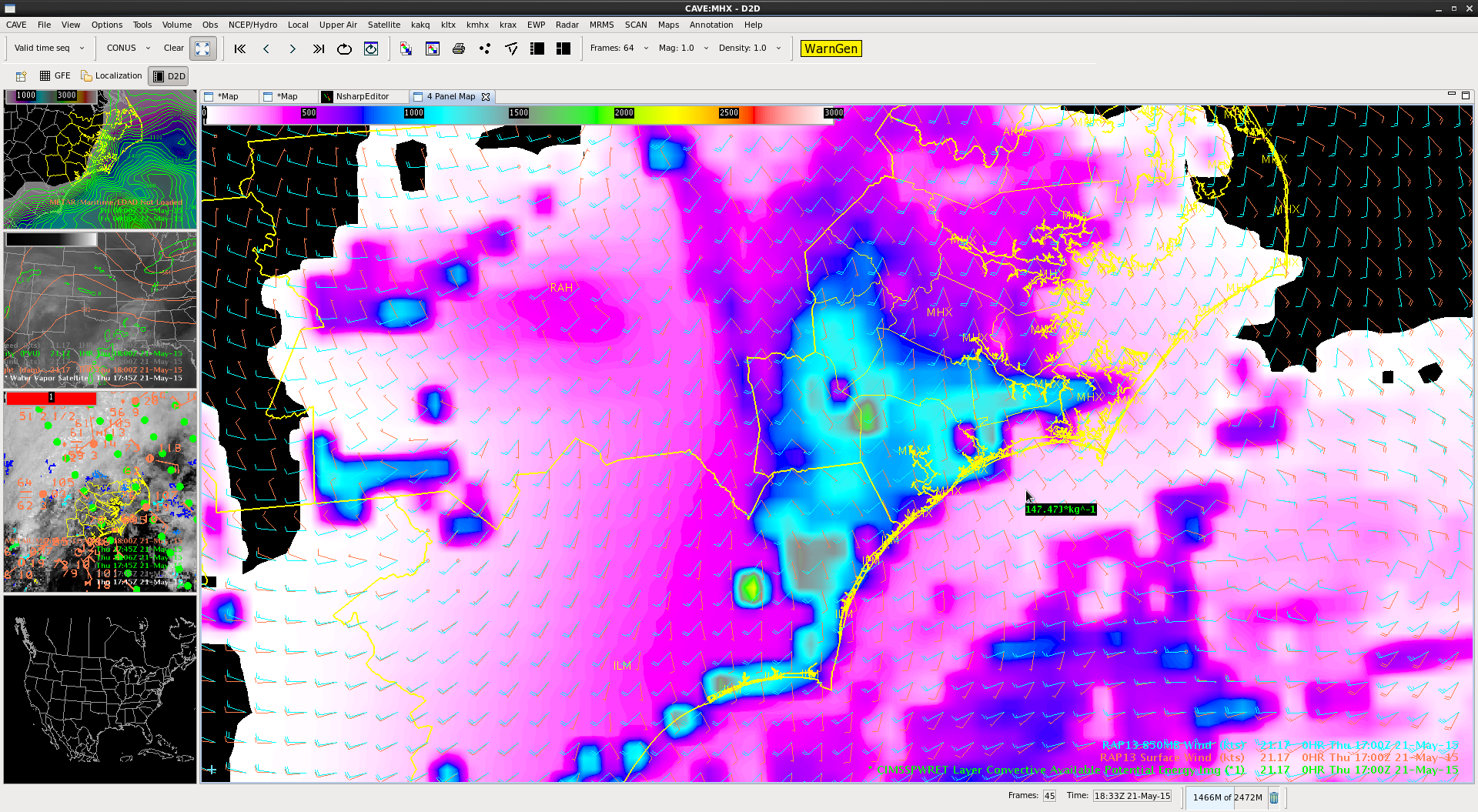
Fig2
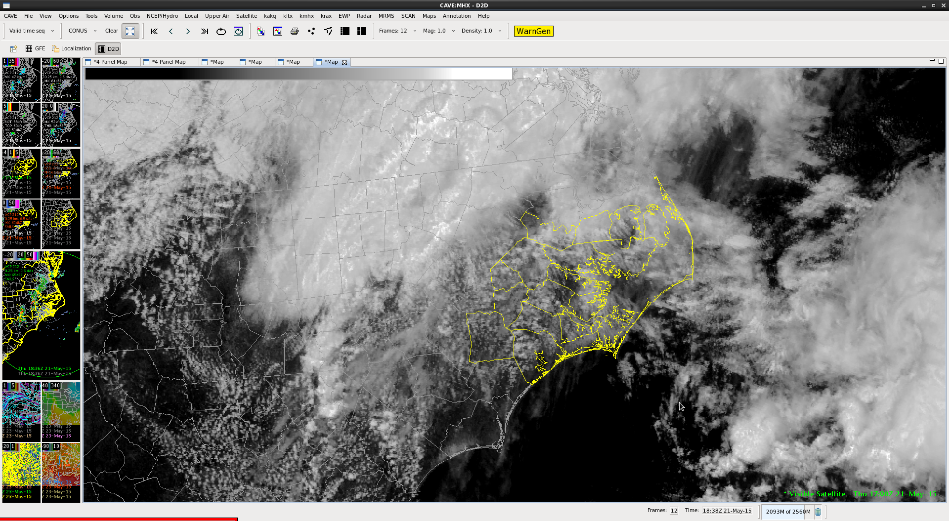
Fig 3
Pickles