

A quick glance at the GOES-R Layer PW as of 1800Z May 13 reveals a large pool of moisture with PW values around 1.8 inches in southeast Texas.
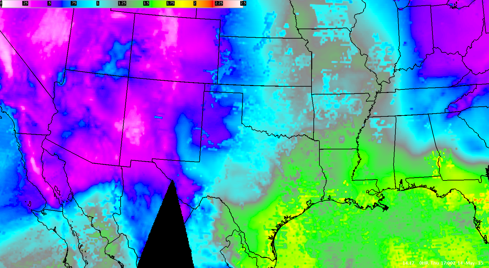
A curl of 0.75 inch layer PW extended up from the main pool, butting up against the mountains of eastern New Mexico.
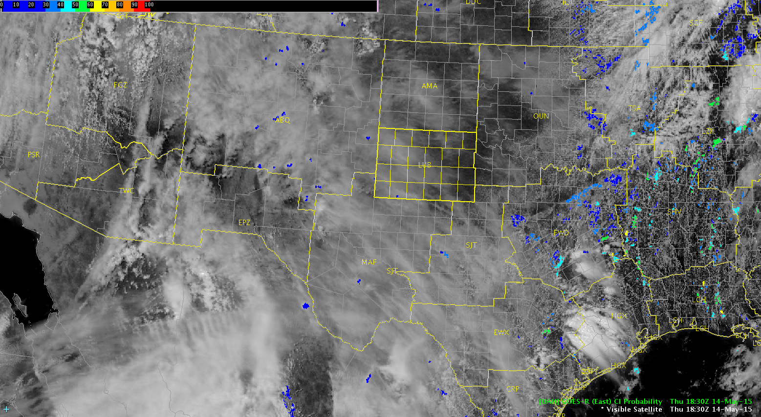
Anticipating storm initiation within this area, with cells developing and moving into northwest Texas and the Lubbock CWA later this afternoon. Kick-off will likely be late in the afternoon due to the thick cirrus cloud layer currently over the area. CI is trying to pick up on a couple cloud elements over eastern New Mexico as the cirrus begins to clear from that area.
Stay tuned….
~Regina Phalange