
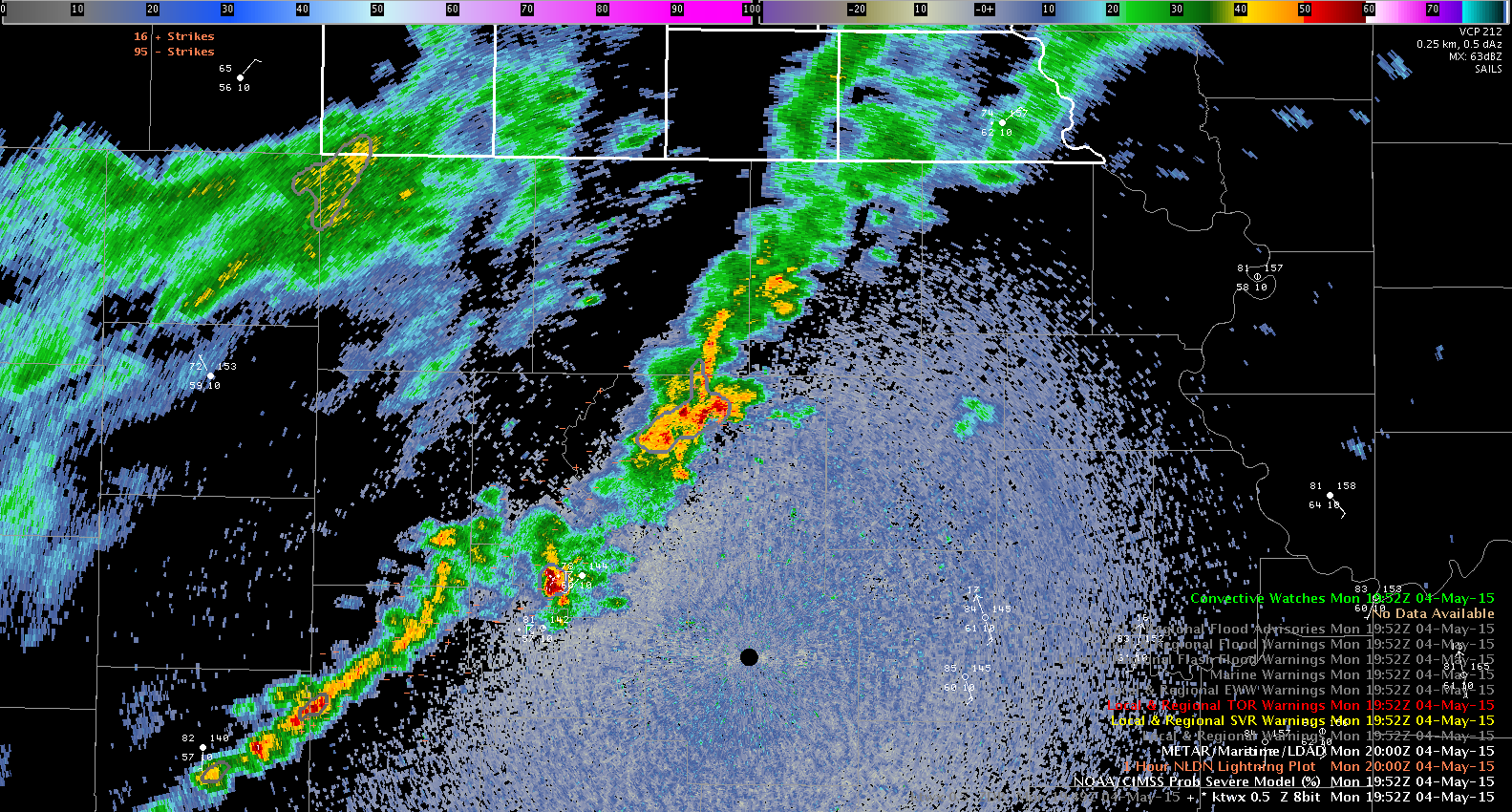
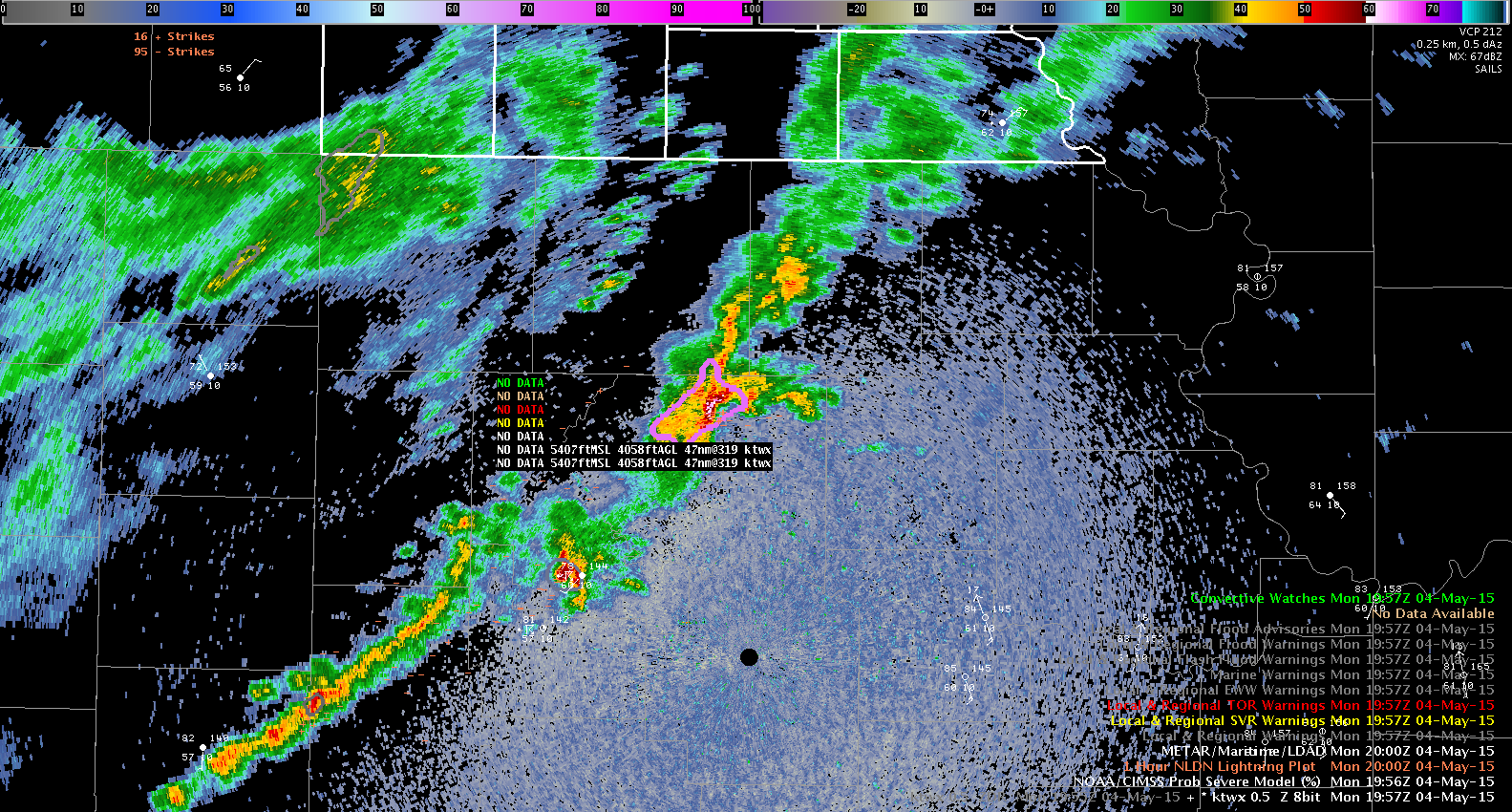
The storm of interest began to develop in a weak line of showers around 1930 UTC. Surface obs through the area indicate temperatures in the lower 80s and dewpoints in the upper 50s to low 60s. ProbSvr indicated around a 10% chance of the storm becoming severe. The storm slowly strengthened over the next 20 minutes, but the Prov Svr remained around 10%. From 19:52 to 19:57 UTC, the storm intensified rapidly, and the Prob Svr jumped from 13% to 72% (time of two radar scans)
It appears the storm is beginning to root along the E-W warm frontal boundary through the region. At 20:11Z, ProSvr MRMS MESH indicates 2″ in diameter hail in the highest dBz core. This area correlates well with lower values of Zdr of near or just below 0 dB.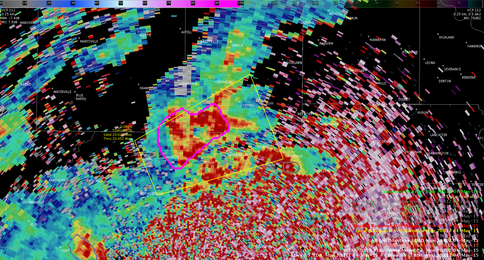
Although I did not see any hail reports while I was watching the storm, the first severe wind gust report (60 mph) occurred at 20:30 UTC, about 32 minutes after the ProbSvr rapidly increased. Because I used the site radar (KTWX), there was a slight lag in the availability of the ProbSvr data.