Experimental warnings over southwestern Oklahoma

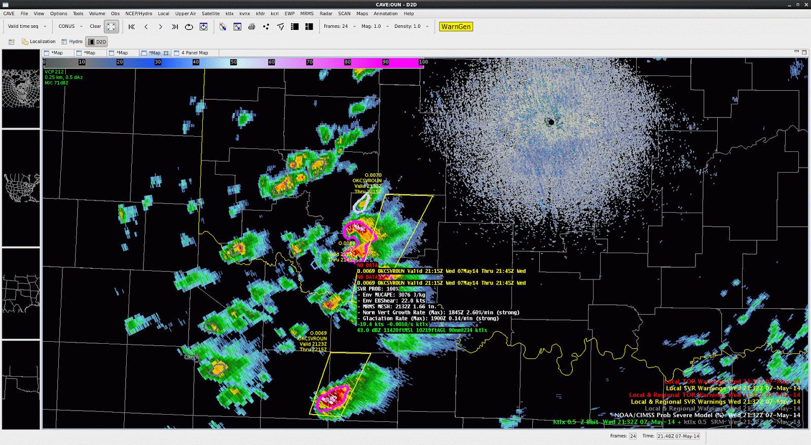
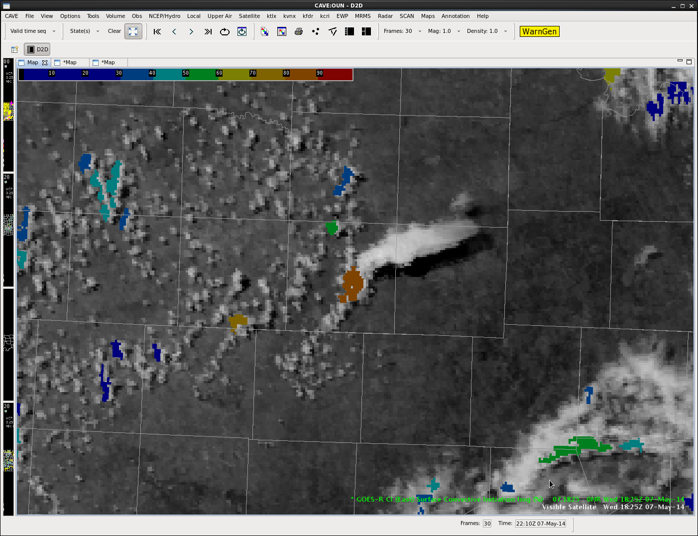
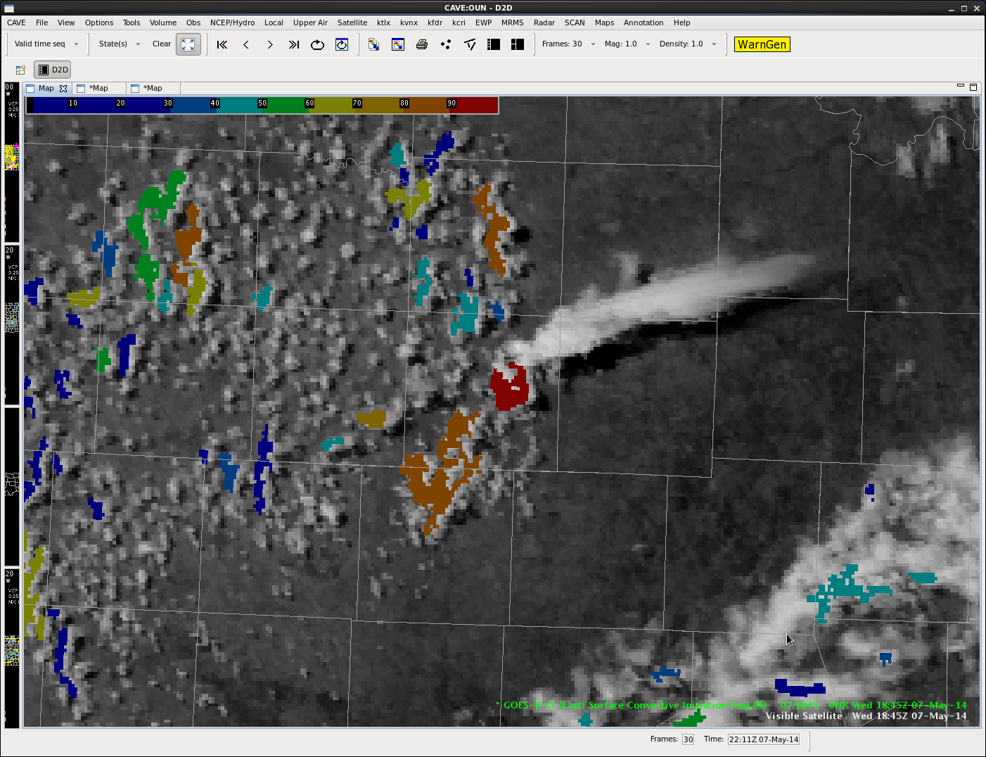
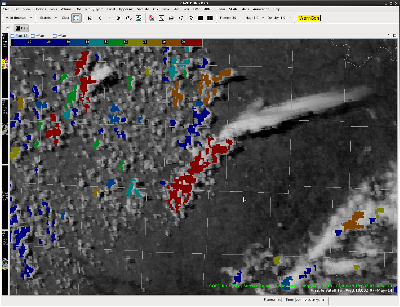
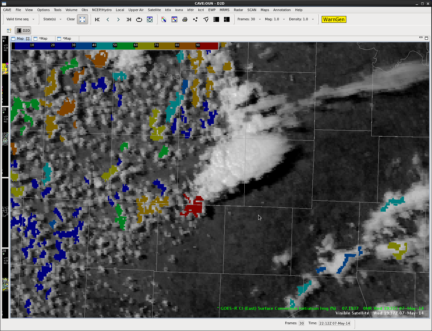
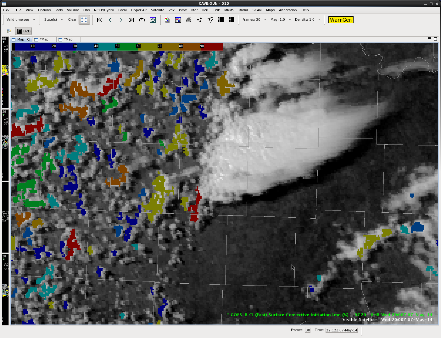
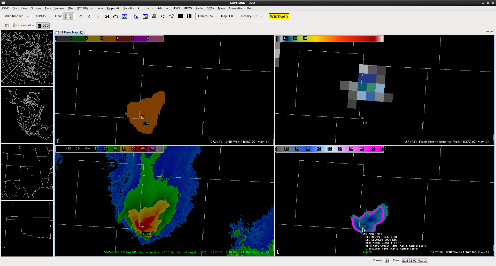
The storms over southwestern Oklahoma have recently increased in intensity and have warranted NWS and EWP severe thunderstorm warnings, with multiple reports of quarter to golf ball sized hail.  The ProbSevere values for these storms with golf ball sized hail are well in excess of 90%–even some at 100% for times.  The evolution of these storms and the generation of severe thunderstorm warnings is demonstrated in Figure 1.

Figure 1.  NOAA/CIMSS ProbSevere, 0.5 degree KTLX reflectivity, and NWS/EWP warnings valid 2132 - 2140 UTC 7 May 2014.
Figure 1. NOAA/CIMSS ProbSevere, 0.5 degree KTLX reflectivity, and NWS/EWP warnings valid 2132 – 2140 UTC 7 May 2014.

A question was posed to the forecasters on the KOUN desk within EWP today, “There have been a number of storms with ProbSevere values in excess of 50% today, some of which seem to be false alarms, is this hampering the use of the product?” The forecasters replied,

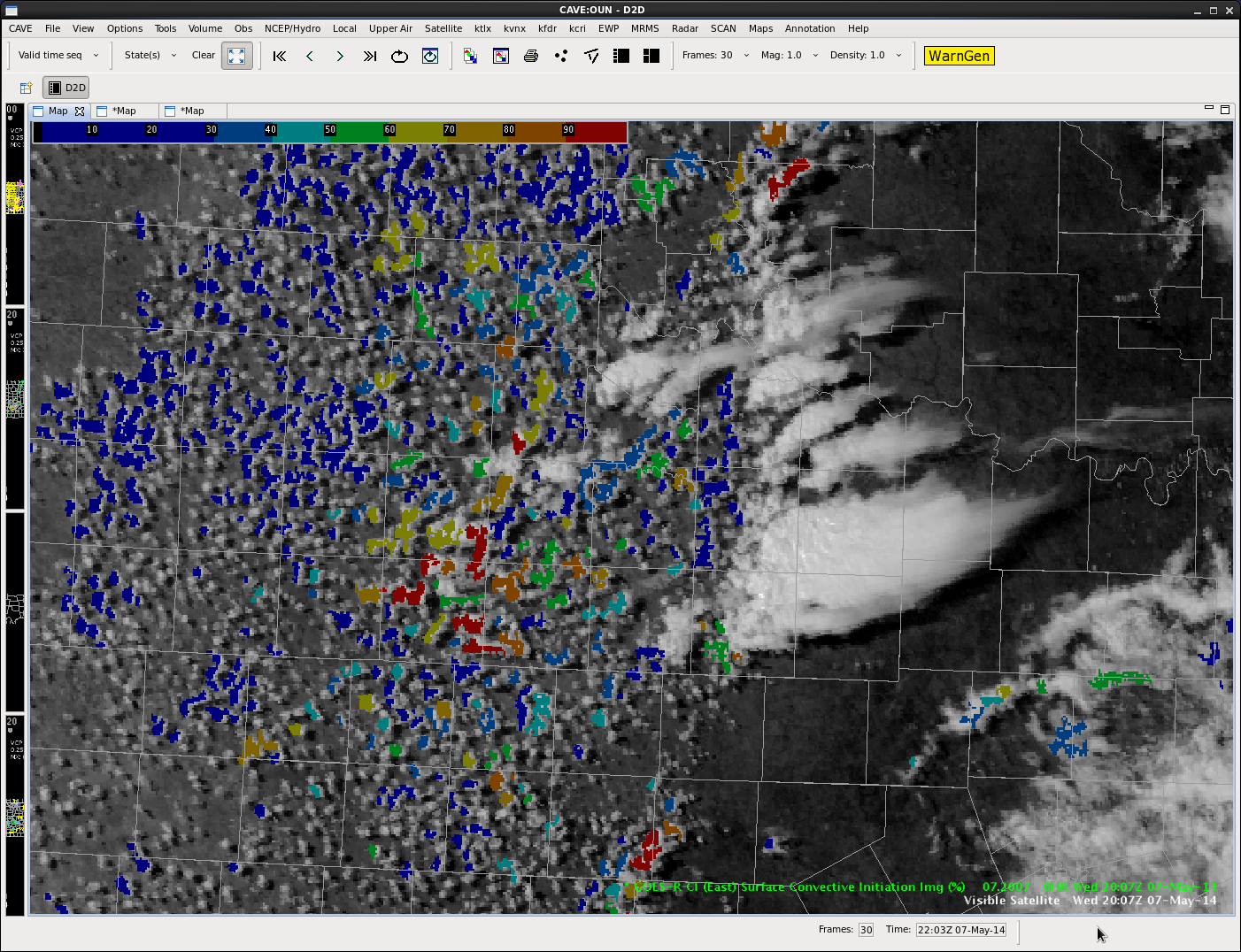
“No I like that the storms with the highest ProbSevere probabilities are in excess of 90% and these are the ones producing golf ball sized hail–these are not marginal hail stones. The ProbSevere is drawing me to which storms are likely to need severe warnings in the near future. The false alarm storms, while they have high probabilities today, are in the 70-85% range–which makes them different than these with 90+% probabilities. I’ve easily been able to adjust to the probabilities and use them appropriately. Also I know the ProbSevere model has not been validated as a tool to reissue severe warnings, but I like how the probabilities diminish a bit when the radar intensity decreases and then come back up if the storm re-intensifies. If you look at this display (Figure 2) it has high probabilities on the right storms, but the ones further west are only (correctly )10-20%”

 Figure 3.  NOAA/CIMSS ProbSevere and MRMS composite reflectivity valid 2204 UTC 7 May 2014.  This was the display the NWS forecaster in the EWP was referring to when he was discussing the ProbSevere continuing to identify the severe storms, but had much lower probabilities for the storms further north and west.

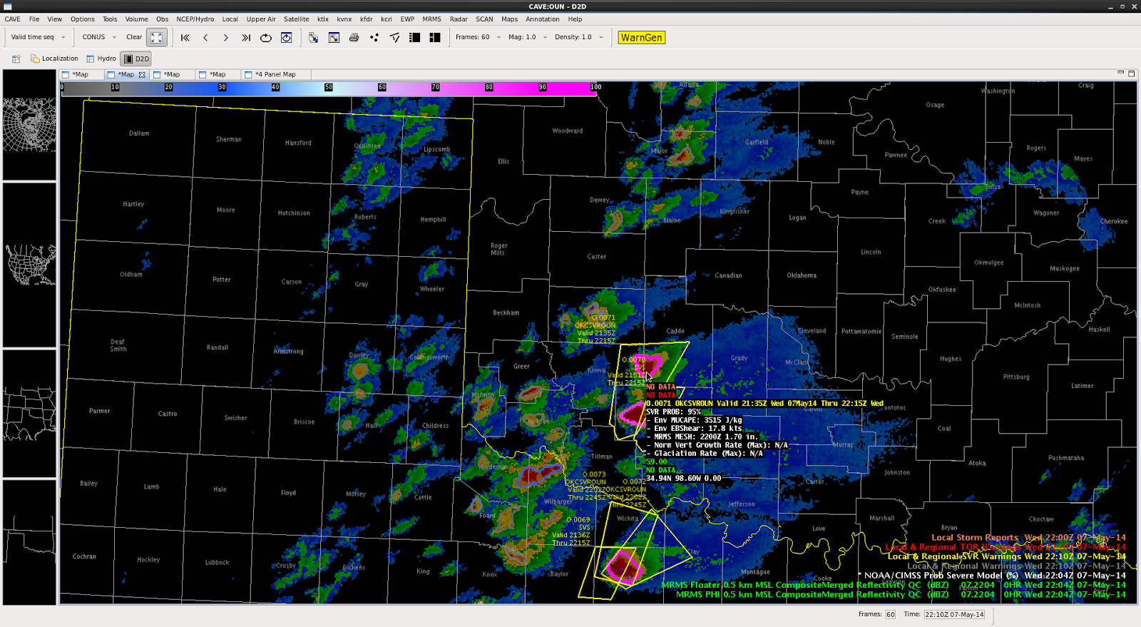
Figure 2. NOAA/CIMSS ProbSevere and MRMS composite reflectivity valid 2204 UTC 7 May 2014. This was the display the NWS forecaster in the EWP was referring to when he was discussing the ProbSevere continuing to identify the severe storms, but had much lower probabilities for the storms further north and west.

-Sieglaff, Week 1 ProbWarn PI

Tags: None

Expanded Lightning Jump View: 2234 UTC (CO/WY)

A wider look at the lightning jump grid at 2234 UTC of the NE Boulder CWA… All tracked storms (with greater than 10 flashes per min and within the 150 km LMA domain) are shown.  Three tracked cells show some type of sigma jump at this same time.  Two in green – 1-sigma (or standard deviation) and one smaller cluster, orange, with a 3-sigma jump.

LtgJump_2234utc_7may14

The three-sigma jump storm corresponds with a ProbSevere 92% and MESH of 1.65 in.

-K. Calhoun, Week 1 Coordinator & Lightning Jump PI

Tags: None

CI miss and hit

First isolated cell builds with a CI of 40-50%.

CI1

Initial cell continues to grow with a CI of 80-90%.

CI2

Initial cell reaches a CI of >90% with a new cell developing to the southwest showing a CI 80-90%.

CI3

Initial cell eventially goes “poof”, with secondary cell continuing to grow and show a CI of >90%.

CI4

Second cell continues to grow with CI still >90% on the southwest flank.

CI6

Second cell continues to grow. A warning was eventially issued for this storm.

CI7

Scott Rudge.

Tags: None

persistent OTs

Convection in CO, NE, WY has exhibited persistent (30 min) OTs as of the 22:15 vis sat pic.

topDrawing


These have been over persistent strong…and at times severe…storms.  OTs have not always meant the storms were severe…and have seen SVR and even TOR under cells that have not had OTs detected.


db


Tags: None

7May14 CI on SVR in CYS7May14 Radar SVR-CI


As seen in the first image, CI is picking up on come cloud cover out ahead of the main convection. Probabilities were 50% and higher in this area at the time. Shortly after, thunderstorms began to develop just to the south of the main line that had already been warned on. These new storms later merged with the northern cell to produce more of a cluster. This example shows how the CI tool has some skill at time that cirrus isn’t inhibiting detection and can also raise awareness on development in a messy area.

Lightning Jump Detection + ProbWarn

For the first time, we have storms in an LMA domain strong enough to produce images on lightning jump grid.

The four-panel image below contains a 3-sigma lightning jump (top left: orange fill region) the pGLM lightning grid (top right: max flash extent density as high as 18 flashes per min), MRMS reflectivity at -10 C (bottom left), and ProbSevere (94%) overlaid on MRMS MESH (bottom right).

AWIPS2 Screenshot from 2136 UTC.
AWIPS2 Screenshot from 2136 UTC on 7 May 2014.

This particular combination has provided a couple ideas for lightning jump algorithm development.  (1) inclusion of metadata similar to the mouse-over ability of the ProbWarn product.  The mouse over for the lightning jump should contain the current flash rate as well as the degree of jump in sigma. (2) Combination with a product similar to ProbWarn (if not, the ProbWarn product itself.  This could provide the forecaster information from satellite,  lightning and radar all-in-one product.  The advantage this provides is that approaches a forecaster-over-the-loop type product without becoming a “black box” as all the information that is part of the product is also provided as metadata.  I look forward to working with CIMSS-WI and other researchers on this type of development.

K. Calhoun, Week 1 Coordinator and Lightning Jump PI

Tags: None

possibililty for more severe WY, NE, CO next few hours

newDrawing

Nearcast forecast instability still at its highest across parts of CO, WY, and NE over the next few hours.  Some data gaps here, but the surrounding trend in the data around the gaps lead me to believe there’s still a good road for these storms to travel and hold strength, if not intensify in some areas where daytime heating continues…

Tags: None

Lightning Density/Weak Rotation

7May14 Velocity-WkRot7May14 Flash Extent Density


The storm that developed earlier this afternoon cycled a few times through its development. At times is showed decent rotation, which was warned on by the Denver WFO. The storm continued to show signs of some possible hail and weak rotation as it crossed the border into Wyoming. The lightning density tool did a good job in picking up on the storm, as show above. Lightning density seems to be a neat tool for awareness, not only for lightning being produced, but also what storms may be the strongest.

Tags: None