

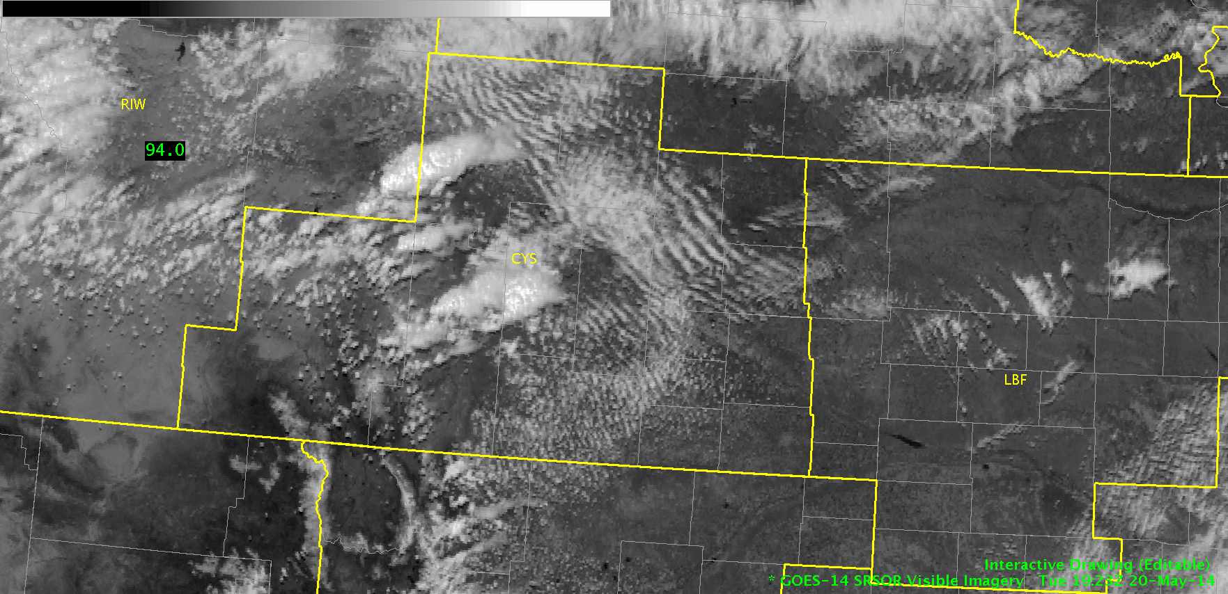
Our forecasters this afternoon are only four feet from each other in the HWT, but they are operating four CWAs apart in Cheyenne, WY (CYS) and Quad Cities, IA/IL (DVN).
Our CYS team is leveraging Super-Rapid Scan, LAPS domain placement from yesterday, and the potential for lightning detection from the few active Northern Colorado LMA sites in their diagnosis of convective potential and current analysis of developing convection in Albany and Platte Counties.
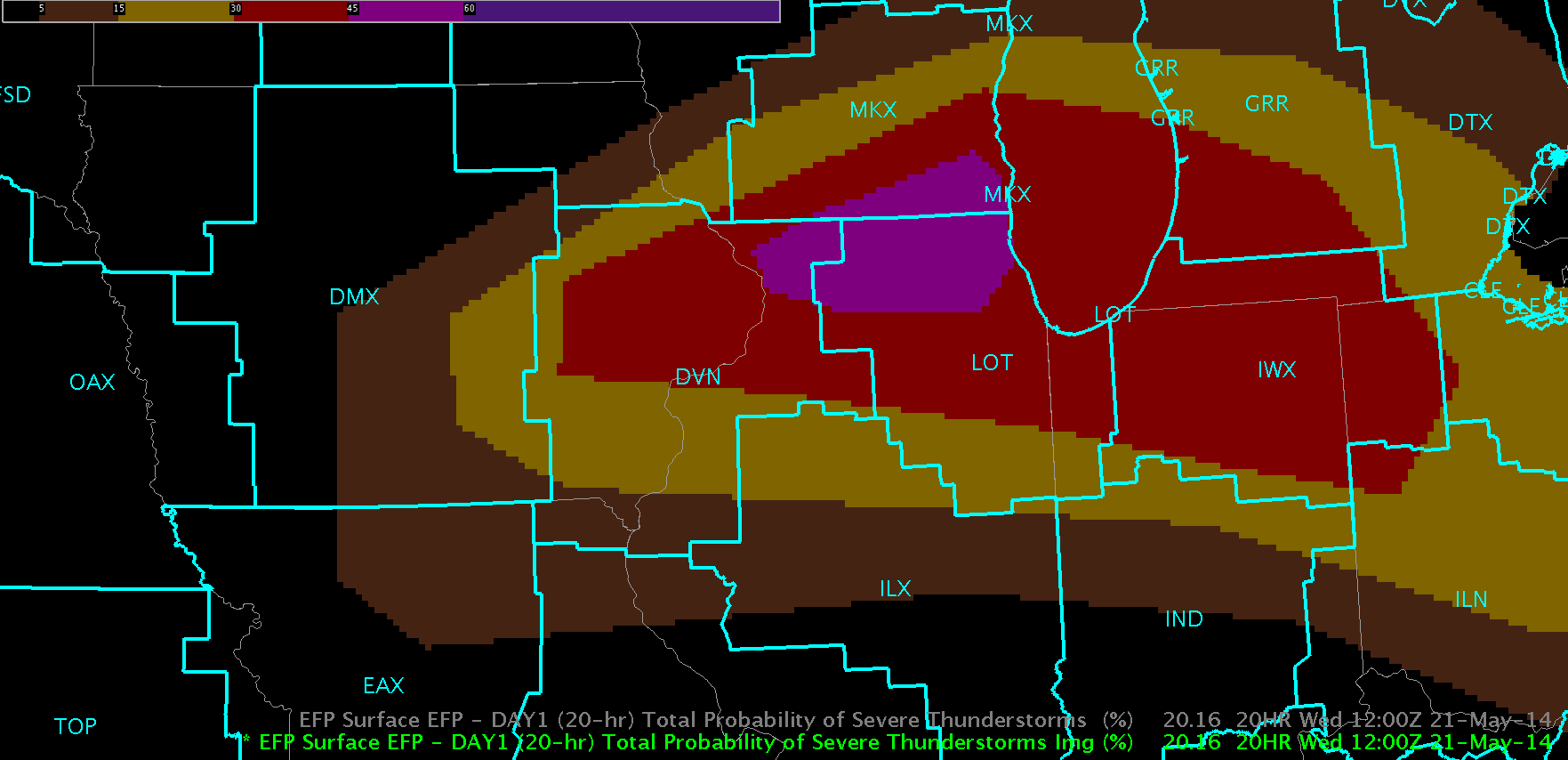
Our DVN team is performing a mesoscale analysis of the region around IA/IL/WI where the highest potential for severe weather and its associated hazards are expected. As destabilization is forecast to occur in the next hour or so, hopefully we will see some cells in this area by 22z.
-Darrel Kingfield
EWP Week 3 Coordinator