

For the first time, we have storms in an LMA domain strong enough to produce images on lightning jump grid.
The four-panel image below contains a 3-sigma lightning jump (top left: orange fill region) the pGLM lightning grid (top right: max flash extent density as high as 18 flashes per min), MRMS reflectivity at -10 C (bottom left), and ProbSevere (94%) overlaid on MRMS MESH (bottom right).
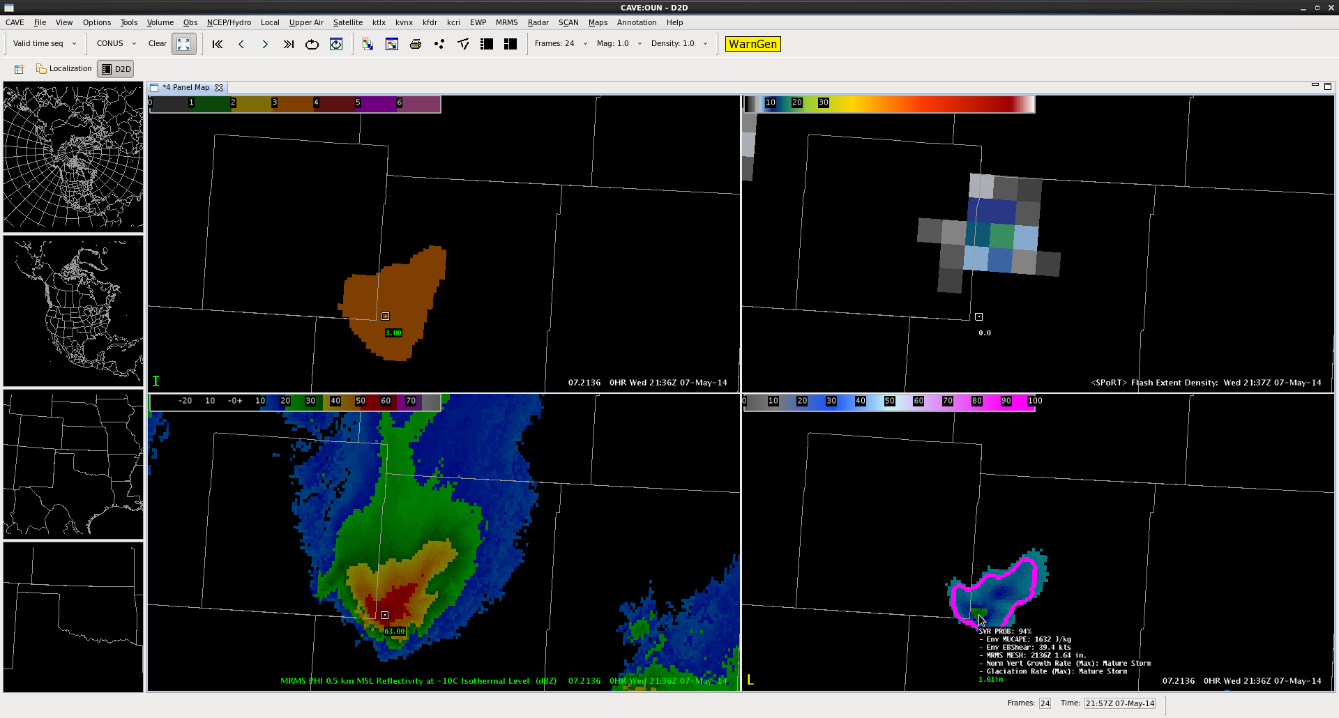
This particular combination has provided a couple ideas for lightning jump algorithm development. (1) inclusion of metadata similar to the mouse-over ability of the ProbWarn product. The mouse over for the lightning jump should contain the current flash rate as well as the degree of jump in sigma. (2) Combination with a product similar to ProbWarn (if not, the ProbWarn product itself. This could provide the forecaster information from satellite, lightning and radar all-in-one product. The advantage this provides is that approaches a forecaster-over-the-loop type product without becoming a “black box” as all the information that is part of the product is also provided as metadata. I look forward to working with CIMSS-WI and other researchers on this type of development.
–K. Calhoun, Week 1 Coordinator and Lightning Jump PI