
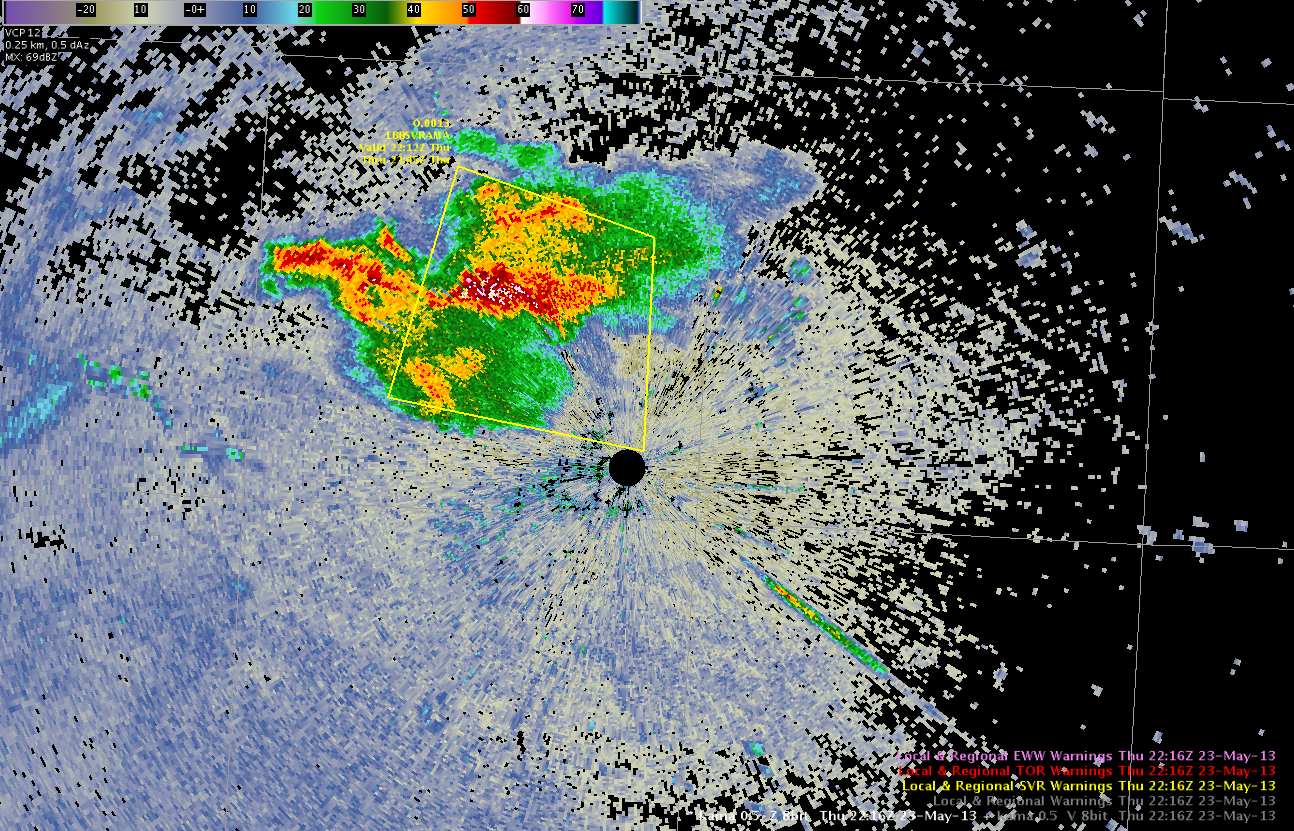
The MRMS products were a big help in this case being able to look at multiple radars since my storm was right near the radar as depicted in the image below. (Wesely)
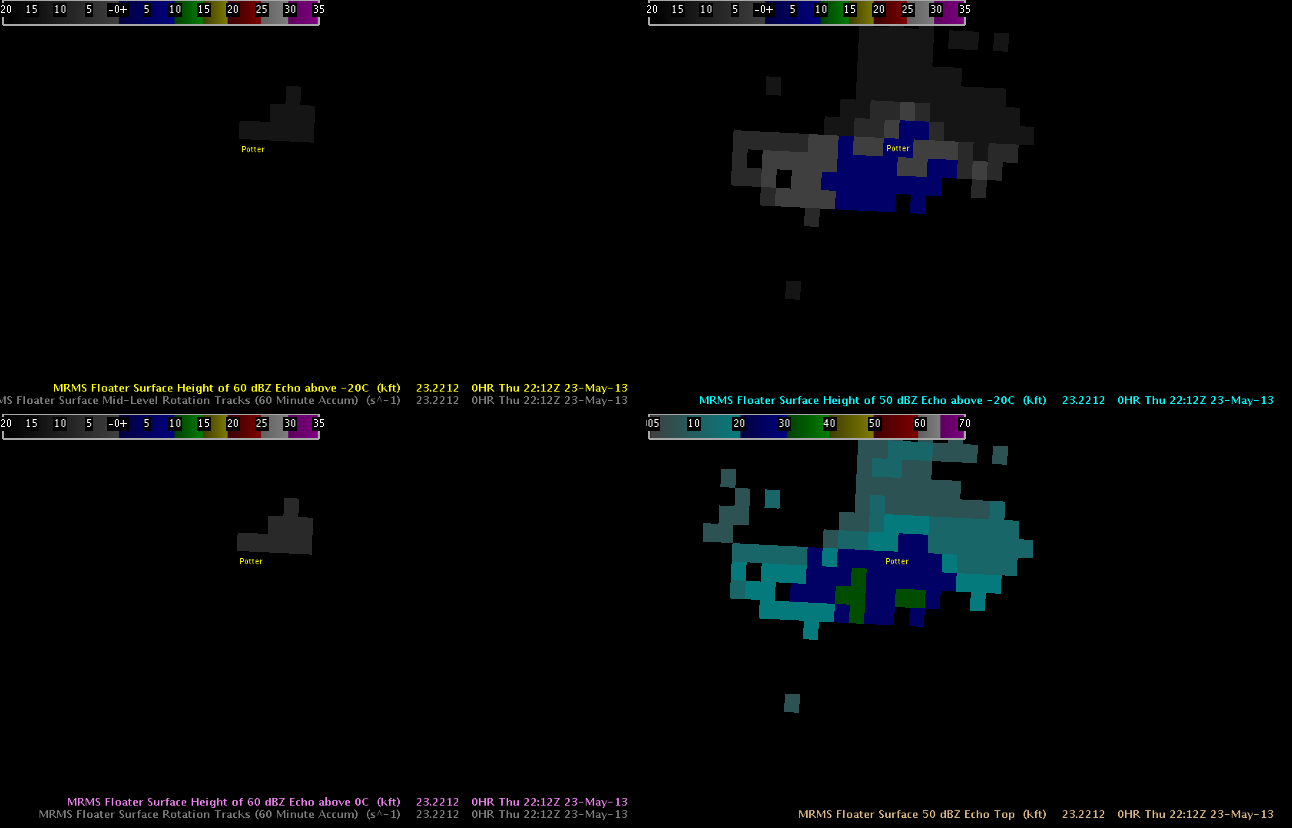
The Height of the 50dbz core went above 30,000ft agl, which was a trigger for issuing the warning. The 4 panel product below made the process easier in two ways. First the storm was near the radar and so having a 50 dbz echo core height product that took into account multiple radars was extremely helpful as the local office radar was unable to see the top of the storm. In addition, you could just look at the one screen and see the 50 and 60 dbz core height quickly without having to look through multiple slices of an adjacent offices radar to find the height of these cores.
The MESH and HSDA algorithms below both provided lead time for the quarter size hail that fell 11 miles north of Amarillo at 2236Z. The multi radar aspect of the MESH algorithm also made it easier to use than having to look at an adjacent radar to see the top of the storm. The HSDA is not multi radar and thus there were some limitations with this algorithm for the storm near Amarillo due to the close proximity of the storm to the radar.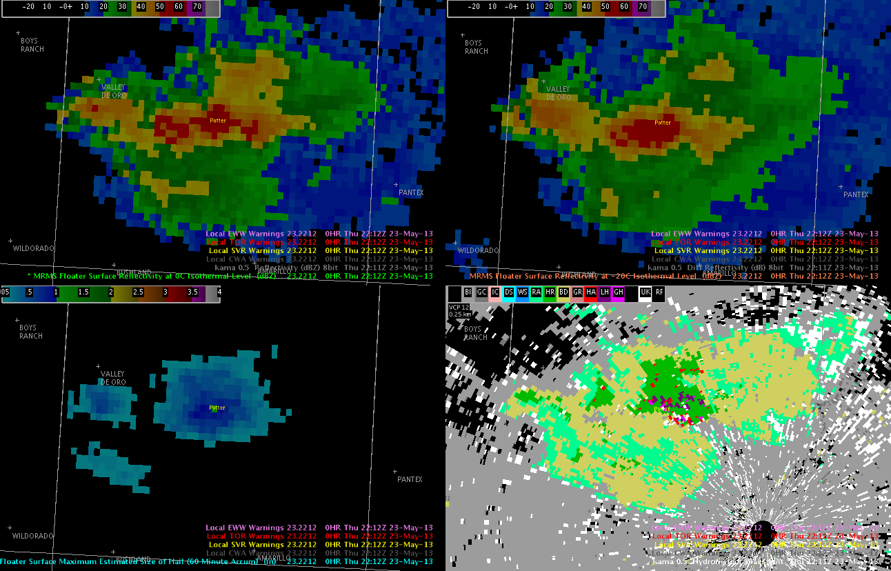
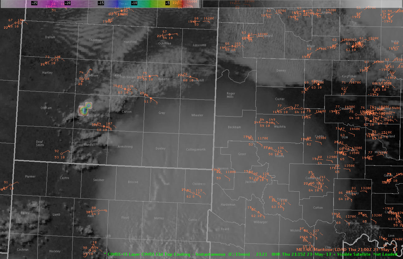
Cloud Top Cooling (CTC) did a nice job of showing that convection was really trying to break out in Amarillo’s County Warning Area (CWA). There were numerous cloud top cooling signatures beginning at 20z. The first 50dbz echo reached the ground at 2146z. So it took awhile but eventually the storms overcame the cap and became severe (See image of CTC below).
Jeremy Wesely