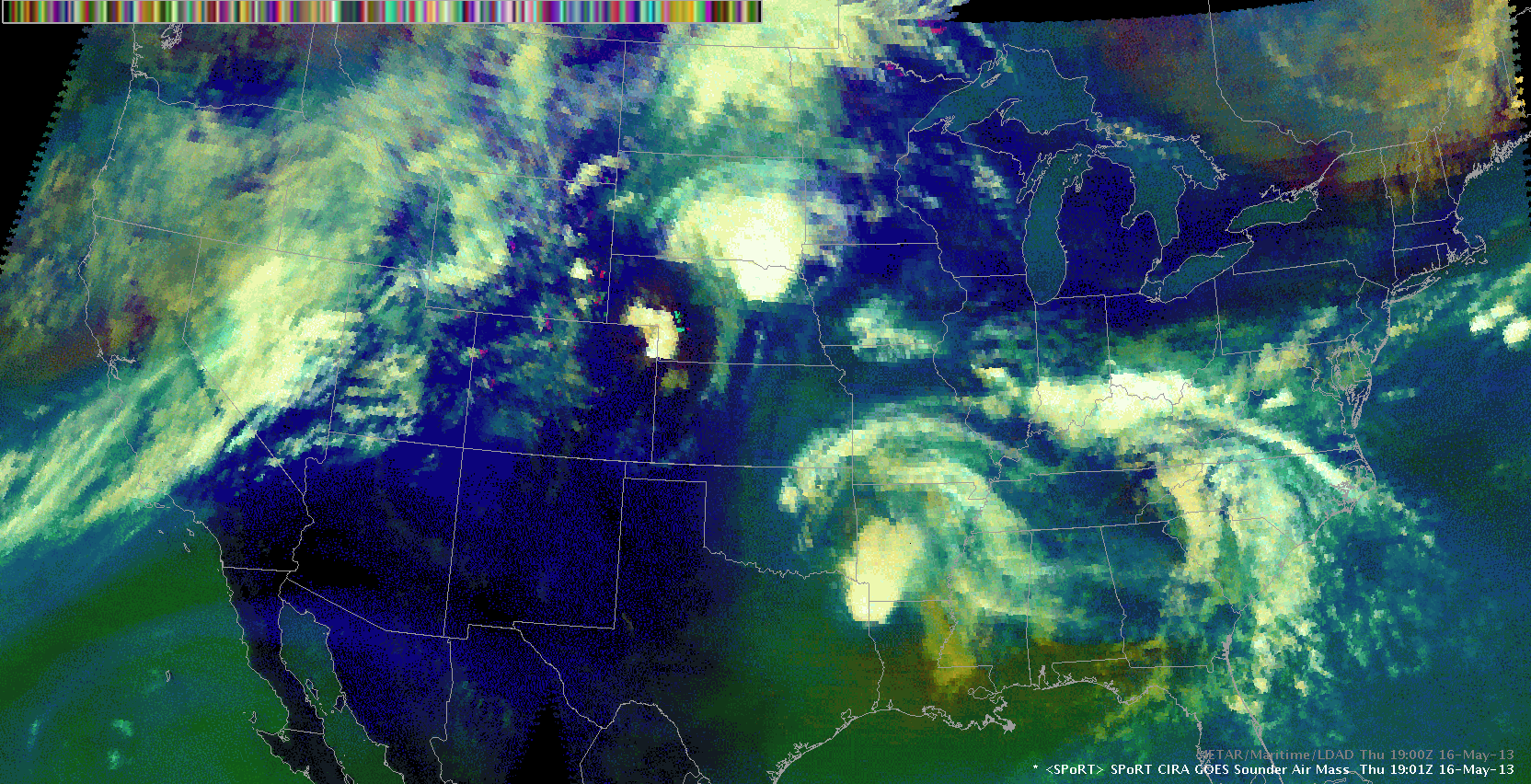
 The GOES Sounder Air Mass image is very useful in highlighting the different features of interest for today. First of all the compact disturbance which is about to leave NE Colorado to the east/northeast is well visualized by mid-level drying in the image. Weak forcing ahead of that feature already caused some initiation over N/NE Nebraska with another round of storms evolving over extreme NE Colorado. Of interest is a southward extending and weakening vorticity lobe which is about to enter Kansas from the west right now. Also, the dryline is well recognized by that product, showing warm/moist air ahead of the dryline advecting to the north (green-ish colour). This correlates well with mid-level moisture, seen in latest RAP output. A gradual transition from ‘green to blue’ occurs when moving westward (e.g. towards the TX Panhandle). This corresponds well with some residual low-level moisture f.ex. in the lowest 850 hPa, which gradually mixes out. We will monitor both the dryline and the eastward moving but weakening PVA lobe for some kind of interaction during the following hours and eventually for sporadic CI. Helge
EWP Blog
Spring Experiments & Beyond
