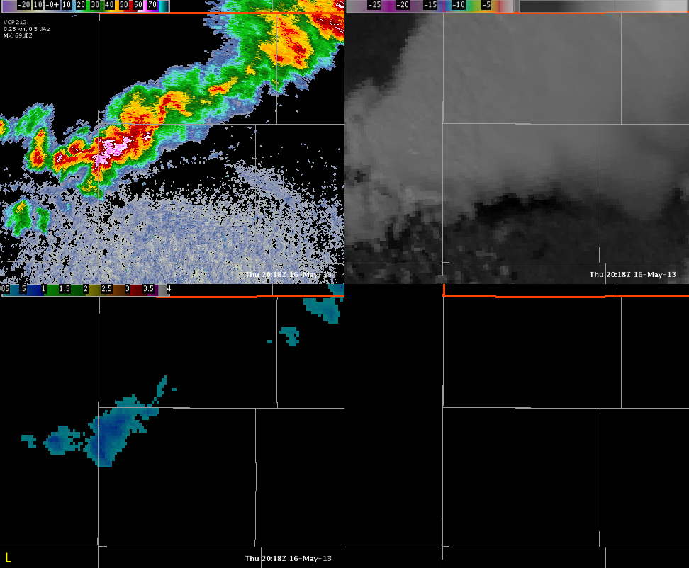
Setting up in the Goodland KS CWA today. A small cluster of storms is ongoing and certainly producing a lot of rainfall and lightning…note the 0.5 reflectivity on the upper left. To the upper right is CTC on top of the visible. No detections here…likely due to anvil cirrus hinderance. On the lower left, we have MESH from MRMS. Nothing at one inch or above here either. Reports from the area have consisted of small hail lately…0.75″ and less. This seems to reinforce the marginal nature of the storms depicted by MESH and other experimental products.
CL