
As mentioned a bit earlier in a post, the NearCast product showed enhanced chances for convection all the way to the Lubbock area. Especially the theta-e difference product placed the tongue of mid-level unstable air just where high based thunderstorms finally evolved. Surface dewpoints in the mid 30s and temperatures in the low 90s point to elevated and high based thunderstorms with a distinct downburst/ heatburst? risk. The product helped a lot to focus on the anticipated area of initiation. GOES-R LAP products also did a great job in developing the elevated thunderstorm activity both in space and time. Helge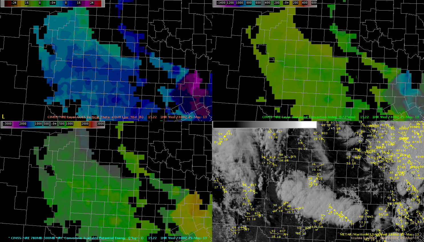 Upper left: vertical theta-e diff., upper right: Sustained convection index, lower left: CAPE and VIS in the lower right.
Official websites use .gov
A
.gov website belongs to an official government
organization in the United States.
Secure .gov websites use HTTPS
A
lock (
) or https:// means you’ve safely connected to
the .gov website. Share sensitive information only on official,
secure websites.
EWP Blog
Spring Experiments & Beyond
