

I was monitoring storms in Clay/Montague counties and potential CI further to the S/SW. Broad field of Cu was seen further south but it was hard to distinguish which of those Cu fields would finally grow into a thunderstorm.
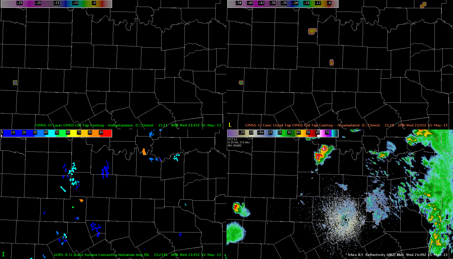 Upper left: Cld top cooling product, upper right: CTC accumulated, lower left convective initiation and lower right: reflectivity
Please have a look at Palo Pinto county, where the CTC product had a 80-90% signal strength of showing initiation potential (the lower orange dot). At the same time in the reflectivity fields only a few weak signals were seen.
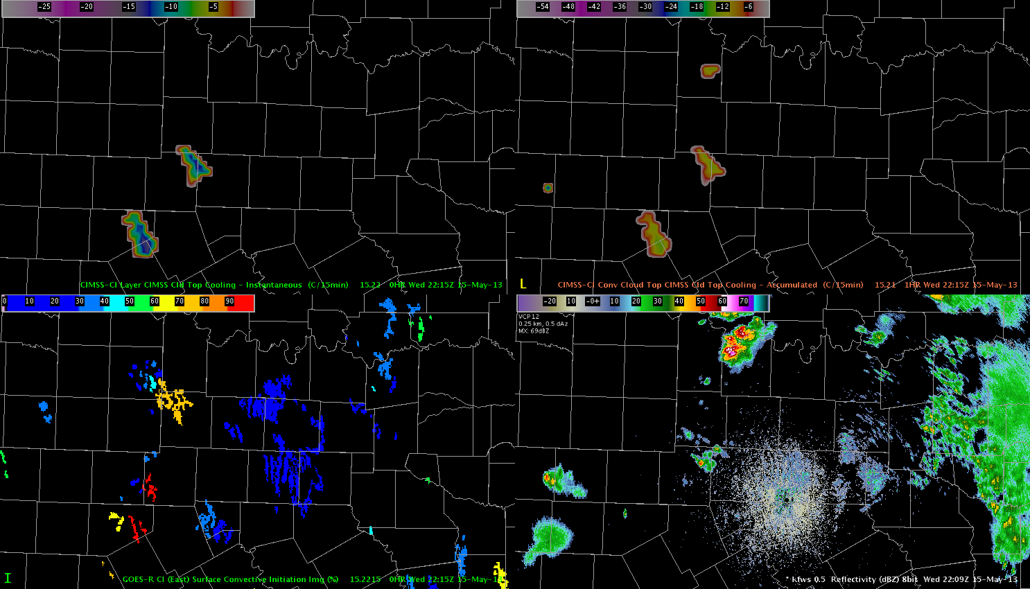 About 30 min later, the CTC instantaneous product showed a modest signal of -15K/15 min over the NE part of that county with reflectivity appraoching 40 dBz at the same time and place.
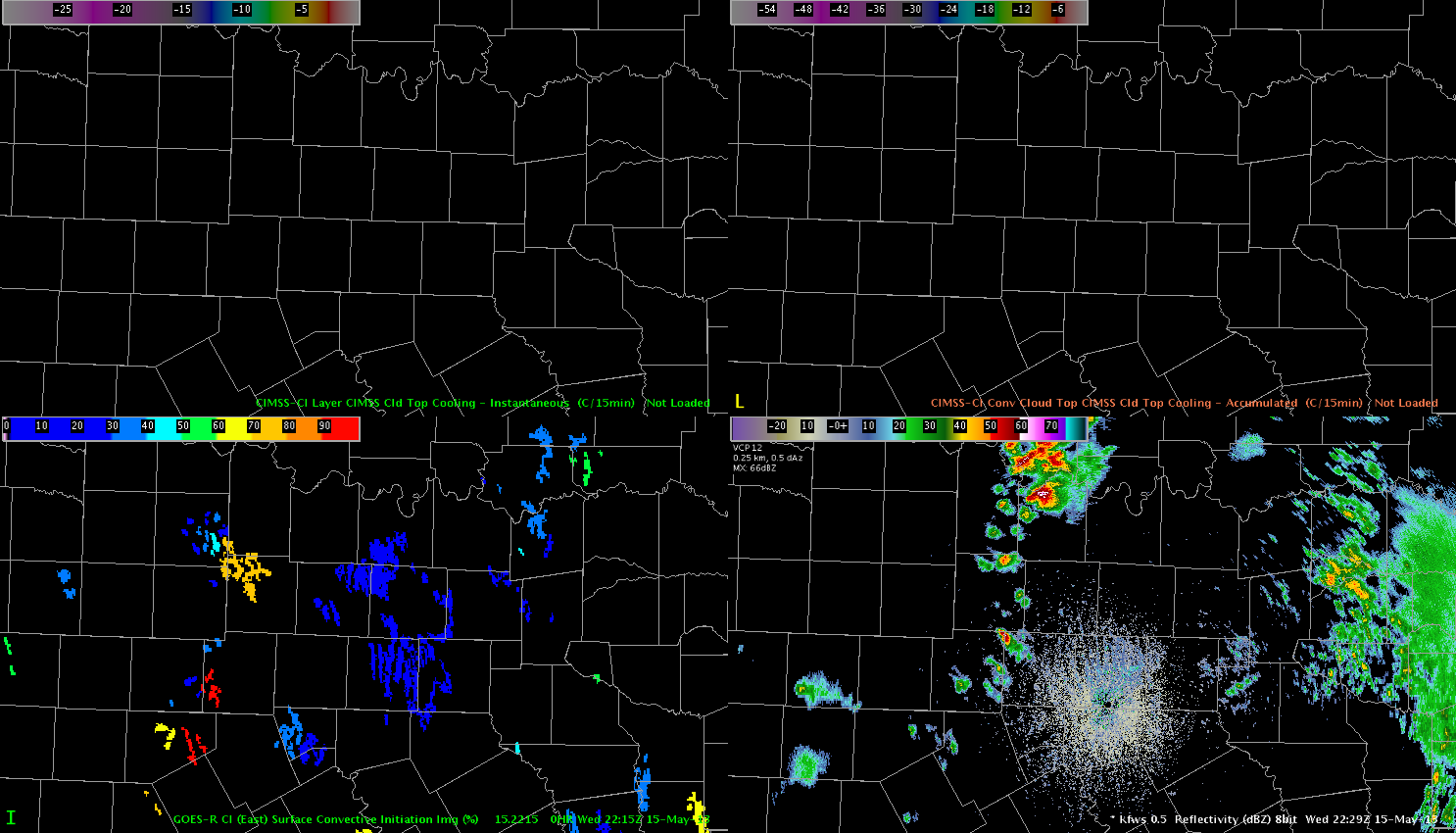 Finally at 2230 Z reflectivity revealed a small core with 60 dBz. The first lightning strike occurred at 2237Z. Those products gave the forecaster a good indication which area would finally see the highest probabilities for thunderstorm development and there was abundant lead time left before that storm finally took off. Helge