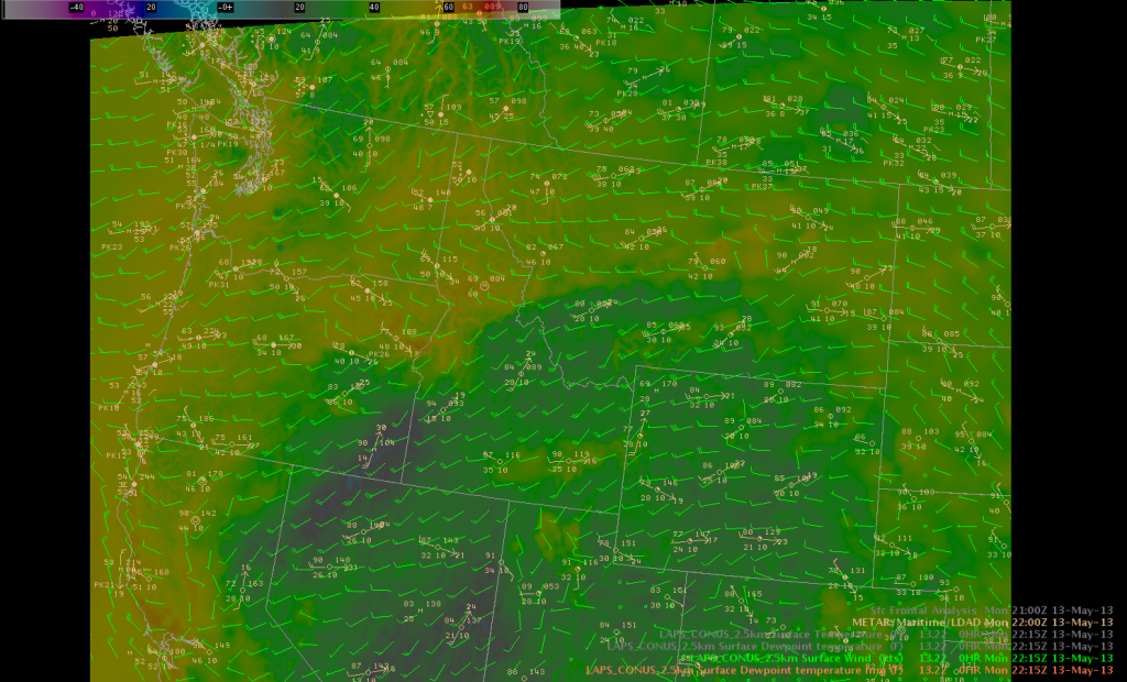
The 2.5 km variational LAPS did a relatively good job at resolving various boundaries that became apparent through the afternoon. Looking at the LAPS surface dew point and wind fields across the northern Rockies around 22Z…higher terrain locations had lower dew points in the 20s and 30s…with the lower terrain locations in the valleys and plains of northern Montana showing dew points in the 40s and 50s. In addition…locations in the wake of convective activity across northeast Oregon and points to the northeast both showed higher dew points and outflow boundary-like signatures in the wind field. These both matched reasonably well with the METAR observations. The model also did well with identifying the convergence boundary in the wind fields stretching from eastern Oregon through central Montana.  Mazur
Mazur
