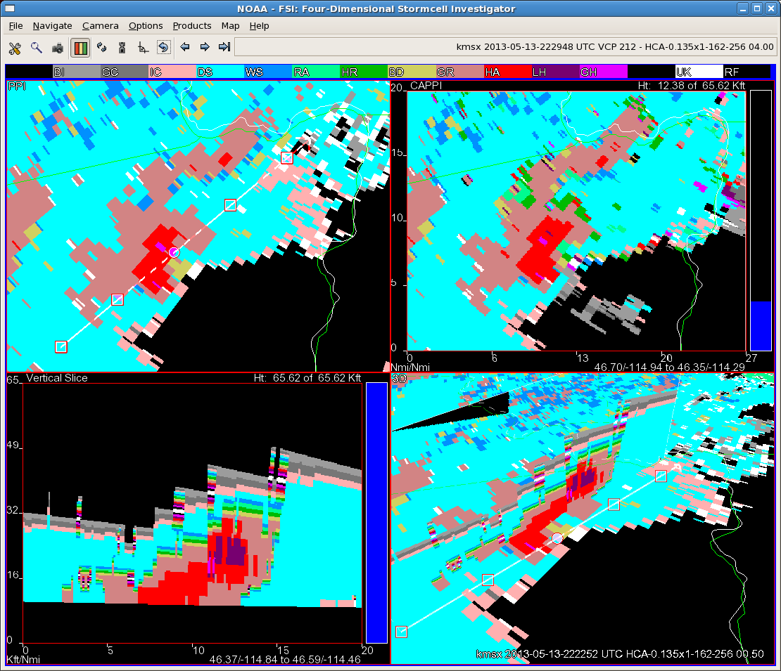
Finally have a storm with decent returns aloft that gives us a chance to investigate the new HSDA (Hail Size Discrimination Algorithm). The image is a four panel from FSI. Note the bottom left panel showing a cross section of the storm. The red color is the usual dual-pol rain/hail mix signature. The purple between 20 and 25 thousand feet is one of the new hail levels…in this case, indicating “large” (between 1 and 2 inch diameter) hail. Of course, with the warm and dry surface layer across much of the area, this hail would likely have a hard time surviving to the surface. We’ll see if we get any hail reports from this storm, but from what I saw to this point, I would be hard pressed to warn on this storm…perhaps an SPS for non-severe hail would be in order.
CL