

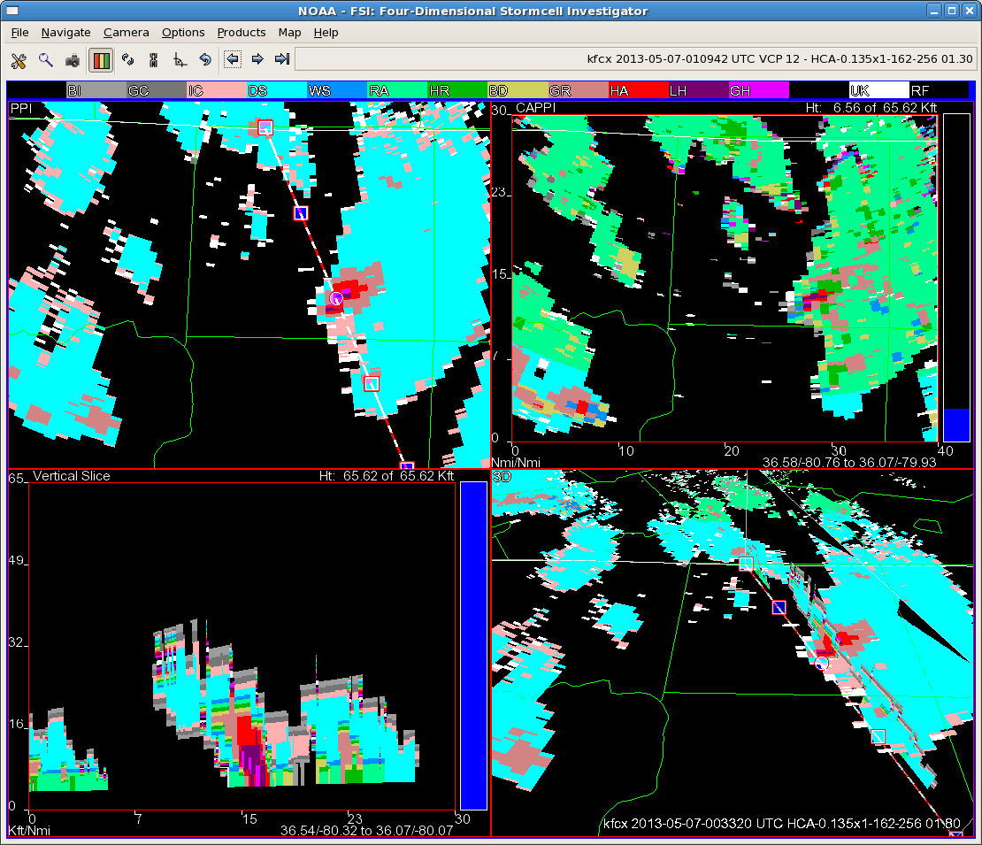
An isolated storm continued to move north/northwest across northern NC. The storm began to intensify as it moved into Stokes and Rockingham Counties. Continued to monitor various MRMS products including MESH and surface height of 50 dBz echo above -20 C, as well as surface reflectivity at -10 C and 0 C. Early MESH values were below .25 inches, with the highest 50 dBz echo approximately 6000 ft below -20C. Recognizing from previous storms this evening, with such a cool air mass, and decent low level lapse rates, severe hail was possible with 50 dBz cores below -20 C. Issuing a warning as the core increased, we continued to monitor the MRMS data, noticing the MESH had increased to approximately .50 in with 50 to 57 dBz at -10 C. We also used FSI to investigate the addition to the HCA algorithm, the new HSDA (Hail Size Determination Algorithm). As the storm moved northwestward, it started to indicated large hail (1 to 2 in) and then increased to greater than 2 inch hail southwest of Meadows, NC, which is where the report of quarter size hail was reported near 0044Z. It was also near this time that the 50 dBz core was finally reaching the -20 C level. Although we only received a report of quarter size hail (1 in), the additional products improved our confidence in the severe nature of the storm.
Kurtz/Frank