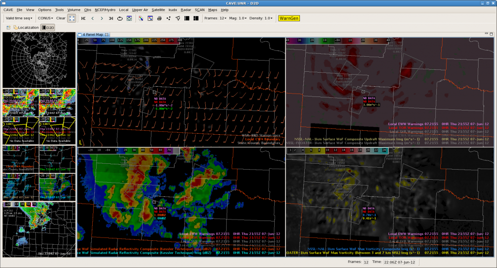
Low freezing (8500ft) and -20C (19900ft) heights are leading to efficient hail producers across the southern portion of the CWA. However, 3DVAR data have been less than exciting. Max updraft composite have only shown updraft strengths in the 7 to 9 m/s range near the time of warning issuance. This is quite different than what was shown in the marginal severe cases of previous days, when maximum updrafts were generally on the order of 11 to 15 m/s. In any case, the MESH was showing 1 to 1.5 inch hail in the severe storms (polygons noted by the gray outlines).

