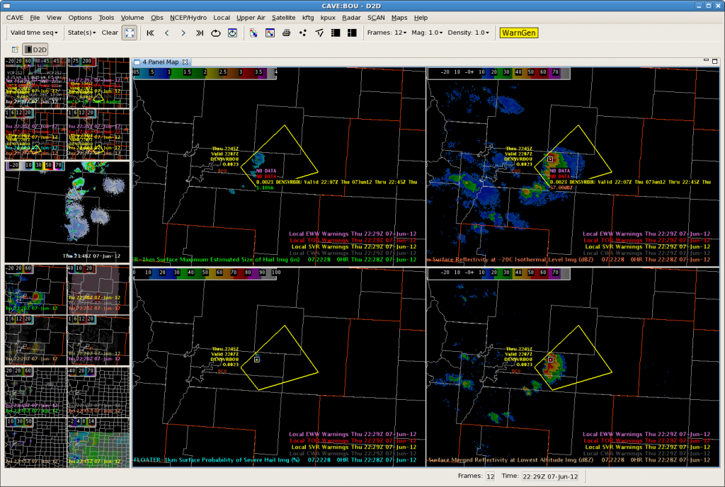
Well…we decided to issue our first warning based on the UW-CTC. Let’s see what kind of lead time we get!
CTC rates were around -20C/15 min and we are just beginning to see some reflectivity.
We will update to let you know if we get any verification or if this turns out to be a false alarm!
Update: A great question was just posed: do you plot the warning downstream of the developing storm – based on the Warn-on-Forecast? Or do you just use the CTC as a ‘red flag’ and follow the development as it progresses…issuing the warning at a later time?? What are YOUR thoughts?!?!

Update: 2207z….
We issued another warning based on CTC! We seemed to kill any potential with the first CTC-based warning….perhaps this one will work out!!

Trends on MESH and reflectivity have improved on this storm and now appears severe on radar.
5:43pm CDT update: VERIFIED! 1.50″ 4:30pm local time (MDT)!! The initial warning was issued at 4:07pm MDT.

