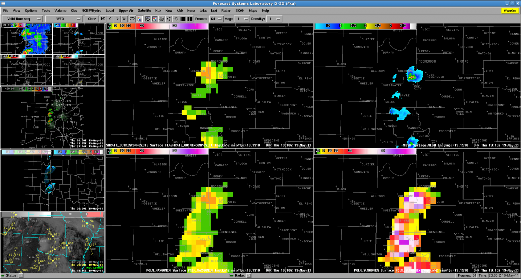
With warning operations already underway for western Oklahoma, forecasters are deep into their storm analysis.
One of the more interesting features they have been picking up on is the consistent signals between the pGLM lightning trends and values from the MESH algorithm as well as the 3D-Var derived updraft fields.
This was well illustrated by the storm north of Elk City moving from Beckham to Roger Mills county. At approximately the same time ~1900-1915 UTC, the lightning rate increased from 5 to 15 flashes per min (per pGLM grid box, not per storm) as MESH ramped up and updraft increased within the 3D-Var product. Shortly after this increase, both the pGLM and MESH values decreased with this storm (the 3D-Var updraft values also showed this, but with a bit of a time lag).

Also of note, prior to losing NLDN data, with the storms seemed to be producing relatively little CG lightning. In this case, the pGLM data was definitely giving a better view of the electrical activity and storm intensity. (1 to 1.75 in hail has already been reported across West and SW Oklahoma).
-K. Kuhlman (pGLM scientist, week 2)
